Iguazú Falls
Iguazú Falls · Misiones, Argentina
Every ledge the river drops over here is a place the rock lost.
Why here
Stand at any one overlook here and you’ll swear you’ve seen the falls. Walk fifteen minutes to the next one and the argument looks completely different — a wider curtain, a narrower chute, water dropping in stages instead of one clean sheet. That’s because Iguazú isn’t a single waterfall so much as hundreds of them, strung along a long curve of cliff where the river meets a stack of old lava rock and refuses to go around it. That rock piled up in layer after layer long before there was a river to argue with it, and each layer holds its edge a little differently — some crumble fast, some hold firm — so the water carves a different shape wherever it meets a new one. The result isn’t one spectacle but a long, ongoing negotiation between moving water and stubborn stone, visible in real time from a dozen different angles and a dozen different distances. Every site below is a place to watch a different round of the same argument.
The story
The land came first, and it came violently. Long before the Iguazú had cut anything, this stretch of the continent flooded with lava — not once, but again and again, each flow cooling into another dark layer stacked on the one before it, laid down across a long stretch spanning the age of dinosaurs. By the time the eruptions stopped, the land here was a thick, layered slab, and it stayed that way, unmoving, for a very long time before any river tested it.
Then came the water, and with the water, the life that depends on its noise and spray. Small swifts nest and roost inside the falling curtain itself in places like this, folding their wings and diving straight through the spray to ledges no ground predator can reach — one of the more startling adaptations in this stretch of forest. Coatis work the trailside undergrowth in loose troops, toucans call from the canopy, and capuchin monkeys move through the trees above the gorge, all making a living in the wet, cooler zone the falls create around themselves.
Who first stood at this line of cliffs and watched the river lose ground to itself, the record here doesn’t say. What’s certain is only that the argument between water and rock was already old by the time anyone thought to write about it.
The sites
The staircase the river cut
Salto San Martín
−25.6887, −54.4442
Salto San Martín is one of the more forceful single drops in the whole system, water pouring hard enough that the platform underfoot can seem to hum with it. Look closely at the rockface it pours over and you can see why it drops the way it does: the water doesn’t slide down a smooth slope, it falls in a stack of short, sharp steps, each one the exposed edge of an old lava layer. This whole region was buried, flow after flow, under molten rock that later cooled into hard, dark stone. Some of those layers fractured and wore back faster than others once the river started working on them, so the drop here isn’t one clean line — it’s a series of ledges, and this fall shows that structure about as clearly as anywhere on the walkway system. Spend a few minutes and you’ll notice the spray thins and thickens with the wind, throwing rainbows across the gorge on a sunny afternoon. It’s loud enough to make conversation difficult at close range, which is itself worth noticing: this is what a very long stretch of falling water sounds like when it hasn’t slowed down yet.
Look at the face of the falls itself, not just the water: find where the drop breaks into distinct ledges rather than one smooth sheet. Each ledge marks the edge of a separate old lava layer, harder rock holding its line while the layers above and below wear back faster.
- AccessShort walk
- ExertionModerate
- TimeAn hour
Mirador Salto Bossetti
−25.6855, −54.4459
From this viewpoint you can pick out several separate drops within sight of each other, each with its own name and its own slightly different shape. That’s normal here: what looks from a distance like one enormous waterfall is really a long run of individual falls, spaced out wherever the river has found a weak seam in the rock to work on. Some of these seams are wide and the river spreads into a broad curtain; others are narrow and the water gets forced into a single hard chute. None of it is random — it follows the joints and layer boundaries in the old lava rock beneath your feet, cracks that opened as each flow cooled and shrank long ago. Water finds the weak line first, always. Give this stop a slower look than most people do: instead of picking one fall to admire, try counting how many distinct drops you can see from where you’re standing, and notice how differently each one is shaped by exactly the same river.
Count the separate drops visible from this one viewpoint, and compare their shapes: a wide curtain here, a narrow chute there. The difference tracks the cracks and layer edges in the rock beneath the water, not the amount of water itself.
- AccessShort walk
- ExertionEasy
- TimeAn hour
Salto Mbiguá
−25.6875, −54.4454
Salto Mbiguá is one of a run of falls where the river narrows and the drop steepens, throwing up a heavier curtain of spray than some of its neighbors. Get close and the mist is constant, enough to keep the surrounding rock dark and slick even on dry days and to support a thin fringe of moisture-loving plants right at the splash line that wouldn’t survive a few meters back from the water. That’s worth noticing here: the falls don’t just shape the rock, they shape a narrow, permanently wet strip of habitat running along their own edges, distinct from the drier forest just beyond it. The name marks it as one stop among many in a chain, and that’s the honest way to see it — not a single postcard waterfall but one link in a long series, each shaped by exactly how hard and how fractured the rock happened to be at that particular point along the cliff.
Look for the band of extra-green, moisture-loving growth clinging to the rock right at the splash line, distinct from the drier vegetation a few steps back. The falls water their own narrow strip of forest continuously, rain or no rain.
- AccessShort walk
- ExertionEasy
- TimeAn hour
The whole argument, seen at once
Mirante Foz do Iguaçu
−25.6871, −54.4396
This viewpoint pulls back far enough to show what the close-up overlooks can’t: the falls aren’t one waterfall, or even a dozen, but a long, curved wall of them wrapped around a bend where the river drops from one shelf of old lava rock down to the next. From here individual falls blur into a single roaring line, and that’s the point — it’s one of the better vantages for the full shape of the argument this river has been having with the rock beneath it for a very long time. The river marks the border between two countries along this stretch, which is part of why there are viewpoints looking back at each other across the gorge from both sides of it. Watch the column of mist rising off the base of the largest falls: on a still day it climbs high enough to be visible, and often visible, well before the sound of the water reaches you. Give this stop more time than it takes to get a good photograph; the scale of the whole curve only really sinks in slowly, one long look at a time.
Trace the curve of falls from one end of your view to the other and count how many distinct drops you can pick out along it. The number changes with how much rain has fallen upstream recently — a plain reminder that this whole system is one river, not several.
- AccessShort walk
- ExertionEasy
- TimeAn hour
Torre Tanque
−25.6834, −54.4461
Climb this tower and the extra height changes what you can see: instead of looking across at a single fall, you’re looking down and across at several tiers at once, the river dropping from one shelf of rock to a lower one and then, further out, to a lower one again. That stepped structure is the clearest evidence of how this landscape formed — not a single cliff but a series of them, each the exposed edge of a different flow of old lava stacked one on top of the next long before any river existed to fall over them. From the extra height you can also watch how the spray column behaves: it rises, drifts with the wind, and where it’s thickest, small dark swifts sometimes cut through it at speed, diving toward gaps in the rock behind the curtain of water that make safe roosting ledges no ground predator can reach. It’s a stop worth slowing down at rather than rushing through — the view rewards several minutes of just watching the water find its way down, tier by tier.
From the extra height, look for Great Dusky Swifts threading through the spray near the base of the largest curtains. They nest and roost on ledges behind the falling water itself, one of the more striking adaptations to be seen here.
- AccessShort walk
- ExertionModerate
- TimeAn hour
Mirante Foz do Iguaçu - Rio Paraná
−25.6841, −54.4400
This overlook faces out past the gorge itself, toward the open country the river flows into once it’s done falling. It’s a useful contrast: everywhere else in this note, the river is fighting the rock, hemmed into ledges and channels forced on it by the old lava underneath. From here you can sense where that fight eases — downstream, past the confined stretch of falls, the land opens out and the river widens into the kind of broad, unhurried water most rivers spend their whole course being. The Iguazú runs on to join the much larger Paraná, the border river this whole region takes its shape from, after crossing country that stays green and humid nearly year-round. Standing here, it’s worth remembering that everything dramatic about this place — the noise, the spray, the layered cliffs — is a short, violent stretch in an otherwise fairly ordinary river’s life. The falls are the exception, not the rule, and this is one of the better spots to feel that contrast rather than just read about it.
Look past the gorge toward the more open country beyond it, and notice how different the river’s manner seems there compared to what you’ve been watching upstream. That calmer stretch is the same river; the falls are a short, violent chapter in a much longer, ordinary story.
- AccessShort walk
- ExertionEasy
- TimeAn hour
Where the canyon quiets
Sendero Macuco
−25.6788, −54.4502
The trail that starts here drops off the main circuit and follows the river through denser forest, well downstream of the crowds at the main overlooks. It’s a quieter way to meet the same story: instead of watching the river drop all at once over the main line of falls, you walk alongside it while it works on a narrower, steeper stretch of canyon, the basalt walls close enough on either side to feel the forest close in. The forest here stays thick and humid enough to support a genuinely different set of sounds and species than the open overlooks upstream — expect birdsong you won’t hear at the crowded viewpoints, and coatis working the leaf litter along the path in loose, unbothered troops. Toucans call from somewhere up in the canopy more often than they show themselves. Treat this as the patient version of the falls experience: less spectacle per minute, more time to notice how a river actually behaves when it’s cutting a canyon rather than performing at the edge of one.
Walk slowly and listen before you look: this stretch of forest carries far more birdsong than the crowded main overlooks. If you cross paths with a band of coatis working the leaf litter, stop and watch how they hunt nose-down, tails up, rather than moving on quickly.
- AccessShort walk
- ExertionModerate
- TimeHalf a day
Salto Arrechea
−25.6552, −54.4572
Salto Arrechea sits at the end of a walk through forest rather than at the end of a paved circuit, and it feels different for it: smaller than the falls upstream, quieter, framed by trees instead of viewing platforms. It’s a good place to see the same forces at work on a smaller scale — the river still meeting a ledge of resistant old rock and dropping over it, still carving back at whatever seam is weakest, just doing it here without the crowd and the roar of the main system. Rivers behave this way everywhere they cross rock of uneven hardness, on this scale of falls and on any other; nothing about the pattern is unique to the main circuit, it’s simply easier to see when there’s no other spectacle competing for attention. The gorge is narrower here and the light comes through the canopy in patches rather than falling on open water, which changes the whole feel of the stop. Come expecting a smaller, calmer version of what you already understood at the big overlooks, and treat that as confirmation rather than disappointment.
Compare the shape of this drop to the larger falls you’ve already seen: the same idea of water finding the weak seam in resistant old rock, playing out at a smaller, quieter scale with nobody else competing for your attention at the ledge.
- AccessHalf-day hike
- ExertionModerate
- TimeHalf a day
When it's best
Iguazú sits in warm, humid borderland country where rain can show up in any month, and the one detailed snapshot behind this note — a stretch of high summer in March, warm days with real rain in the same week — is a fair sample of the ordinary pattern rather than an exception. What changes more than the season is the rain immediately upstream: after a heavy spell the river runs fuller and louder, filling channels that stay dry or thin the rest of the time, while after a dry stretch some of the smaller falls quiet down or nearly vanish. There’s no one month that reliably guarantees the fullest possible show, and none that guarantees a disappointing one either. What stays constant year-round is the forest itself, humid and green whichever week you land in, and the noise and spray of the largest falls, which never really go quiet. Come whenever suits your travel, and treat whatever flow you find as the honest, ordinary condition of a river that never stops working.
Go deeper
The names behind what you saw - The old lava that forms every ledge along the falls is mapped as the Paraná Flood Basalt, part of the wider Paraná Basin — search that name for the geology of the whole flood-basalt province, dated to somewhere in the long stretch spanning the Jurassic and Cretaceous periods. - Great Dusky Swift — Cypseloides senex — the swift most associated with nesting and roosting behind and within waterfall spray in this region. - South American Coati — Nasua nasua — the ring-tailed, long-snouted mammal working the trailside leaf litter. - Toco Toucan — Ramphastos toco — the large-billed bird calling from the canopy along the forest trails.
To read next - Wikipedia, “Iguazu Falls” — the clearest overview of how the falls are organized as one system split across two river levels and two countries. - Wikipedia, “Iguazú National Park” — for the scale and protected status of the Argentine side of the falls and its surrounding forest. - Macrostrat’s Paraná Basin stratigraphic column (Column I) — for readers who want the full stacked rock record beneath the flood basalt, not just the layer the falls are cut into. - iNaturalist’s observation record for the South American Coati around Iguazú — a look at how frequently this species turns up on the falls trails, useful for knowing what you’re likely to actually see. - An eBird checklist recorded near the falls — a real, dated snapshot of which birds, Great Dusky Swift among them, were seen together at the falls, useful context beyond a curated species list.
The names behind what you saw
What lives here, and what it's called. Photographs from open collections — an aid to identification, not decoration.
-
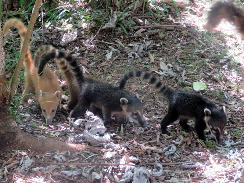
South American Coati Nasua nasua -
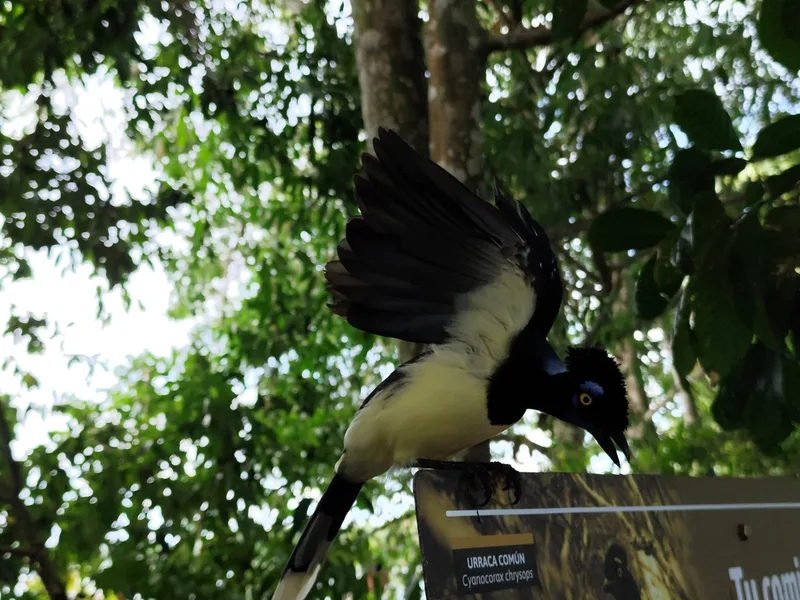
Plush-crested Jay Cyanocorax chrysops -
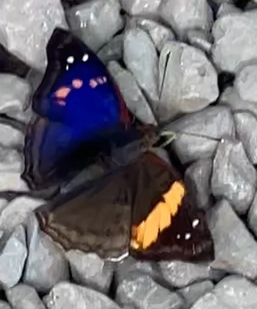
Agathina Emperor Doxocopa agathina -
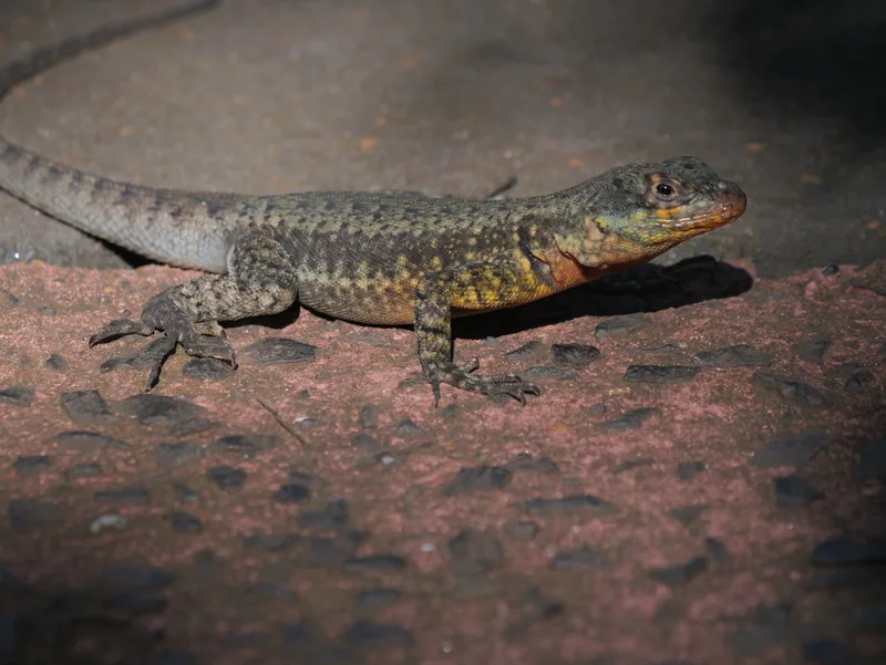
Western Collared Spiny Lizard Tropidurus catalanensis -
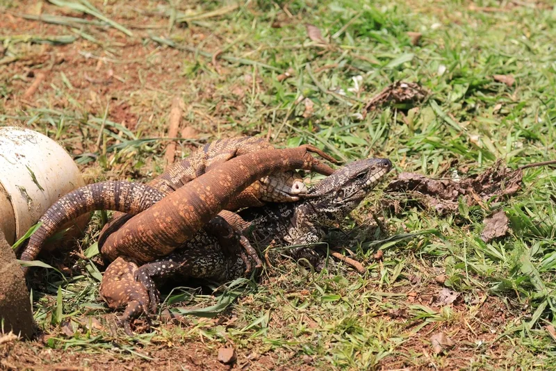
Argentine Black-and-white Tegu Salvator merianae -
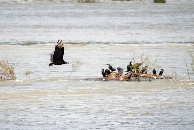
Black Vulture Coragyps atratus -
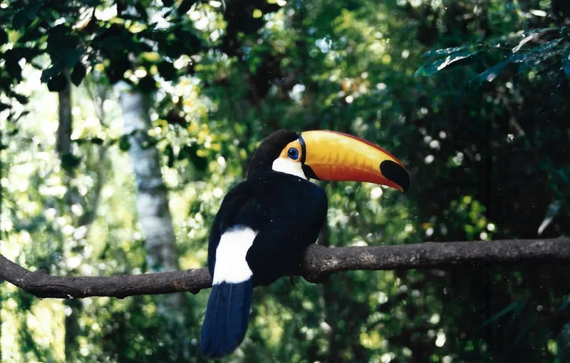
Toco Toucan Ramphastos toco -

Hydaspes Eighty-Eight Callicore hydaspes -
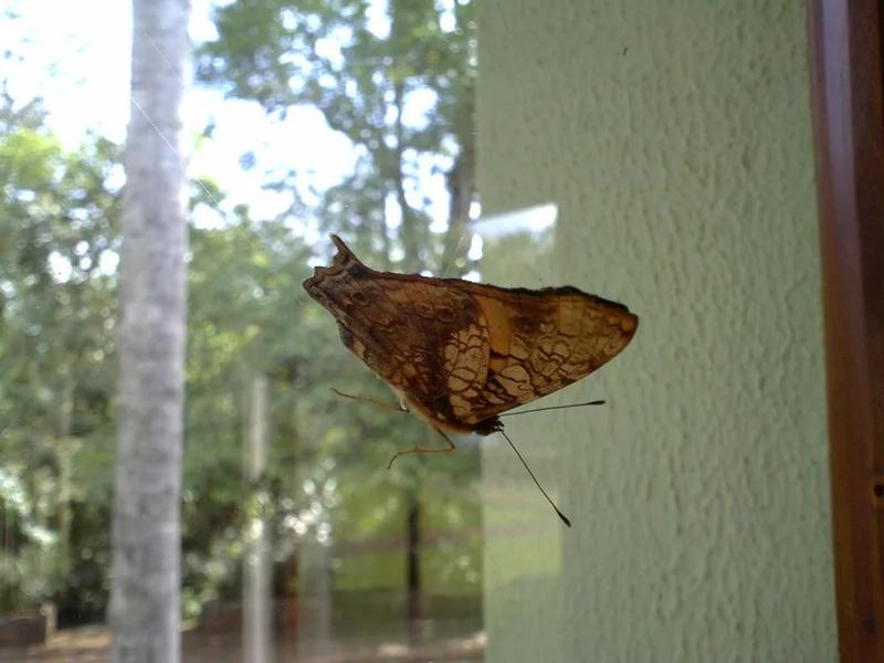
Orange Mapwing Hypanartia lethe -
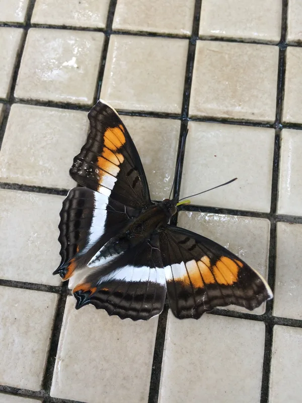
Doxocopa linda -
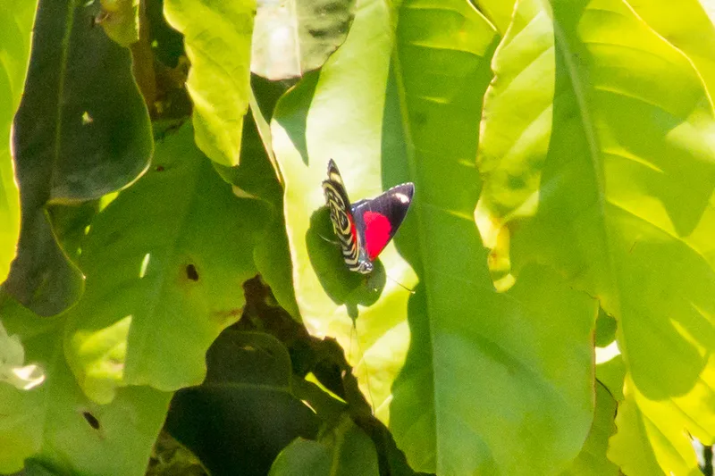
Godart's numberwing Catagramma pygas -
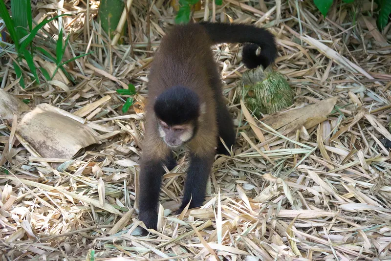
Black capuchin Sapajus nigritus
Field Notes · Rivers & Canyons lens · Iguazú Falls · −25.6479, −54.2856