Hallasan
Every hill on this island was once a small mouth of fire, and most of them are barely cold.
Why here
From a plane, Jeju looks deceptively gentle—rounded green hills scattered across a wide plain, more pasture than volcano. Land, and the trick becomes obvious: nearly every one of those hills is its own small volcano. Hallasan is not a single mountain that erupted once and went quiet. It rose as a broad, gently sloped mass built by hundreds of separate vents, each one opening, cooling, and going still while its neighbors kept working, over a span that geologists trace from a few million years ago into a stretch close enough to the present to still feel recent. The rock underfoot is, on this scale, freshly made. That is the idea this note keeps returning to: not one eruption but many, not a finished mountain but a still-recent one, and evidence of both scattered across the whole island if you know the shape to look for—the low, round-shouldered hill with a slightly dished-in top, the mark of its own private vent.
The story
Land first: Hallasan is less a single mountain than a raised plain that kept erupting. This island’s lava built the base beginning a few million years ago, and unlike a steep-sided cone that blows apart, it was thin and runny—it spread out low and wide, which is why the island reads as a broad, low rise rather than a single sharp peak. As that broad rise built up, hundreds of smaller vents broke out on its flanks, each building its own low hill rather than feeding the main one. Where a rising vent met seawater instead of open air, the result was different again: steam-driven blasts of ash and rock built steep rings rather than gentle domes. The record runs close enough to the present that this reads less like ancient history than an unfinished project.
Life came after, once slope and soil held still long enough to grow something. Forest climbed the cooled flanks, and the birds now moving through it—crows, bulbuls, thrushes—use those old vents and craters as shelter without needing to know what shaped them.
People arrived and read the restless ground on their own terms. Southern Jeju developed a shamanic tradition found nowhere else in Korea: priests inherited a set of sacred brass tools, and their most sacred rites include the recitation of an origin myth explaining where those tools—and the gods behind them—came from. The record says little about exactly when that tradition took root here, only that it took hold nowhere else.
The sites
The shapes lava takes
산굼부리 분화구
33.4343, 126.6898
Most of the volcanic vents scattered across this island built a hill: magma rose, spattered into loose rock, and piled itself into the low, round shape repeated across the island’s skyline. This crater did the opposite. It sits nearly level with the surrounding fields, a wide bowl sunk straight into flat ground with almost no rim built up around the hole. Instead of piling a cone, the vent seems to have thrown its material outward, leaving a crater you look down into rather than climb up to see. Standing at the rim, it helps to have already seen one of the ordinary round hills nearby — the contrast is the point. A vent this size elsewhere on the island became a familiar hill; here it became a hole in flat ground, for reasons the rock itself doesn’t fully explain. That kind of variety, ordinary cone next to unlikely crater, is close to the whole story of how this island was built: not from one blueprint repeated hundreds of times, but from the same raw materials arriving at the surface by different routes and leaving different marks.
Walk the rim boardwalk and look for where the crater wall drops away sharply rather than sloping gently like the hills around it — the sharper the drop, the less time the vent had to pile loose rock before it stopped erupting. Compare that edge with the gentler outer slope leading up to the rim from the entrance, built from older, more gradually deposited material.
- AccessDrive-up
- ExertionEasy
- TimeAn hour
금오름
33.3546, 126.3058
Geumoreum is the classic shape repeated across the island: a low, round-shouldered hill built from loose volcanic rock thrown up around a single vent, with a dished-in top marking where the vent itself once opened. Unlike the lava that spread out flat to build the island’s base, the rock here piled close to where it landed — cinders and ash falling near the mouth instead of running downhill as flowing lava. That difference in behavior is why this island has both a broad, gentle base and hundreds of these small, steep-sided hills rising off of it: the same magma, arriving at the surface in a different manner. A path climbs the outer slope to the crater rim, and from the top the shape becomes obvious in a way it isn’t from the ground: a near-perfect ring, standing apart from the flatter ground around it. On a clear day the rim gives a long view back across the wider landscape the smaller hill sits on, one vent’s work set against the whole island’s.
From the rim path, look down into the crater bowl and see whether it’s holding any water. Some of these craters seal enough to pool rain into a shallow pond for a while; others drain straight through the loose rock. Either way tells you something about how tightly the ash and cinder settled when they fell.
- AccessShort walk
- ExertionModerate
- TimeAn hour
산방산
33.2416, 126.3133
Sanbangsan looks different from every hill around it, and the difference is the point. Where the low oreum cones are loose, cindery, and round-shouldered, this one is a single steep mass with smooth, unbroken sides and no dished-in crater at its top. That shape points to lava thick enough to barely move: instead of running downhill or blasting into loose cinder, it piled up close to its own vent and hardened into one solid dome. Most of the rock making up this island is thin and fluid, the kind that spreads for a distance before it cools; whatever came up here behaved differently, stacking rather than spreading. From a distance, Sanbangsan reads almost like an outcrop dropped onto flat ground, because in a sense it is exactly that: a mass of especially stiff material that never traveled far from where it surfaced. Circle its base rather than expecting the loose, walkable slopes of the other cones nearby, and notice how abruptly the ground changes from level fields to standing rock.
Stand at the base and run your eye up the cliff face for a change in the rock’s texture or color banding. A dome built from one thick pulse of lava tends to show fewer distinct layers than a cone built from many separate showers of cinder — count how many bands you can pick out, if any.
- AccessShort walk
- ExertionModerate
- TimeAn hour
Where fire met the sea
성산일출봉
33.4589, 126.9408
Where lava met the sea instead of open air, the eruption changed shape entirely. Seongsan sits right at the coast, and the encounter between rising magma and seawater produced a much more violent, steam-driven blast than the quieter cinder cones inland — ash and shattered rock thrown up and out rather than spattering gently into a pile. The result is a steep-walled crater open on its seaward side, its rim standing high enough to be visible well out at sea, unlike the low, grassy hills further inland. Where an inland vent like Geumoreum built a modest rounded hill, this one built something closer to a fortress wall. Approach from the base and the change in the rock itself is visible: not the loose black cinder of an inland cone, but a paler, harder, more compacted stone, cemented by the same steam that made the eruption so violent in the first place. Climb toward the rim and the crater interior opens into a broad grassy bowl, its far wall dropping straight to the water — land built in one specific kind of eruption you won’t find anywhere inland on the island.
From the base, look closely at the cliff face and pick out the pale, compacted rock — finer and harder than the loose black cinder you’ll see at an inland oreum. That difference in texture is the fingerprint of an eruption that happened at or under the shoreline, where steam did as much work as the magma itself.
- AccessShort walk
- ExertionModerate
- TimeAn hour
용두암
33.5160, 126.5120
At the shoreline, waves have spent a long time working on whatever lava reached the sea and hardened there, and this rock is what’s left after the softer material around it wore away. It stands apart from the coast behind it, exposed once the surrounding rock eroded down, and the surf keeps cutting at its base even now. Because it formed from a mass of solidified lava rather than layered cinder, it holds together as a single resistant lump instead of crumbling the way a loose cone would if the sea reached it. That resistance is exactly why it’s still standing while softer material nearby has already washed away: hard rock outlasts soft rock at a coastline, given enough centuries. Look at the rock’s surface up close and you can still find the coarse, bubbled texture typical of lava that cooled with gas trapped inside it, unlike the smoother stone you might expect from something shaped entirely by water. Both processes made this rock what it is — the lava built it, the sea is still finishing the sculpture.
Get close enough to see the rock’s surface texture rather than just its silhouette. Look for small rounded holes or bubbles across the stone — gas trapped in the lava as it cooled, now exposed by however much the sea has worn away since.
- AccessDrive-up
- ExertionEasy
- TimeAn hour
The hollow places
용연
33.5149, 126.5141
A short stream here has spent a long time cutting down through the same hardened lava responsible for the coastline nearby, and the result is a narrow, steep-walled valley rather than a gentle bank. Water is a slower sculptor than surf, but given enough time it works the same basic bargain: soft or fractured rock wears away first, leaving the harder, more resistant material standing as cliff. Walk along the rim and the valley narrows and opens again in places, evidence of buried variation in the lava itself — the flow that filled this stretch of coastline wasn’t perfectly uniform in hardness, cooling rate, or how it fractured, and the stream has found and followed every seam of weakness in exactly that record. A footbridge crosses partway along, giving a view straight down the throat of the valley toward the sea, where the same hard rock meets the surf. It’s a quiet companion piece to the more dramatic shoreline stone nearby, and a reminder that a river need not be large to leave a lasting mark, given geologic time to work.
From the bridge, look at both valley walls opposite each other. Note whether one side juts out further than the other, or shows a different rock color or texture band — signs that the lava filling this valley wasn’t a single uniform pour but several, stacked or side by side, each with slightly different hardness.
- AccessShort walk
- ExertionEasy
- TimeAn hour
구린굴 (Guringul)
33.4113, 126.5474
Look into this opening and you’re looking at the plumbing of an old lava flow, not just a random hole in the ground. When a stream of lava flows for any distance, its outer surface cools and hardens into a crust while the still-molten rock underneath keeps moving. If the eruption feeding it stops, or the flow simply drains onward, the liquid interior can empty out from beneath its own hardened roof, leaving a long, hollow tunnel where a river of rock used to run. This entrance marks a break in that roof, whether from a partial collapse or a natural opening that formed as the tube emptied. The rock walls carry no soil, no root systems, nothing that took hold gradually over time — it’s raw, largely unweathered rock from the moment the tube’s interior stopped flowing. Lava tubes like this one can run for a considerable distance underground in many volcanic landscapes, threading beneath ground that gives no obvious sign of what’s hollow beneath it. This entrance is simply one point where that hidden plumbing happens to reach daylight.
Look at the opening’s shape rather than just its darkness — these entrances are often taller than they are wide, closer to a slot than a mouth, because they mark where a tube’s roof gave way rather than where it was built to open. Notice any change in vegetation right at the rim, where roots can suddenly reach open air instead of packed soil.
- AccessShort walk
- ExertionEasy
- TimeAn hour
When it's best
None of this changes with the calendar—craters, domes, and lava tubes hold their shape in every month—so there is no wrong season to read this island’s volcanic story. What does shift is the walking. Late winter into early spring tends to run cool and often damp, with daytime temperatures hovering only a little above freezing and nights dropping well below it, so pack for cold higher up even if the coast feels mild. Rain or the occasional snow shower is common in that window, which thins the crowds at the better-known cones and softens the light for reading rock texture up close. Later in the year brings warmer, more humid conditions more typical of an island this far south. Either way, expect weather to change over the course of a single day near the coast, and treat any clear window at a rim or dome as worth taking rather than waiting out.
Go deeper
The names behind what you saw: every site in this note sits on what geologists classify simply as Cenozoic volcanic rocks — mafic volcanic rocks, meaning basalt and its close relatives, dated from the Pliocene into the Pleistocene. That is the formal name for what this note has been calling old lava throughout. One note on status: at least one historical source describes Hallasan explicitly as a dormant volcano, not an extinct one — worth knowing if “long quiet” and “finished” seem like the same thing. They are not.
To read next: - Jeju Island (Wikipedia) — the plain scale of the landmass this volcanic history built, useful for placing any single crater or cone here in context. - Hallasan National Park (Wikipedia) — when formal protection of the mountain and surrounding land began, and roughly what falls inside its boundary today. - Jeju Province (Wikipedia) — the wider picture: this island is the largest piece of a province built entirely from volcanic islands, a reminder that Hallasan’s story didn’t stop at the coastline.
The names behind what you saw
What lives here, and what it's called. Photographs from open collections — an aid to identification, not decoration.
-
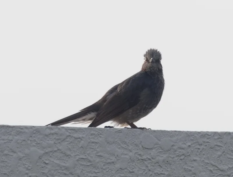
Brown-eared Bulbul Hypsipetes amaurotis -
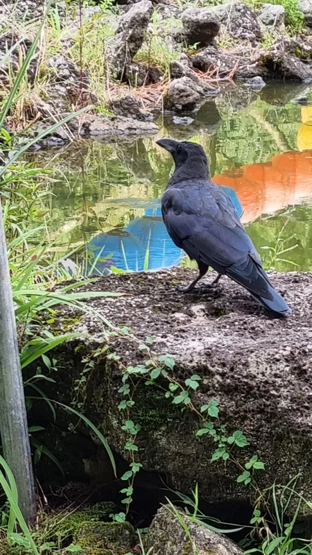
Large-billed Crow Corvus macrorhynchos -
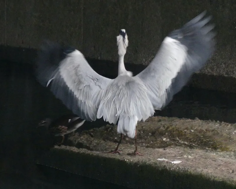
Grey Heron Ardea cinerea -
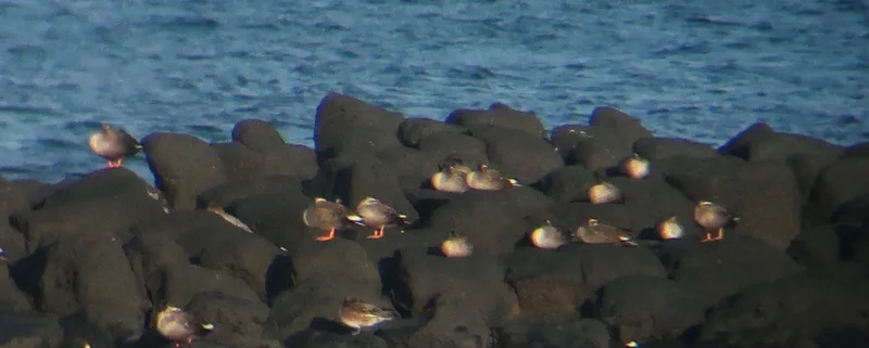
Eastern Spot-billed Duck Anas zonorhyncha -
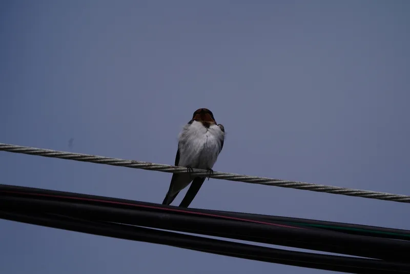
Barn Swallow Hirundo rustica -
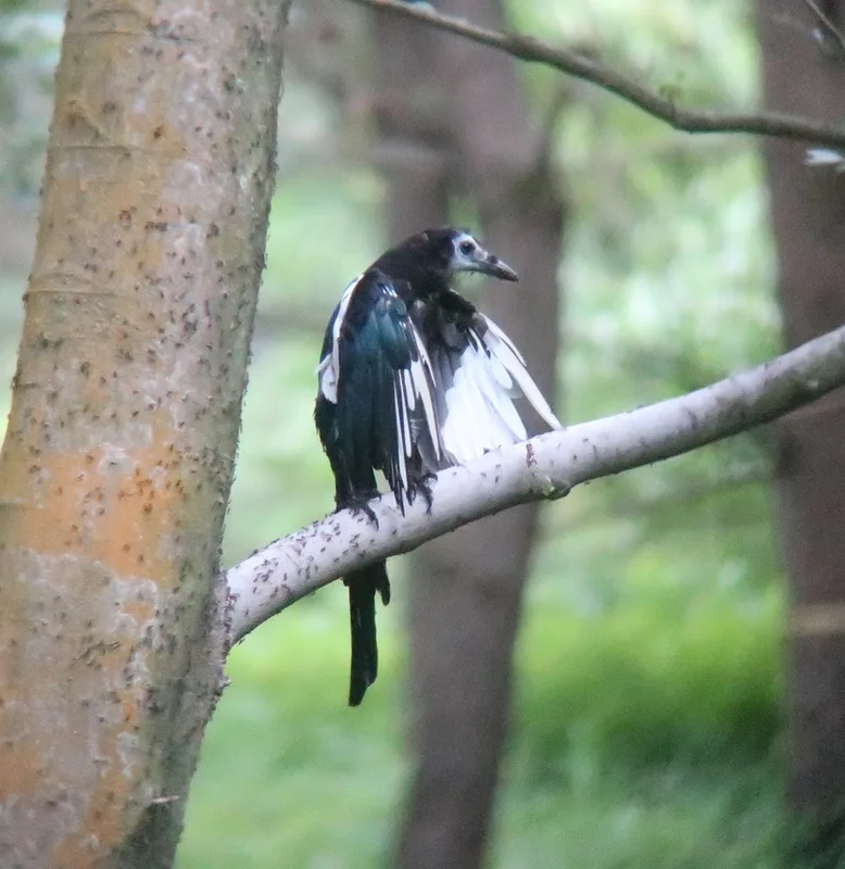
Oriental Magpie Pica serica -
Black-tailed Gull Larus crassirostris -
Blue Rock-Thrush Monticola solitarius -
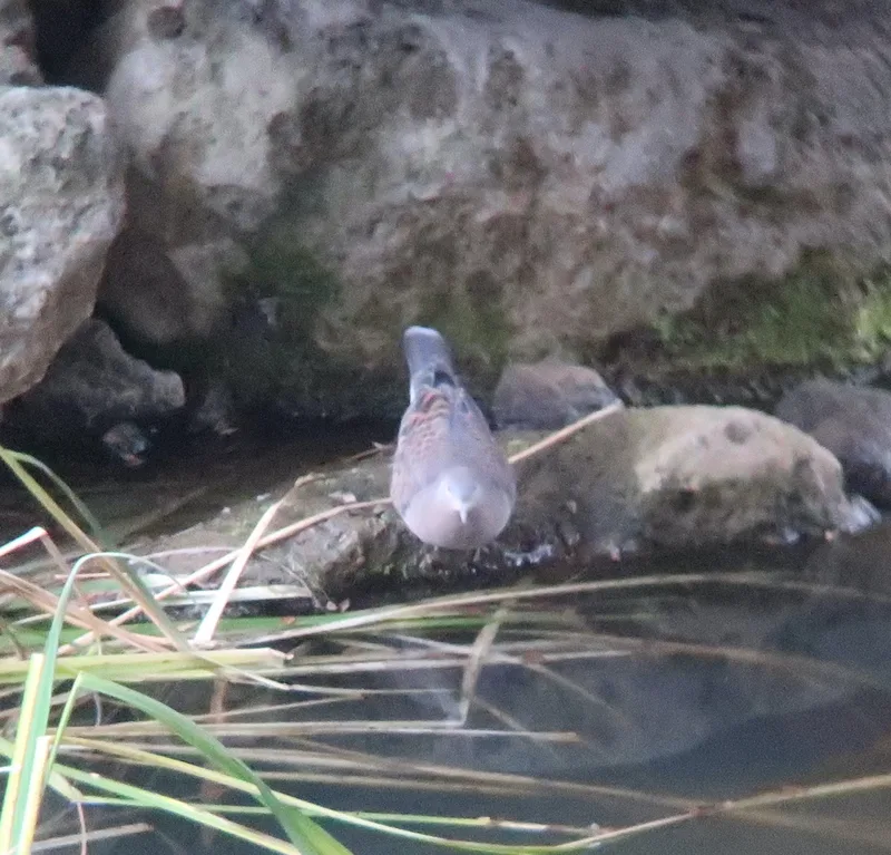
Oriental Turtle-Dove Streptopelia orientalis -
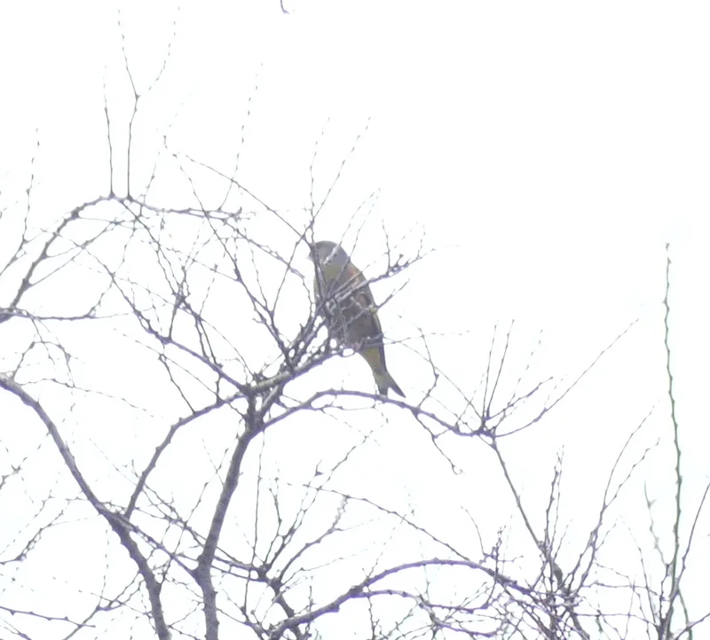
Oriental Greenfinch Chloris sinica -
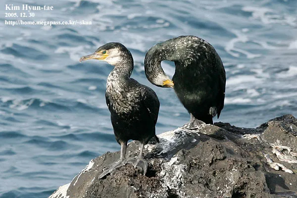
Japanese Cormorant Phalacrocorax capillatus -
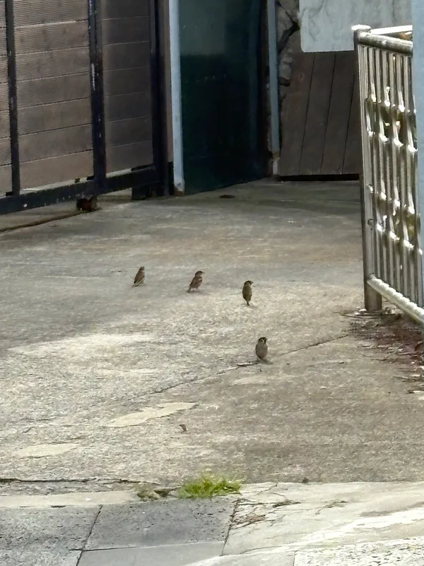
Eurasian Tree Sparrow Passer montanus
Field Notes · Volcanic lens · Hallasan · 33.3803, 126.5483