Hạ Long Bay
Hạ Long Bay · Quảng Ninh, Vietnam
The name means descending dragon — a fitting story for a coast where the land seems to drop straight out of the sky and into the water.
Why here
From offshore, Hạ Long Bay looks less like a coastline than a drowned mountain range: thousands of limestone towers standing shoulder to shoulder in gray water, their bases lost in tide and their tops lost as often as not in low cloud. It is tempting to read that scene as scenery, fixed and finished, the way a photograph freezes it. It isn’t. The sea lapping at the base of every tower is the same sea, in one form or another, that first buried this rock as soft sediment on an ancient floor, long before there was a bay to name. Water buried this land once, and water is still working on it — dissolving it from below the surface, undercutting it at the waterline, feeding the fog that settles into the forest still holding on up top. Nothing here is finished. What looks like a fixed and famous view is really a slow argument between land and sea that has been running for longer than anyone has watched it, and that this note keeps circling back to, one stop at a time.
The story
The land here began as ordinary sediment, settling on the floor of a shallow sea somewhere between roughly 250 and 145 million years ago. That sediment hardened into limestone, was folded and pushed upward into hill country, and then — as sea levels and coastlines shifted over an immense stretch of time — found itself partly drowned again, leaving only its highest ground standing above the water as the thousands of towers and islets seen today.
Life took hold wherever the drowning left enough forested high ground to hold on to. Each surviving tower behaves a little like a small island of its own, cut off from its neighbors by open water: rhesus macaques work the canopy and forest floor, sun skinks and tree lizards bask in the breaks between trees, and orb-weavers string webs across any gap that might catch a passing insect. Kites and rock-thrushes work the cliffs and open air between towers, going where the forest can’t.
People arrived later and read the same landscape as story before they read it as rock: the bay’s name means descending dragon, one of many old tales that gave a hard-to-explain coast some kind of shape and meaning. The city that now looks out over the bay is comparatively young in its current form, created in 1993 by joining the old provincial capital, Hòn Gai, with its neighboring tourist town, Bãi Cháy — a modern administrative act laid over a landscape that had already been old for longer than any human record here reaches back.
The sites
The towers above the water
Núi Bài Thơ
20.9483, 107.0783
Climb here and you get the view the bay is named for: land that seems to be dissolving into water. From this height, the mainland’s last high ground gives way, tower by tower, to islands that were once part of the same unbroken limestone country. Every one of those towers is made of the same old rock as the ridge under your feet — sea-floor sediment that hardened long before either sea existed in its current shape, then rose into hills, and is now slowly being taken back by the water that first buried it. What’s unusual about this particular vantage is that you don’t need a boat to see it: the whole relationship between land and sea plays out below you, silent and ongoing. On clear days the pattern runs to the horizon; on foggy ones, only the nearest towers hold their shape, and the rest dissolve into gray the same way the rock itself is dissolving, at a pace too slow to watch but not too slow to understand.
Find the point where the solid mainland ridge gives way to standing towers rising straight from the water. That break marks where the same limestone country continues, but now mostly drowned. Try counting how many towers you can still make out before fog or haze swallows the rest — the number changes by the hour.
- AccessShort walk
- ExertionModerate
- TimeAn hour
Cầu Koi
20.9559, 107.0727
Where the mainland peak shows the bay from above, this small waterside viewpoint puts you level with it. Fog behaves differently down here — instead of a blanket you look down into, it becomes something you stand inside, thinning and thickening around you as air moves off the water. This is also where the sea’s daily work is easiest to watch up close: herons and wagtails working the tideline, water lapping at rock that never fully dries between one high tide and the next. The towers that looked whole from higher ground now show themselves in pieces — a cliff face here, a notch there, cut by water that has been doing the same job, patiently, for longer than anyone has been watching. Stand here at different times of day and the light changes what you can see of it: flat gray in fog, sharp-edged in the hour after it lifts. Nothing about the view is dramatic in the way a postcard promises; it is closer to watching a slow argument between rock and water, one neither side is winning outright, and won’t for a long time yet.
Look at the waterline on the nearest rock face for a shallow groove or notch cut straight across it. That’s the sea working one narrow band harder than any other — the same line, hit twice a day, every day, for longer than the rock has been standing above water.
- AccessDrive-up
- ExertionEasy
- TimeAn hour
Where the karst hollows out
Trung Trang Grotto
20.7895, 106.9980
Every cave in this country is proof that limestone is never really solid. Rain that lands anywhere nearby picks up a little acid from the air and soil, seeps into cracks in the rock, and slowly widens them into passages — the same process happening below the waterline, out among the towers, only here you can walk into it. A signboard at the entrance marks what’s known of this particular passage; step inside and the air cools before your eyes adjust, sheltered from the sun for longer than there has been a bay outside it. The limestone itself goes back a long way — somewhere between roughly 250 and 145 million years, laid down as sediment in a much older sea, long before the rock ever rose into hills or the current coastline existed at all. Caves like this are a reminder that the karst towers rising from the water outside are not solid mountains so much as the leftover high points of a landscape that has spent an immense stretch of time being dissolved from both outside and in.
Look at the walls just inside the entrance for smooth, rounded surfaces rather than sharp, broken edges. That rounding is the signature of water dissolving stone along its path over a very long time, the same process shaping the towers outside from the water side.
- AccessShort walk
- ExertionEasy
- TimeAn hour
Dark passage cave
20.8035, 107.0987
Not every cave here is a single chamber; some are corridors, cut clean through a tower from one side to the other, so what starts as a dark passage ends in daylight and water again. Moving through one like this gives a different sense of what a karst island is made of than looking at it from outside: less a solid rock than a shell, riddled and hollow in places, held up mostly by its own outer walls. The air inside stays cool and still even when the outside is thick with heat or fog, and that stillness is its own kind of evidence — water moves through here slowly enough to have had time to carve rather than just wash. Come out the far side and the light change is abrupt, water and sky again after however long the passage took, the same limestone now standing as an island instead of a wall. It is a small, physical way of feeling what erosion actually does over time: not flattening, but hollowing, tower by tower, passage by passage.
As you move through the passage, notice where the ceiling is lowest and darkest versus where daylight starts to reach back in from either end. Try tracing the rock texture along the way — it tends to run smoother where water has worked longest, rougher where it hasn’t.
- AccessHalf-day hike
- ExertionModerate
- TimeHalf a day
Dỉnh Kim Giao
20.7947, 106.9974
The forest that covers the high ground here exists because fog and rain keep it wet enough, year round, to hold on to soil in a place where soil has nowhere flat to sit. Karst islands like this one are steep almost everywhere; without a steady supply of moisture caught out of the air itself, most of that thin cover would simply wash into the sea. What grows here instead is a close, humid tangle that shelters a small, semi-isolated set of animals — macaques working the canopy and forest floor, skinks and tree lizards sunning on exposed rock in the breaks between trees, and orb-weavers stringing webs at head height across any gap wide enough to catch flying insects. Because so many of these high points are cut off from one another by water, the forest on each one behaves a little like its own small island, holding on to residents that don’t mix easily with the ones on the next tower over. Climb to the viewpoint and the vantage makes both halves of the story visible together: bare rock and open water outside, closed green forest underfoot, held there by air that never quite dries out.
Watch the canopy for movement at eye level rather than overhead — macaques here tend to work the mid-story and forest floor as much as the treetops. If you don’t see one, look instead for a large, gold-toned spiderweb strung across a gap in the trail; the spider that built it sits at the center and is often easier to spot than any animal moving.
- AccessHalf-day hike
- ExertionStrenuous
- TimeHalf a day
The bay's outer reach
Núi Sư Tử
20.9826, 107.2443
The bay most people picture ends well before the water does. Northeast of the crowded core, the same limestone country keeps going, sharing the same rock, the same climate, and the same fog, but seeing far less traffic. From a rise like this one, that continuity is the whole point: towers exactly like the famous ones, the same haze settling into the same channels between them, just fewer boats around to remind you a name has been drawn around only part of it. It’s a useful corrective to the idea that Hạ Long Bay is a single discrete place — the geology doesn’t recognize the boundary, and neither does the weather riding in off the gulf. Stand here on a hazy day and the towers nearest you stay sharp while the ones further out soften into gray, exactly as they would from any viewpoint back in the busier water — proof that the fog is a property of the whole coast, not a special effect laid on for the postcard views.
Pick out the farthest tower you can still see clearly, then the next one behind it that has already gone soft in the haze. That transition zone marks roughly where the fog is thickest right now — it will have shifted by the time you look again, sometimes within the hour.
- AccessExpedition
- ExertionModerate
- TimeHalf a day
Núi Voi
20.9835, 107.2440
Names like this one, elephant, turn up across the region, given by people trying to describe an unfamiliar shape in familiar terms. Whatever the rock actually looks like up close, from a distance the karst towers out this way keep repeating a few basic silhouettes — a rounded hump, a single tusk-like spire, a long low back — because they are all being shaped by the same limestone and the same slow erosion, just at slightly different stages. Standing on one of them puts you inside that repetition rather than looking at it from a boat: rock underfoot behaving exactly like the rock across the water, forest holding on in the same thin, fog-fed cover. Birds move through here the way they do across the wider bay — crows and small songbirds working the forest edge, wagtails picking along any open rock or shoreline. Nothing here is rarer than what’s found closer to the main tourist water; it is the same coast, doing the same thing, a little further from where most people stop to look.
Compare the shape of this peak to the nearest neighboring tower you can see. Look for the same basic profile repeated — rounded top, steep sides dropping straight to water — and notice how each one differs mainly in how far the erosion has gone, not in what it’s made of.
- AccessExpedition
- ExertionModerate
- TimeHalf a day
When it's best
This coast doesn’t really have an off season so much as a mood that shifts with the months. Cooler months tend to bring the fog that gives this lens its name — moist air riding in off the gulf and settling low over the water and the tower tops, thinning and returning through the day rather than sitting fixed in place. Warmer months generally clear the air more reliably, trading the haze for sharper, more distant views but also a livelier sea and heavier rain. Neither is better outright: the fog is part of what this place is, and missing it isn’t missing the point so much as seeing a different one. Come whenever suits you, and let the weather that day decide which version of the bay you get.
Go deeper
The names behind what you saw
The rock under every tower and cave belongs to a unit geologists label the Mesozoic sedimentary rocks — limestone laid down through the Triassic and Jurassic periods, roughly 252 to 145 million years ago (macrostrat).
Species mentioned in this note, by their scientific names: Rhesus Macaque (Macaca mulatta), Common Sun Skink (Eutropis multifasciata), Scale-bellied Tree Lizard (Acanthosaura lepidogaster), Giant Golden Orbweaver (Nephila pilipes), Black Kite (Milvus migrans), Blue Rock-Thrush (Monticola solitarius), Pacific Reef Heron (Egretta sacra).
To read next
- Wikipedia, “Hạ Long Bay” — the clearest short account of the karst geology, the UNESCO listing, and how this bay connects to Bai Tu Long and Cát Bà as one shared landscape.
- Wikipedia, “Hạ Long” — the modern city’s own short history, including its 1993 formation from Hòn Gai and Bãi Cháy.
- Wikipedia, “Vietnamese mythology” — background on the folk tradition behind names like the bay’s own “descending dragon.”
- Wikipedia, “French Indochina” — colonial-era context for the wider region this coast sits within.
- Macrostrat, unit record 3188675 — the primary source for the age range of the limestone used throughout this note.
The names behind what you saw
What lives here, and what it's called. Photographs from open collections — an aid to identification, not decoration.
-
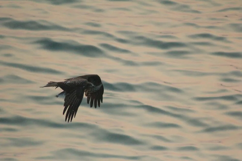
Black Kite Milvus migrans -
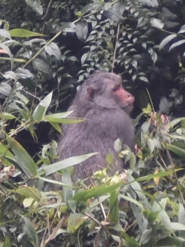
Rhesus Macaque Macaca mulatta -
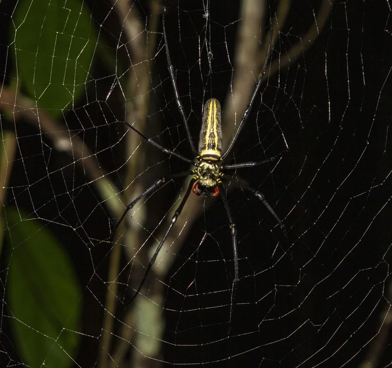
Giant Golden Orbweaver Nephila pilipes -
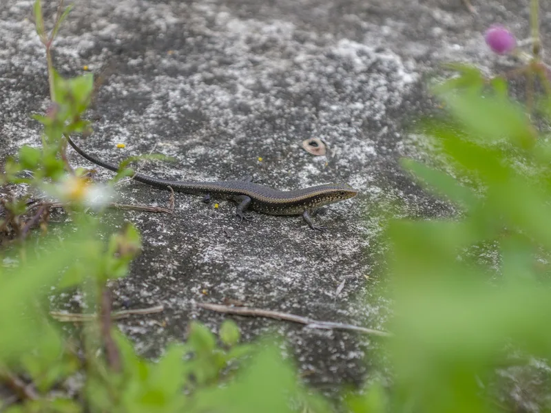
Common Sun Skink Eutropis multifasciata -
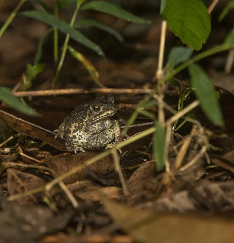
Asian Common Toad Duttaphrynus melanostictus -
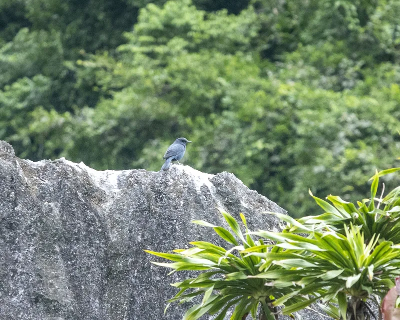
Blue Rock-Thrush Monticola solitarius -
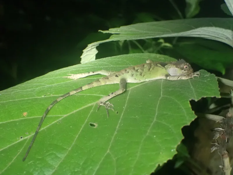
Scale-bellied Tree Lizard Acanthosaura lepidogaster -
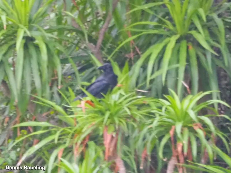
Large-billed Crow Corvus macrorhynchos -
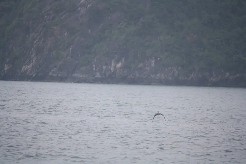
Pacific Reef Heron Egretta sacra -
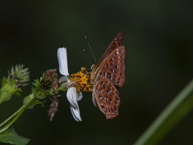
Punchinello Zemeros flegyas -
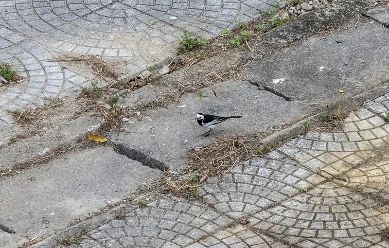
White Wagtail Motacilla alba -
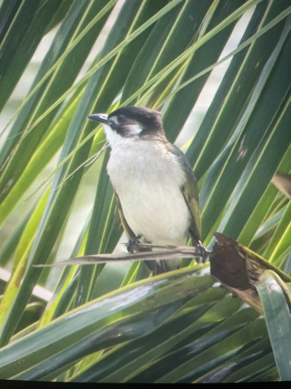
Light-vented Bulbul Pycnonotus sinensis
Field Notes · Fog Coast lens · Hạ Long Bay · 20.9489, 107.1035