The Guadalupe Mountains
Guadalupe Mountains National Park · Texas, USA
The desert keeps an old sea floor standing above the dry country.
Why here
The Guadalupe Mountains rise from desert country as a piece of an older sea. Their sedimentary rock records layers made in water, then lifted and exposed above the surrounding flats. That contrast is the key to the place. A mountain can be dry now and still carry the shape of a marine past in its limestone, ledges, and fossils. Walk from the lower desert toward the peaks and the change in elevation becomes a change in climate as well. Texas madrone and agave occupy the living mountain, while the rock keeps the deeper story. The Guadalupe Mountains are an open archive because the desert has not covered the pages.
The sites
An ancient sea above the desert
El Capitan
31.8773, −104.8580
El Capitan is the mountain’s most direct statement. Sedimentary rock rises above the desert, and the high face carries the memory of material deposited in a much wetter world. Look across the lower flats and then back at the wall. The dry country makes the contrast sharp, but the mountain’s story began in water. Weather now cuts ledges and gullies into those layers, exposing more of the old sea floor with every season.
Find a horizontal band in the mountain face and follow it across the wall. The continuous layer is the old deposit, now raised above the desert.
- AccessShort walk
- ExertionEasy
- TimeAn hour
Bartlett Peak
31.9179, −104.8819
Bartlett Peak brings the marine rock into a higher, colder setting. The same sedimentary foundation changes character as elevation adds wind, shade, and occasional moisture. Texas madrone and agave use different parts of the slope, showing that deep time and living time overlap here. The mountain is old in its rock, but its plants respond to the present exposure. Read the face and the vegetation together.
Compare plants on a sheltered slope with those on the exposed face. Elevation and moisture sort life over the same ancient sedimentary rock.
- AccessHalf-day hike
- ExertionStrenuous
- TimeA full day
Elevation changes the desert
Bush Mountain
31.9296, −104.8802
Bush Mountain makes the transition from desert floor to high country visible in one climb. The lower slopes are dry and open; higher ground offers cooler air and different plants. Parry’s agave holds to the rocky desert, while Texas madrone marks a more sheltered mountain community. The rock beneath them is part of the same old marine record. A climb here is therefore a walk through both elevation and time.
Look for the point where the plant community changes as the trail rises. The change marks a shift in moisture and temperature over a continuous rock layer.
- AccessHalf-day hike
- ExertionStrenuous
- TimeA full day
Coyote Peak
31.9946, −104.8950
Coyote Peak opens a broad view of the mountain’s relationship to the surrounding desert. From above, the sedimentary country appears as a raised block with lower flats on every side. That shape makes the geological story easier to hold: water made the layers, later forces lifted them, and erosion is now lowering their edges again. Look for washes at the base and exposed rock on the high slopes.
Trace a wash from the mountain toward the plain. It is a present route through a landscape whose rock was made in a much older marine setting.
- AccessHalf-day hike
- ExertionStrenuous
- TimeA full day
Plants on old rock
Cutoff Mountain
31.9946, −104.9188
Cutoff Mountain keeps the attention on the living surface of the old rock. Agave, madrone, and desert shrubs occupy pockets made by slope, soil, and shade. The plants do not erase the sedimentary layers. They point to them, because each root is choosing a place where the rock has weathered into something usable. Walk slowly enough to see the small differences between bare ledge and plant-bearing ground.
Find an agave rooted in a crack or shallow pocket. The plant’s position shows where weathered sedimentary rock can hold enough soil and moisture for life.
- AccessShort walk
- ExertionModerate
- TimeHalf a day
When it's best
Fall and spring are the most comfortable seasons for climbing the exposed mountains. Summer heat makes early starts important, while winter can bring cold and wind to the high ridges. Plants respond to elevation and moisture, so spring can bring different signs of life at different heights. The mountain remains readable year-round, even when weather changes the route.
Go deeper
The names behind what you saw. The payload includes Paleozoic sedimentary rocks. Texas madrone, Arbutus xalapensis, and Parry’s agave, Agave parryi, occupy the mountain desert.
To read next. - The Guadalupe Mountains geological map — for the ancient marine layers and uplifted reef. - The park’s natural-history material — for the elevation zones above the desert floor.
The names behind what you saw
What lives here, and what it's called. Photographs from open collections — an aid to identification, not decoration.
-
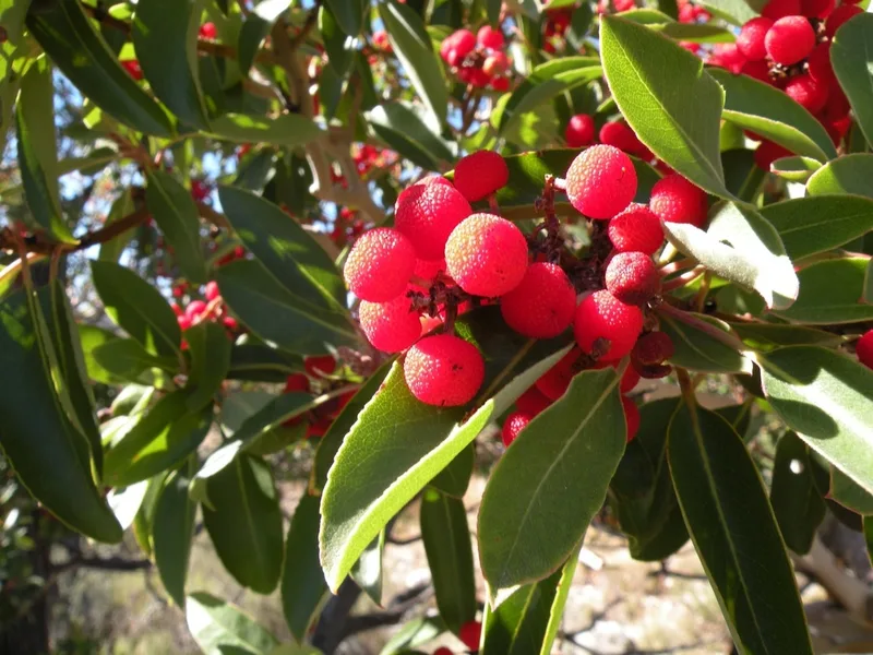
Texas madrone Arbutus xalapensis -
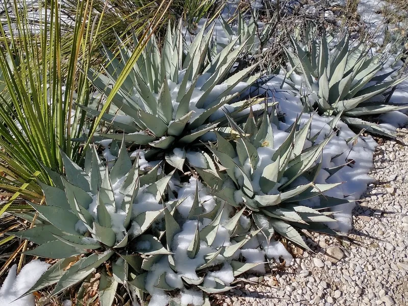
Parry's agave Agave parryi -
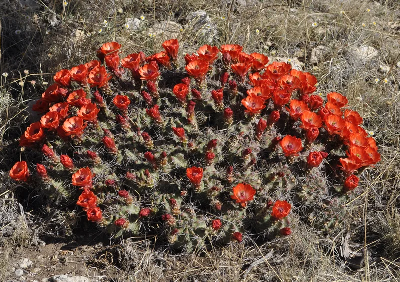
scarlet hedgehog cactus Echinocereus coccineus -
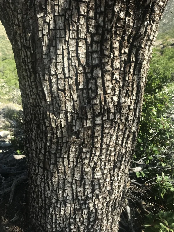
alligator juniper Juniperus deppeana -
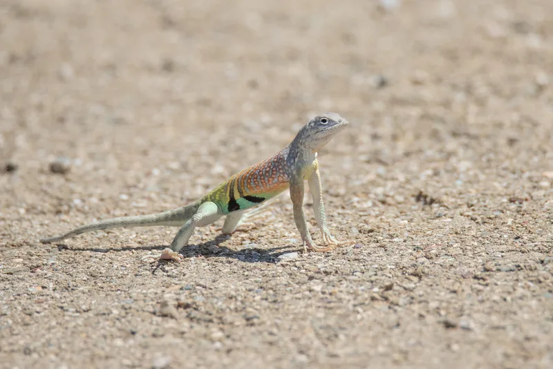
Greater Earless Lizard Cophosaurus texanus -
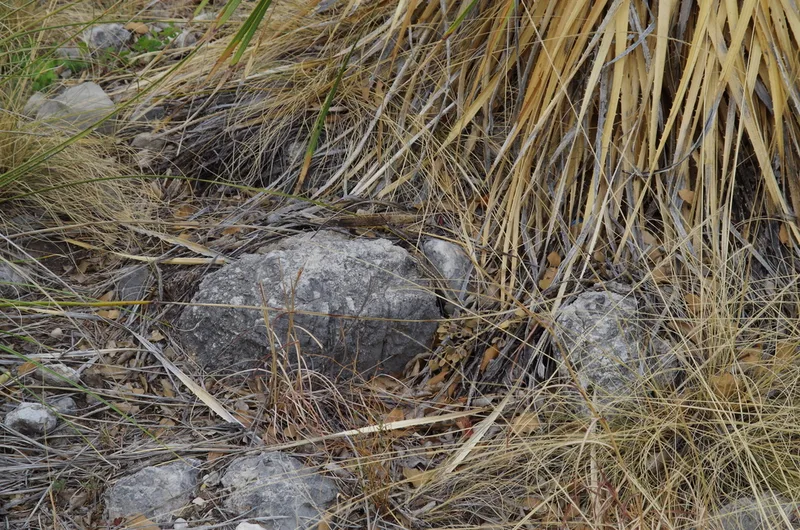
Southwestern Fence Lizard Sceloporus cowlesi -
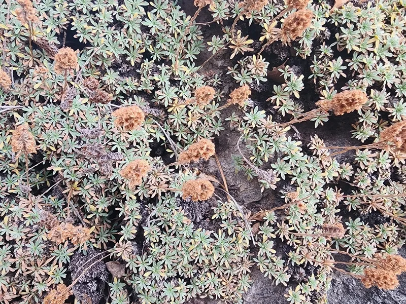
mat rock spiraea Petrophytum caespitosum -
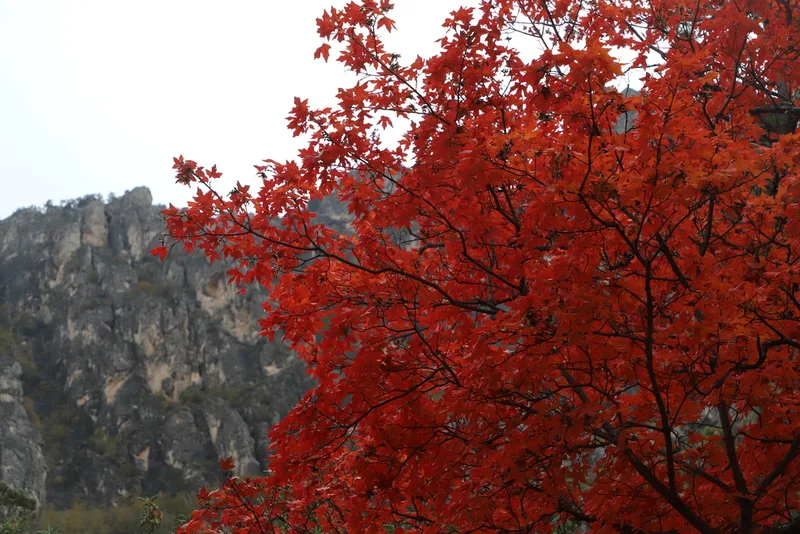
bigtooth maple Acer grandidentatum -
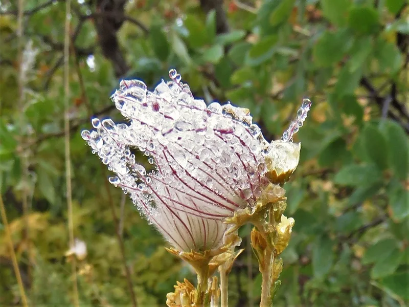
Apache plume Fallugia paradoxa -
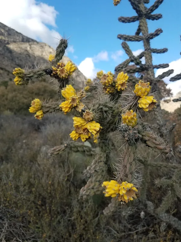
tree cholla Cylindropuntia imbricata -
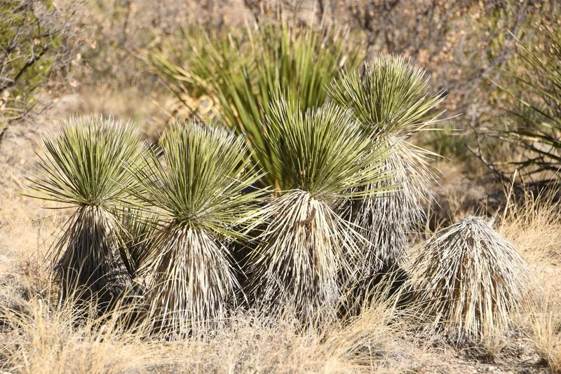
soaptree yucca Yucca elata -
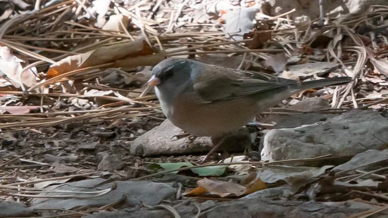
Dark-eyed Junco Junco hyemalis
Field Notes · Desert & Deep Time lens · Guadalupe Mountains National Park · 31.9161, −104.9007