Glacier
The rock remembers a warm, shallow sea. The mountains remember the ice.
Why here
The rock in these peaks began as mud. More than a billion years ago, before there were plants or animals to leave a mark in it, this was the floor of a shallow sea — lime and silt settling in warm, quiet water, layer on patient layer. That ancient stack sat mostly flat and mostly buried for almost all of Earth’s history. Then, in the last short stretch of geologic time, the ice arrived. Rivers of it filled these valleys and set to work on the soft, layered stone — plucking, grinding, scooping — and when the ice drew back it left the mountains you see now: blades of rock too thin to stand on, bowls cut from solid stone, valleys squared off like troughs. The material is impossibly old; the shapes are young. Stand at Logan Pass, the high saddle where the one road across the park crosses the divide, and you are standing inside the ice’s finished work. Everything in this note is one of two things: the old sea floor the ice carved, or the shape it carved that sea floor into.
The story
Start with a sea. For a stretch of time hard to hold in the mind, this corner of the world lay under shallow water, and the mud and lime that settled there hardened into the banded rock the peaks are built from. Look closely and you can still read that old seabed: ribbons and pods of pale lime squeezed through the layers, and the low domed mounds left by mats of ancient microbes that grew toward the light in the shallows.
The sea floor was later lifted, tilted, and shoved up into mountains. But the shapes that make this place were cut last, and quickly, by ice. Glaciers filled the valleys and ground the soft layers into blades and bowls, then melted back into the high hollows, leaving the walls and hanging valleys and deep troughs behind.
People came to a landscape already made. This was Blackfeet country, and the names on the map carry that history plainly — one peak above the road is named for Chief Heavy Runner, killed with most of his encampment by a US Army detachment on the Marias River in the winter of 1870. Later, road crews spent more than a decade blasting a single route up and over the divide, finished in the early 1930s. In the brief warm months, songbirds fill the valley bottoms; by autumn the high country is closing again under snow.
The sites
The divide and the wall
Logan Pass
48.6967, −113.7179
Logan Pass sits on the Continental Divide, the high saddle where the one road across the park crests and starts down the other side. A pass like this is itself a piece of ice-work: a low notch chewed into the ridgeline where glaciers spilling off both flanks met and ground the crest down between them. Stand in the meadow here and the shape of the whole valley reads at a glance — the squared-off trough below you, the steep bowls hung on the peaks around, the thin ridges that connect them. The rock is the same banded sea-floor stone you will see everywhere in the park, and in early summer the meadows around the pass hold snow long after the lowlands have greened. It is the best single place to stand inside the ice’s finished work without walking a step from the road.
From the boardwalk, face the sawtooth ridge running off to the northwest and pick out the lowest notches along its crest. Each notch is a place where ice cut down through the ridge from both sides at once; the sharper the notch, the harder two glaciers worked against each other there.
- AccessDrive-up
- ExertionEasy
- TimeHalf a day
Garden Wall
48.7437, −113.7204
The Garden Wall is the long, knife-edged ridge that runs northwest from Logan Pass, and it is the clearest single lesson in what glaciers do to a mountain. Ice worked at it from both sides at once — one glacier grinding down the valley to the west, another to the east — each eating into the ridge until only a thin blade of rock was left standing between them. Geologists call a ridge cut this way an arête. In places the wall is narrow enough that you could nearly straddle it, with a long drop falling away on either hand. It carries the same billion-year-old layered rock as the rest of the range, but here the layers stand exposed edge-on in a wall barely thick enough to hold them. Seen from the pass or from the trail that traverses its face, it is the backbone of this whole stretch of the divide.
Trace the top of the ridge with your eye and find the spots where it pinches to almost nothing. Those pinches are where the two glaciers came closest to meeting through the mountain; a little more ice and a little more time, and they would have cut the wall clean through into a notch.
- AccessShort walk
- ExertionEasy
- TimeAn hour
Where the ice hangs its water
Bird Woman Falls
48.7080, −113.7480
Across the valley from the road, a thin white ribbon drops from a notch high on the mountainside: Bird Woman Falls, one of the tallest falls in the park, fed by snow and meltwater off the peak above. What makes it worth understanding is not the height but the shelf it leaps from. The small valley behind the falls was carved by its own modest glacier, which could not cut down nearly as fast as the great trunk glacier grinding through the main valley below. When the ice melted, the side valley was left stranded, its mouth hanging in the air high above the floor of the larger one. Geologists call that a hanging valley, and every tall, thin waterfall in this kind of country is water simply falling out of one. The falls run hardest in the warm months, when the snowfields feeding them are melting fast; by late season the ribbon thins.
Follow the falls upward to the lip it pours over, then look down at the wide valley floor far below it. The gap between the two — the sheer height of the drop — is the measure of how much deeper the big glacier cut than the small one behind the falls could ever keep up with.
- AccessShort walk
- ExertionEasy
- TimeAn hour
Mount Oberlin
48.7044, −113.7360
Mount Oberlin stands just northwest of Logan Pass, and its snow and meltwater are what feed Bird Woman Falls off its far side. The peak is a good place to see how ice sharpens a summit. Glaciers gnawed at it from several directions, each carving a steep bowl into a different flank, and where those bowls met near the top they left the angular, chiseled crown you see now — not the rounded dome the mountain would wear if water and weather alone had shaped it. The rock is the same layered sea-floor stone as the rest of the range, and on Oberlin the banding is easy to pick out, running level across the face like courses of brickwork despite everything the ice did to the mountain’s outline.
Look at the top of the mountain and notice how it is built from steep scoops meeting at sharp edges, not smooth curves. Each scoop is a bowl a glacier carved into a different side; the sharpness where they meet is what is left of the mountain after the ice took everything it could reach.
- AccessShort walk
- ExertionModerate
- TimeAn hour
Reading the old sea floor
Going-to-the-Sun Mountain
48.6908, −113.6365
Going-to-the-Sun Mountain rises on its own above the St. Mary Valley, north of the road, a bold pyramid set a little apart from the main crest. Standing separate the way it does, it shows off the thing that is easy to miss when peaks crowd together: the whole mountain is built of flat, level layers, stacked like the pages of a closed book. Those layers are the old sea floor — mud, silt, and lime laid down grain by grain on the bottom of shallow water more than a billion years ago, long before there were plants or animals to disturb it. The ice carved the mountain’s outline, its steep faces and its point, but it could not erase the layering; it only exposed it, slicing cleanly across the ancient beds. A mountain like this is two stories at once — an old, patient one written in the layers, and a fast, violent one written in the shape.
Scan the mountain’s face from bottom to top and count the broad bands of rock, each a slightly different color, running dead level across the whole peak. Every band is a chapter of sea floor; the fact that they still lie so flat is the ancient world showing through the ice’s newer handiwork.
- AccessDrive-up
- ExertionEasy
- TimeAn hour
Heavy Runner Mountain
48.6769, −113.6940
Heavy Runner Mountain rises close to Logan Pass and is easily picked out from the road and the pass itself. It carries the same banded sea-floor rock as its neighbors, with glacier-carved bowls bitten into its flanks, but its name asks you to hold the human history alongside the geology. The mountain is named for a Blackfeet chief killed, with most of his encampment, by a US Army detachment on the Marias River in the winter of 1870. This was Blackfeet country long before it was a park, and the map here is honest about that where you take the time to read it. Standing at the pass, the mountain offers both at once: rock older than almost anything on Earth, ice-shaped in the last blink of geologic time, and a name that reaches back only a century and a half to a hard chapter of the country’s history.
Look toward Heavy Runner from the pass and search its upper slopes for a rounded, scooped hollow bitten into the rock. That kind of bowl is a cirque — the print left where a small glacier once sat, gnawing backward into the mountain year after year until the ice finally melted away.
- AccessDrive-up
- ExertionEasy
- TimeAn hour
When it's best
This is high, cold country, and for much of the year it belongs to the snow. The road over Logan Pass is a short summer affair: crews have to clear drifts that pile deeper than a house before anyone can drive it, and the pass can hold snow well into summer. Come in the warm months and the high meadows green up and bloom while the peaks above still carry white, and the waterfalls run hardest then, fed by melting snowfields. By early autumn the light thins, the crowds ease, and the first storms begin closing the high country down again. There is no way to hurry the season here; the mountains open late and shut early.
Go deeper
The names behind what you saw. The banded rock is mostly the Helena Formation, part of the Belt Supergroup — the billion-plus-year-old sea-floor sediments that build most of these peaks; search either name for the full story. The pale ribbons and pods squeezed through it are called molar-tooth structure, and the low domed mounds are stromatolites, the fossil remains of ancient microbial mats; one thick band of them, the Conophyton zone, stands out in relief across the cliffs. Among the glacial landforms, the knife-edge ridge running off Logan Pass is an arête (the Garden Wall), a scooped hollow high on a peak is a cirque, and Bird Woman Falls pours from a hanging valley — a smaller ice-carved valley left stranded above the main one.
To read next. No pre-vetted reading list came with this note, so these are general directions rather than specific titles: - Any overview of the Belt Supergroup, for how a billion-year-old sea floor ended up two thousand meters in the air. - A plain guide to glacial landforms — arête, cirque, horn, hanging valley — which turns these peaks into a vocabulary you can read straight from the road. - A published geologic map of the park, if you want to match each cliff band to its named rock layer. - Anything careful on the Blackfeet and this land, to set the human history alongside the geology.
The names behind what you saw
What lives here, and what it's called. Photographs from open collections — an aid to identification, not decoration.
-
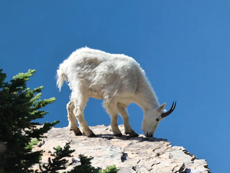
Mountain Goat Oreamnos americanus -
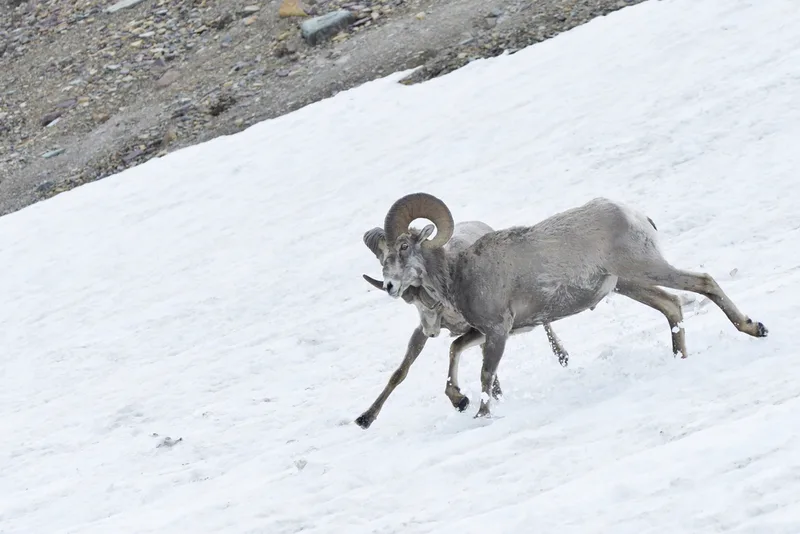
Bighorn Sheep Ovis canadensis -
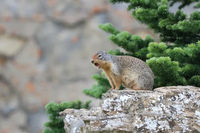
Columbian Ground Squirrel Urocitellus columbianus -
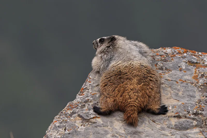
Hoary Marmot Marmota caligata -
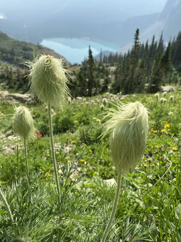
white pasqueflower Pulsatilla occidentalis -
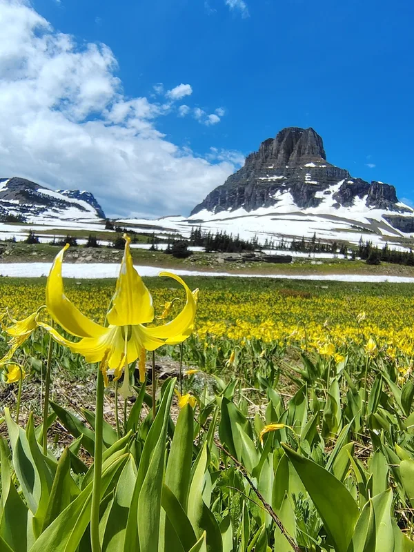
Glacier Lily Erythronium grandiflorum -
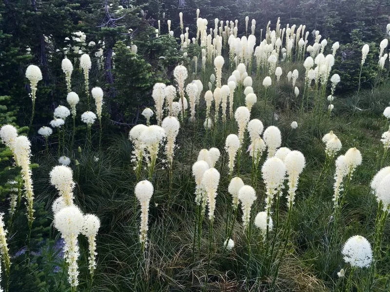
common beargrass Xerophyllum tenax -
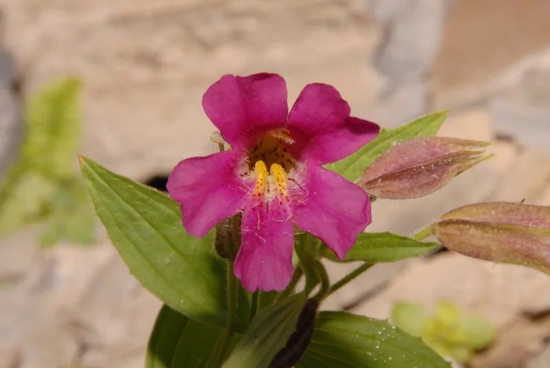
Lewis' monkeyflower Erythranthe lewisii -
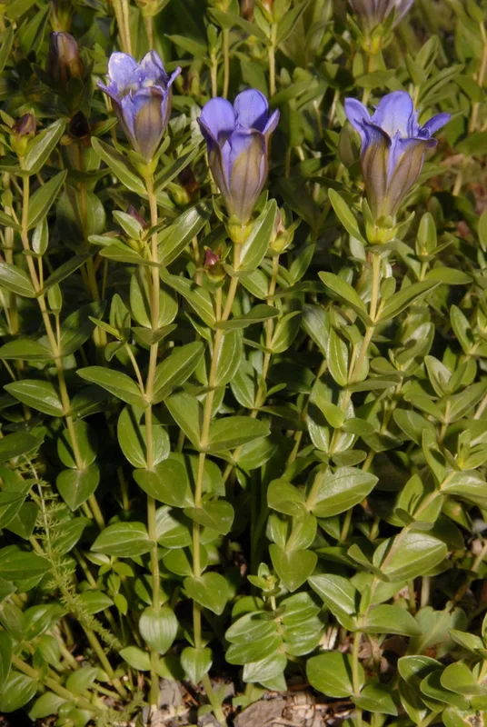
Mountain Bog Gentian Gentiana calycosa -
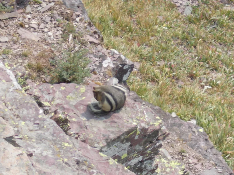
Common Golden-mantled Ground Squirrel Callospermophilus lateralis -
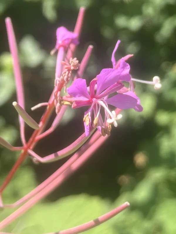
fireweed Chamaenerion angustifolium -
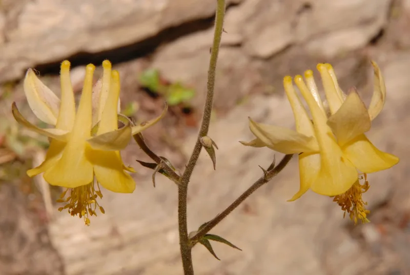
yellow columbine Aquilegia flavescens
Field Notes · Ice & Glaciers lens · Logan Pass · 48.7103, −113.6922