Fish River Canyon
Fish River Canyon · ǁKaras, Namibia
The rock underfoot is as much as 1.6 billion years old; the river arguing with it is not finished yet.
Why here
Look over the rim and it takes a moment to find the river at all — a thin, pale thread on the canyon floor, so far below that it seems too small to have done anything. That thread is the whole story. The walls around it are crystalline rock as much as 1.6 billion years old, folded and hardened deep in the earth long before there was any canyon here to hold it. The river is far younger, and for an immense stretch of time it has done one plain thing: cut down, and keep cutting, bend after bend, until it opened the largest canyon on the African continent. This is desert country, dry and short on water most of the year, and still the water won. The walls fall away for hundreds of metres beneath the rim, and the river below is often more sand than flow — proof that patience, not volume, is what carved this place. Everything ahead in this note is another way of watching that same slow argument: in the layered rock, in the water’s stubborn bends, and in the one place downstream where the river finally comes up warm.
The story
The walls of this canyon began as ordinary crust, buried, heated, and folded into crystalline rock as much as 1.6 billion years ago, long before any river ran here. For most of that time, nothing cut into it. Then, at some point far more recent, a river found a line across this dry country and began lowering itself into the old rock, bend by bend, until it had opened the largest canyon in Africa.
Life on the plateau above answers to the same scarcity that shaped the river. The quiver tree survives here by holding water inside a thick, pale trunk through long rainless stretches, and the birds working the rim are built for dry country too — small doves and chats moving through the scrub, and overhead, now and then, a snake-eagle working the thermals for anything that moves below. None of them can afford to waste water, and none of them do.
People have long known the one place that water is not scarce. At the canyon’s southern end, hot mineral springs rise straight out of the riverbed, and a small resort has grown up around them. This far south of Namibia is home to the Bondelswarts, a Nama community centered near the town of Warmbad. The canyon and its surrounding country are now held as protected land, part of a wider network across Namibia that keeps this scarcity from being spent all at once.
The sites
Reading the cut
Fish River Canyon
−27.6102, 17.6061
This is the place to take in the whole canyon at once. From the rim the ground simply stops, and the far wall stands across a gap that is both wider and deeper than it looks at first glance. This is the largest canyon in Africa, a ravine long enough that walking its length takes days, and every bit of it was opened by a single, unremarkable-looking river working down through very old, very hard rock. Give your eye a minute to adjust. What first reads as one clean drop resolves, the longer you look, into a staircase: ledges and benches stepping down the far wall, marking places where a harder layer of rock held out longer than the softer stone around it. The canyon is not one event but the sum of many small ones — every ledge is a place the river’s cutting slowed, and every gap between ledges is where it went fastest. Stand here before chasing any of the details below. This one view holds the whole argument between rock and water that the rest of this note only looks at more closely.
From the rim, count the ledges stepping down the far wall toward the river. Each one marks a band of rock that resisted the cutting longer than the layers around it — read the staircase from top to bottom and you’re reading the canyon’s whole history of the river slowing down and speeding up.
- AccessDrive-up
- ExertionEasy
- TimeAn hour
Fish River
−27.6102, 17.6061
Find the river itself, far below the rim, and the scale of this place turns over. The Fish River on the canyon floor is a thin, pale line — often more sand than water, and so modest against the walls around it that it seems impossible this is what did the work. It did. The river is far younger than the rock it runs through, and its only real tool has been time. Watch how it moves: not in a straight line but in tight loops, swinging from one wall toward the other and back again. Those bends are the river’s signature. As it cut downward over a very long stretch of time, it also swung sideways, wearing into first one wall and then the other, and the loops visible today are that sideways cutting frozen in place, still slowly deepening whenever water actually runs. A river this small, given enough time, turns out to be one of the most patient carving tools there is. Binoculars help here — the floor is a long way down, and the pale water is easy to lose against the paler stone around it.
With binoculars, trace one tight bend in the river along the canyon floor from where it starts to swing to where it straightens out again. That single loop is the river cutting sideways as well as down — widening the canyon, not just deepening it.
- AccessDrive-up
- ExertionEasy
- TimeAn hour
Life on the rim
Fish River Canyon
−27.6102, 17.6061
The same dry plateau that frames the canyon supports a small, tough community of living things, all working around the same scarcity that shaped the river below. Look along the rim for quiver trees — pale, thick-limbed succulents that hold water inside a swollen trunk to ride out long rainless stretches, one of the signature plants of this far southern desert. Small doves and chats move through the low scrub near the edge, unbothered by the heat that keeps most other things still in the middle of the day. Overhead, watch for a heavy-winged raptor riding the rising air off the canyon walls — a snake-eagle hunting by sight for anything moving in the open ground below. None of these animals or plants can afford to waste water, and their whole manner out here, unhurried and economical, reflects it. It is worth walking a stretch of the rim slowly, away from the main overlook, simply to notice how much is living on so little. The same patience that cut the canyon over an immense stretch of time shows up here too, just at a much smaller and faster scale.
Walk a stretch of the rim scanning the sky rather than the ground. A heavy-winged bird soaring in slow circles without flapping is likely a snake-eagle riding the rising warm air off the canyon wall — it hunts by sight, so stillness and patience are the only equipment you need.
- AccessShort walk
- ExertionEasy
- TimeAn hour
The far end of the canyon
ǀAi-ǀAis
−27.9198, 17.4898
Follow the canyon down its length and the river finally does something generous. At its southern end, hot mineral springs rise straight out of the riverbed, and a small resort has grown up around the warm water. For most of the year the river here is a dry bed of sand and stone, so this reliable warmth, pushed up from deep in the earth rather than fallen as rain, feels like an exception to everything else the canyon teaches about scarcity. It is also the natural end point of the whole story the rim begins upstream: the river carved the canyon over an immense stretch of time, and here, at last, it delivers you to the one place its water is easy and constant rather than rare and hard-won. The springs sit at the base of dry uplands that frame the canyon’s lower reaches, a long way by road from the main overlook. Reaching them is a proper trip in its own right rather than a quick stop, but they are where the long argument between rock and water finally settles into something warm enough to sit in.
At the springs, put a hand into the water and notice it stays warm even after the desert night has turned cold. That heat is rising from deep underground, not from the sun — the opposite of almost everything else in this dry country, where warmth comes from above and water almost never comes from below.
- AccessExpedition
- ExertionModerate
- TimeA full day
ǀAi-ǀAis
−27.9198, 17.4898
This is also a good place to notice how the canyon and the people around it fit together today. The far south of Namibia, where the river finally reaches these springs, is home to the Bondelswarts, a Nama community centered on the town of Warmbad. The canyon and the dry country around it are now held as protected land, part of a wider Namibian network of parks and reserves built to keep places like this from being used up all at once. In places nearby, local communities hold formal rights to manage wildlife and tourism on their own land, an arrangement built into how Namibia handles conservation more broadly. None of this is dramatic to look at — there’s no single view that captures it — but it is worth knowing as you sit by the warm water: the same scarcity that carved the canyon and shaped every plant and animal in this note has also shaped how people here have chosen to hold and share the land around it.
Look at the resort grounds built around the springs and notice how deliberately they sit right on the water rather than beside it — a sign of how central this one source has been to every plan for using this stretch of desert, long before any of it was formally protected.
- AccessExpedition
- ExertionEasy
- TimeHalf a day
When it's best
This is desert canyon country, and timing a visit is mostly a question of heat rather than season in the usual sense. In the hotter stretch of the year the sun on the rim is fierce and the air bone-dry, hard going for more than a short look from an overlook. The cooler months are kinder — the light lasts longer, walking is easier, and the canyon holds its shape instead of washing out under midday glare. Rain here is never reliable in any season, so the river’s floor may be dry sand as often as it is water. The rock and the great cut are there in any season; only your own comfort changes.
Go deeper
The names behind what you saw. The old crystalline rock in the canyon walls belongs to the Namaqua Metamorphic Complex, as much as 1.6 billion years old. The pale, water-holding tree on the plateau is the quiver tree, or kokerboom — Aloidendron dichotomum. A raptor working the thermals over the rim recorded here is the Black-chested Snake-Eagle, Circaetus pectoralis.
To read next. - The Fish River Canyon overview — for the scale of the ravine and how modest the river looks against it. - ǀAi-ǀAis — on the hot springs at the canyon’s southern end and the resort built around them. - The quiver tree, Aloidendron dichotomum — on how a desert succulent stores water to survive the dry stretches. - Protected areas of Namibia — on how this dry landscape is held and managed today. - The Bondelswarts — on the Nama community of this far southern corner of Namibia. - Communal wildlife conservancies in Namibia — on how nearby communities share in caring for the land.
The names behind what you saw
What lives here, and what it's called. Photographs from open collections — an aid to identification, not decoration.
-
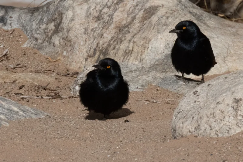
Pale-winged Starling Onychognathus nabouroup -
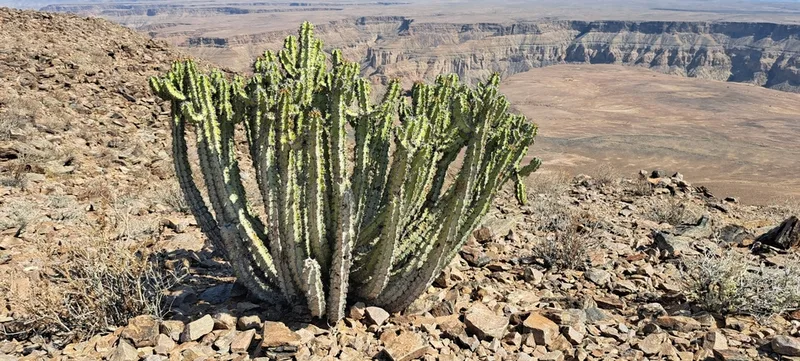
Namib Candelabra Naboom Euphorbia virosa -
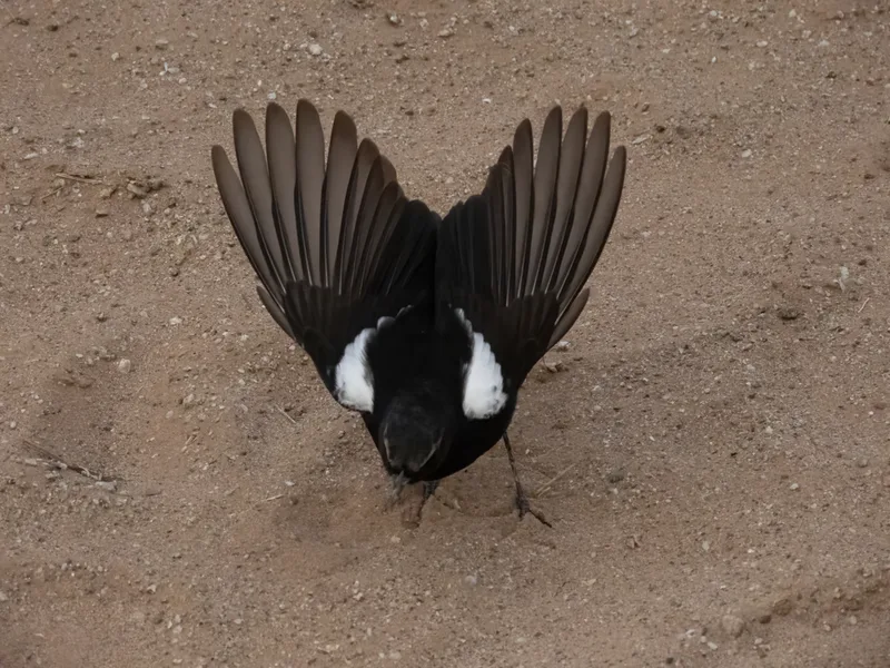
Mountain Chat Myrmecocichla monticola -
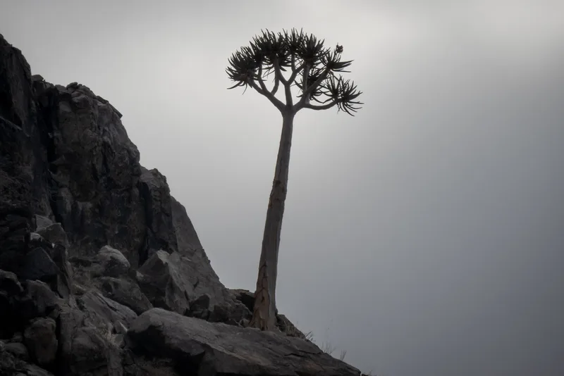
Quiver Tree Aloidendron dichotomum -
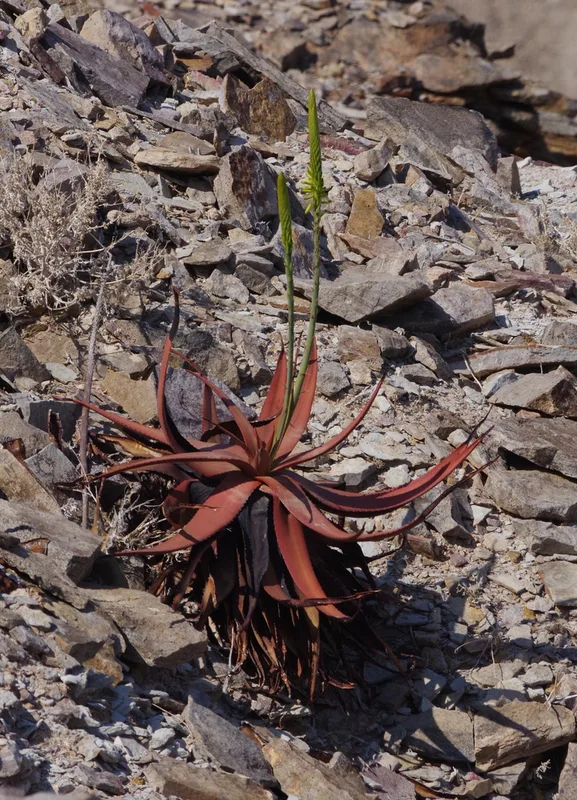
Gariep aloe Aloe gariepensis -
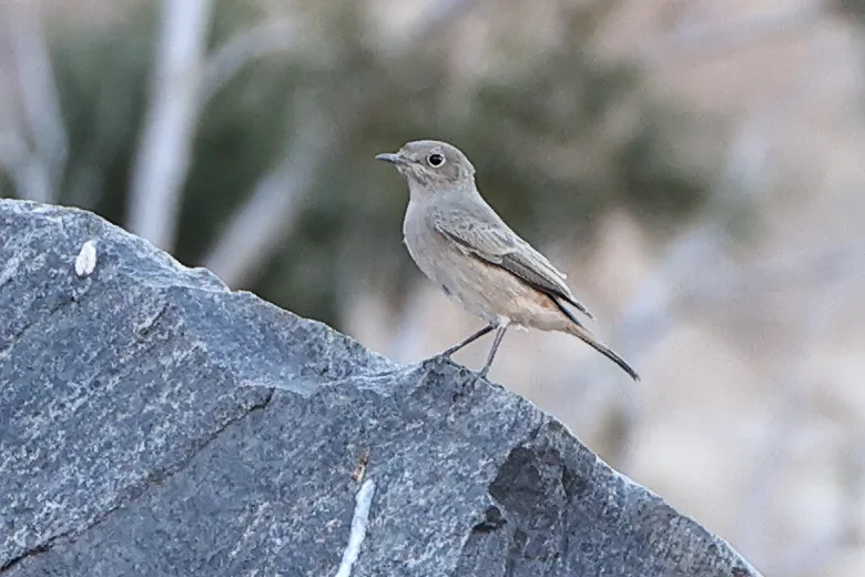
Familiar Chat Oenanthe familiaris -
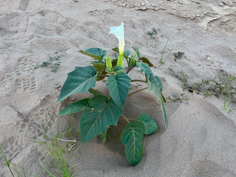
downy thorn-apple Datura innoxia -
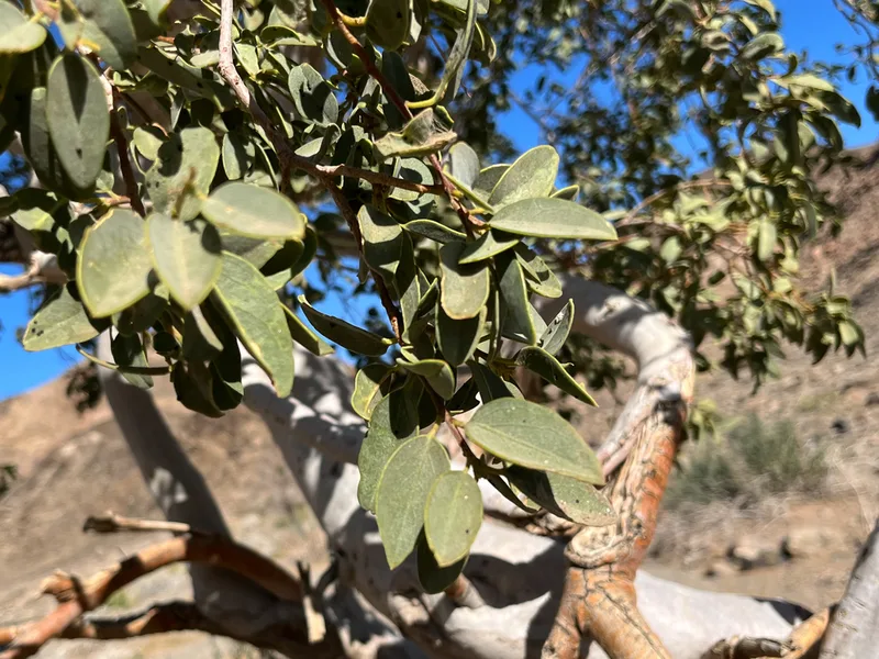
Ringwood Maerua schinzii -
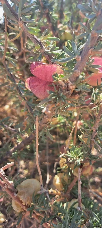
Chinese Lantern Nymania capensis -
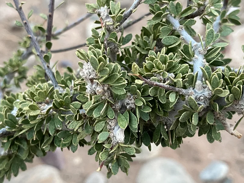
Stink Shepherdstree Boscia foetida -
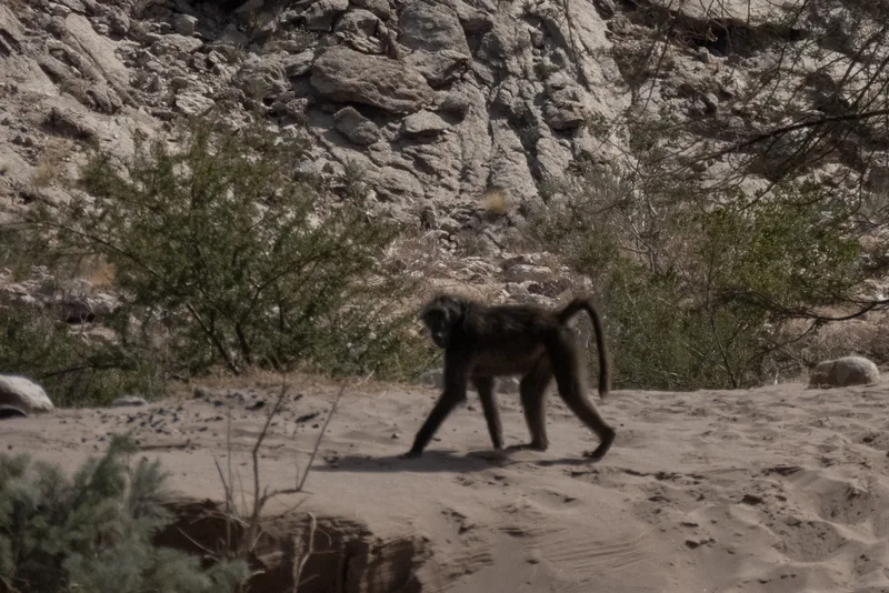
Chacma Baboon Papio ursinus -
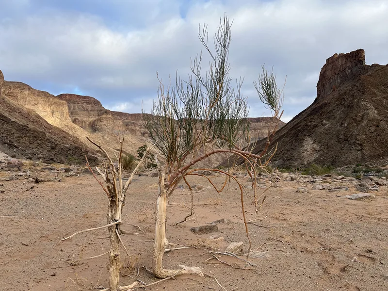
Desert Broom Sisyndite spartea
Field Notes · Rivers & Canyons lens · Fish River Canyon · −27.7650, 17.5479