The Faroe Islands
The Faroe Islands · Faroe Islands
The fog does not pass through these islands. It is how the grass gets fed.
Why here
Tórshavn holds a record no city wants to claim: the fewest recorded hours of sunshine of any city in the world. It isn’t a flaw in the weather, it’s a fact of the water. The same current that carries warmth this far north, past Norway and Iceland, also carries the cloud that wraps it, so an island close enough to the Arctic Circle to earn short winter days and pale, sleepless summer nights stays mild instead of frozen, green instead of grey. Fog and drizzle do here the slow, steady work that sun and heat do elsewhere: they keep grass alive on steep basalt fells long after the thin soil should have washed to the sea, and they keep the cliffs loud with birds working a cold, restless ocean at every hour of the light. Everywhere you go on Streymoy, the same two facts sit side by side, the rock is old, dark, and stark, and the life on it is green and constant, because the sea refuses to let go of the land it made. The rest of this note keeps returning to that trade.
The story
The islands began as lava, poured out in sheet after sheet during the same restless stretch of the Paleocene and Eocene that pulled the North Atlantic open between Greenland and Europe. Each flow cooled flat before the next one came, which is why the fells here still rise in shelves and the fjords cut through them like pages in a closed book. Ice ages and an unresting sea did the rest, planing the old plateau down into the separate peaks and cliffs you climb today.
Life arrived slower and stayed close to the sea’s terms. Heath, thrift, and hardy wildflowers hold what thin soil survives on the fell-sides, fed as much by drifting fog as by rain. Offshore, a cold, restless current keeps the water rich enough that puffins, razorbills, kittiwakes, and fulmars can crowd the cliffs through the light half of the year.
People arrived by the same sea. An Irish monk may have sailed past in the sixth century and reported an island of sheep, thick with birds, evidence, if the story is true, that someone had beaten him to it. Norse settlers arrived for certain in the ninth or tenth century, adopted Christianity around the year 1000, and were pulled into the Kingdom of Norway by 1035, later passing to the Danish crown. Streymoy, the largest island and the ground this note stands on, still carries its old name plainly: the island of currents.
The sites
The ridge that gathers the fog
Slættaratindur
62.2967, −7.0132
Climb here on a clear morning and you can watch the day’s fog get made in real time. Streymoy’s high ridge runs long enough, and stands tall enough, that moist air blowing in off the Atlantic has nowhere to go but up and over it, and air that rises this fast cools fast, wringing itself out into the low cloud that so often sits along this line while the coast below stays clear. It is the same general mechanism that keeps clouds parked over island mountain ranges the world over, but here it happens close to the sea itself, with nothing between the ridge and open ocean to slow the wind down first. On the ground, the ridge is walked more than climbed: open, treeless, wind-scoured sheep pasture running along the spine, the grass kept green by the very cloud the ridge is busy making. Look down either side and the land drops fast toward the water on both flanks, a reminder of how narrow these islands really are, how little distance separates any point on Streymoy from the sea that shapes it. Expect wind here even when the forecast below promises calm.
Stand on the ridge crest and watch the cloud on the windward side: look for it thickening and lowering as it climbs the slope, then thinning and lifting again just past the highest point, where the air starts to sink and warm on its way back down.
- AccessHalf-day hike
- ExertionStrenuous
- TimeHalf a day
Sornfelli
62.0688, −6.9670
Sornfelli sits near the middle of Streymoy, far enough from either coast that the weather here reads less like a forecast and more like a negotiation between two seas. Wind and cloud can arrive from the Atlantic side one hour and the more sheltered eastern side the next, and the fell’s open slopes register the difference in real time, grass and heath a slightly different shade of green depending on which way the last few days of weather came from. Like the other interior fells on this note, Sornfelli is built of the same stacked lava that makes up the rest of Streymoy, and the terracing shows plainly on its flanks: broad, faintly stepped shelves where one old flow ended and the next began, softened now by heath and grass. Sheep hold this ground the way they hold most open fell in the Faroes, moving slowly across slopes too steep and thin-soiled for much else. From the top, on a clear stretch, the shape of the whole island reads at once, narrow, fjord-cut, ringed by water on every side, which is really the only fact Streymoy has ever needed.
From the summit, trace the skyline in both directions and notice how close the sea sits on every side; count how few minutes of walking, by eye, would get you from this ridge back down to open water.
- AccessHalf-day hike
- ExertionModerate
- TimeHalf a day
Skálafjall
62.2095, −6.8922
Skálafjall closes out the ridge on this note’s northeastern ground, and it earns its place by being a good plain answer to a simple question: what does a Faroese fell actually look like up close, without a famous view or a legend attached to it. The slopes are steep and grassy, laced with the low heath and wildflowers, heather, thrift, orchid, that hold what soil exists here, all of it kept damp more by drifting cloud than by rain falling straight down. That distinction matters more than it sounds: a plant rooted in thin basalt soil on an exposed fell survives on moisture that condenses out of passing fog as much as on what actually falls from the sky, which is part of why these slopes stay green through weather that would dry out thinner soils elsewhere. Sheep work the lower slopes; the upper ground is quieter, mostly wind and birdsong. There’s no single dramatic feature to point to on Skálafjall, which is the point. Most of Streymoy looks like this: unglamorous, green against grey rock, and entirely dependent on a sea it can’t see from every angle but never stops feeling.
Run a hand through the heath on the upper slope after a foggy morning and feel how wet the leaves are even where no rain has fallen; that’s condensed fog doing a rain shower’s job without a drop falling from above.
- AccessHalf-day hike
- ExertionModerate
- TimeHalf a day
Where the fells drop into the sea
Vørðuklettar
62.0500, −7.2167
Vørðuklettar is marked as a viewpoint for a plain reason: it sits close to Streymoy’s western edge, high enough to look straight down a stretch of coastline where fell meets open Atlantic with no buffer between them. This is the coast that takes the weather first, and it shows, the ground here is shorter, wind-flagged, harder-cropped than the sheltered eastern slopes, everything bent slightly away from the prevailing wind. Seabirds work the air below the cliff edge here in numbers, riding the wind that the cliff itself deflects upward, a trick coastal cliffs perform for gliding birds everywhere they meet open water at height. Fog tends to arrive from this direction first as well, rolling in off the sea and climbing the cliff face before it reaches the fells further inland, so a clear morning at Vørðuklettar can turn to cloud within the hour, and the reverse happens just as fast. It’s a good place to simply wait a while and watch the weather arrive, rather than to rush past on the way to somewhere else.
Watch the cliff edge for birds gliding without a single wingbeat; they’re riding the updraft the cliff itself creates by pushing the wind straight up as it meets the rock.
- AccessShort walk
- ExertionEasy
- TimeAn hour
Trælanípa
62.0209, −7.2301
Trælanípa rises where Streymoy’s western ground finally gives way to open sea, a peak with nothing but water beyond it in the direction the wind usually comes from. A name like this describes a working relationship with the coast more than a postcard view: a headland used, watched, and respected long before it was ever visited for its own sake. Stand near the top and the two dominant facts of this coast sit side by side, hard, dark rock underfoot, laid down in old lava flows now cut back by a sea that never stops working at it, and a thin cover of grass and coastal wildflowers, sea thrift especially, rooted in whatever soil the wind and salt spray haven’t stripped away. The air here carries salt as often as it carries fresh water, and plants that manage to hold this ground have made their peace with both. On a clear day the sightline down the coast is long; more often, weather moves through fast enough that the view changes every quarter hour. Either way, this is as close as Streymoy gets to standing at the actual edge of itself.
Look for sea thrift growing right at the cliff edge, in cracks with almost no soil; its tight cushion shape and thick, salt-tolerant leaves are built for exactly this exposure, where nothing else will take root.
- AccessHalf-day hike
- ExertionModerate
- TimeHalf a day
Syðrugota
62.1792, −6.7605
Syðrugota sits on Streymoy’s eastern side, looking out across calmer water than the Atlantic-facing coast gets, and the difference between the island’s two faces is easy to feel here even without knowing the geography behind it. Wind moves differently, cloud breaks up faster, and the fjord-and-channel water below reads more like a lake at times than open sea. That contrast is the real reason to stop here on a note about fog and coast: it’s a clear demonstration that the sea around Streymoy isn’t one single condition but several, and the island’s weather changes accordingly depending on which shoreline you’re standing over. Fishing and ferry traffic still move through these sheltered channels, a working reminder that this calmer water has always been used as a route rather than just admired as a view. Settlements sit close to the shore in the distance, tucked into whatever flat ground the fjords allow, which on Streymoy is never very much. It’s a short stop, easily paired with the interior fells on a longer day, and worth taking slowly rather than rushing through.
Compare the water’s surface here to open coast you may have already seen elsewhere on Streymoy; look for the smaller waves and calmer texture that sheltered fjord water keeps even on a windy day.
- AccessShort walk
- ExertionEasy
- TimeAn hour
The old lava underfoot
Reynsatindur
62.0820, −7.1878
Reynsatindur is a good place to read the rock plainly, without a view or a legend competing for attention. The slopes step down in faint shelves, one old lava flow after another, each one having cooled flat before the next one buried it, the same building method that raised all of Streymoy, repeated so many times that the island is really just a stack of these flows, tipped, cracked, and worn down since. Up close the rock is dark and dense, and where it’s freshly broken it can show a rounded, almost bubbled texture, old gas trapped in lava as it cooled, a common feature of basalt formed this way. Heath grows in the gaps between the harder ledges, wherever enough broken rock has weathered into something like soil, which on a slope this exposed rarely amounts to much depth. The fell rewards slow attention: little about it announces itself, but the layering is the whole story of how these islands came to exist, written in plain rock rather than in words.
Look along the slope for the shelf-and-drop pattern repeating at intervals: each flat shelf is the top of one old lava flow, and each short drop below it is the edge where the next flow began.
- AccessHalf-day hike
- ExertionModerate
- TimeHalf a day
Kirkjubøkambur
61.9548, −6.7787
Kirkjubøkambur closes this note the way the island itself works: rock first, then whatever grows and lives on top of it. The ridge carries the same layered basalt as the rest of Streymoy, but stands close enough to the southern coast that sea wind reaches it more directly, and the vegetation reads differently as a result, lower, tighter to the ground, shaped by salt as much as by cold. Wildflowers here lean toward the tougher, more exposed-ground specialists: thrift, heather, the low mats that can take a battering. Birds moving along this stretch of coast use the ridge as a marker as much as people do, riding the wind it throws up on the windward side. Standing here, it’s easy to see the whole argument of this note laid out at once: hard old rock, worn down by a sea that also waters and feeds everything living on it, all of it wrapped, more often than not, in the same fog that first shaped the ridge’s thin soil. That trade, rock given up slowly, life sustained constantly, is Streymoy’s whole arrangement with the water around it.
From the ridge, watch for the fog line drifting along the coast below: note where it thickens against the slope and where it thins, and see if you can spot the boundary between fog-fed green ground and the drier, browner ground just beyond its reach.
- AccessHalf-day hike
- ExertionModerate
- TimeHalf a day
When it's best
There isn’t a wrong season here so much as two different moods. Come in the long light of summer and the nights barely darken; the cliffs crowd with puffins, razorbills, and terns working the cold water round the clock, and the fells stay a startling green fed as much by fog as by rain. Come in winter and the days shrink hard, but the same current that waters the summer keeps the air oddly mild for the latitude, so expect wind and low cloud more than deep cold. Whichever window you choose, build in slack for fog. It is the islands’ most reliable weather, and it is also the whole reason the green persists at all.
Go deeper
The names behind what you saw The layered rock underfoot is flood basalt: Palaeogene basalt and related Cenozoic volcanic rock, expressed as tholeiite, olivine basalt, alkali basalt, and basanite, with pillow basalt marking old flows that met the sea, all dated to the Paleocene and Eocene. The seabirds crowding the cliffs through summer include the Atlantic Puffin (Fratercula arctica), Razorbill (Alca torda), Northern Fulmar (Fulmarus glacialis), and Black-legged Kittiwake (Rissa tridactyla). The heath underfoot is largely common heather (Calluna vulgaris) and sea thrift (Armeria maritima).
To read next - “An Account of some Geological Facts observed in the Faroe Islands” (1815) — an early naturalist’s first-hand description of the same basalt stack, from when the flood-basalt idea was still new. - “Exploring for extended continental shelf claims off Greenland and the Faroe Islands – geological perspectives” (2004) — traces how far the same lava pile extends under the surrounding seabed. - “Transfer zones: the application of new geological information from the Faroe Islands applied to the offshore exploration of intra and sub-basalt strata” (2009) — on the faulting that breaks the basalt pile into the blocks you walk today. - “A different surface geology in Denmark, the Faroe Islands and Greenland influences the radiological contamination of drinking water” (1990) — an unexpected consequence of standing on basalt instead of sedimentary rock: what it does to the water itself.
The names behind what you saw
What lives here, and what it's called. Photographs from open collections — an aid to identification, not decoration.
-
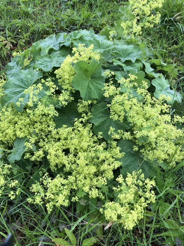
Garden Lady's-mantle Alchemilla mollis -
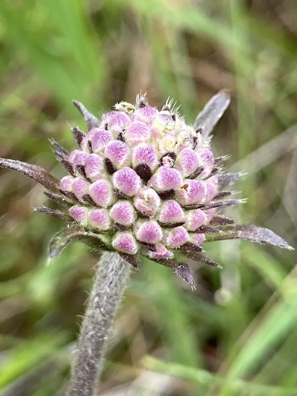
Devil's-bit Scabious Succisa pratensis -
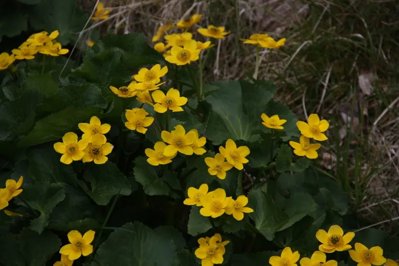
marsh marigold Caltha palustris -
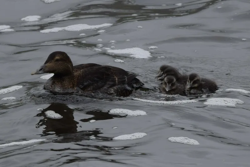
Common Eider Somateria mollissima -
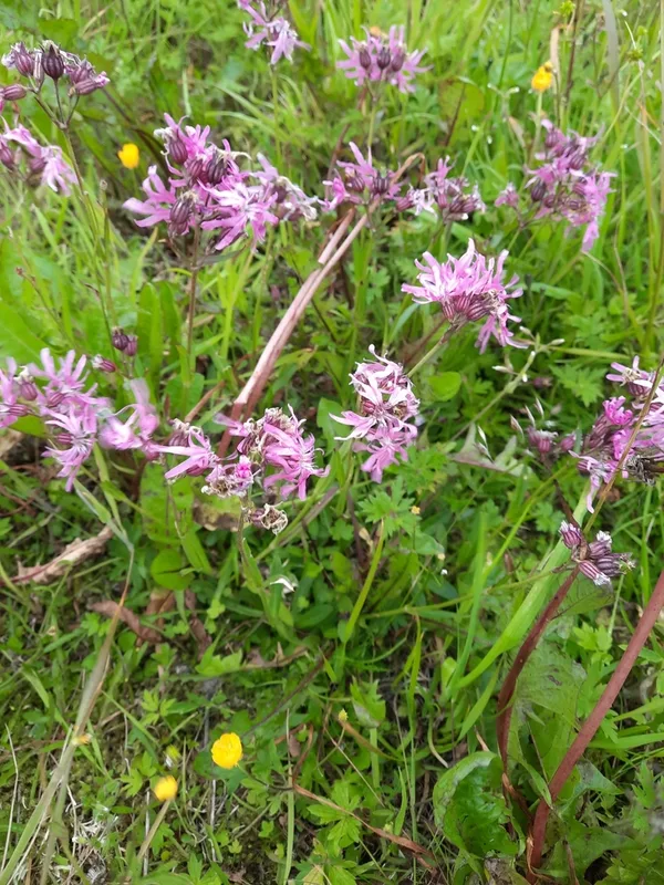
ragged-robin Silene flos-cuculi -
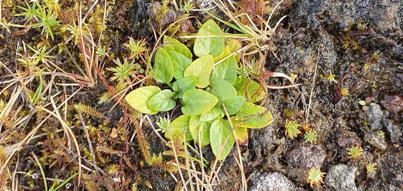
common selfheal Prunella vulgaris -
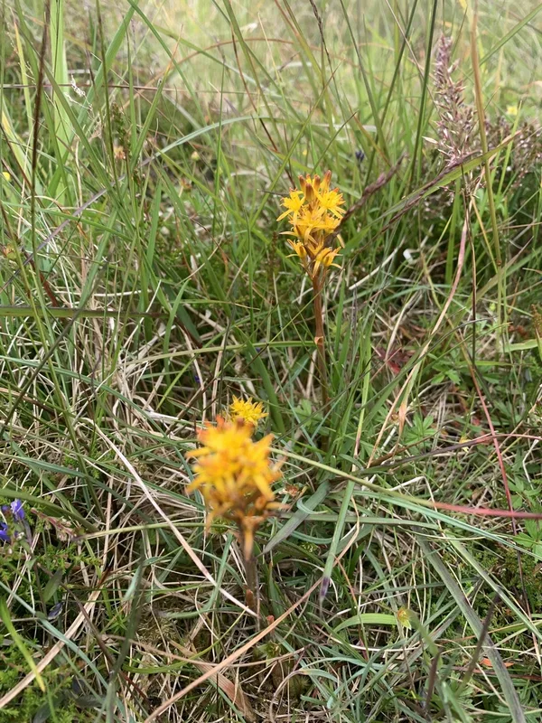
bog asphodel Narthecium ossifragum -
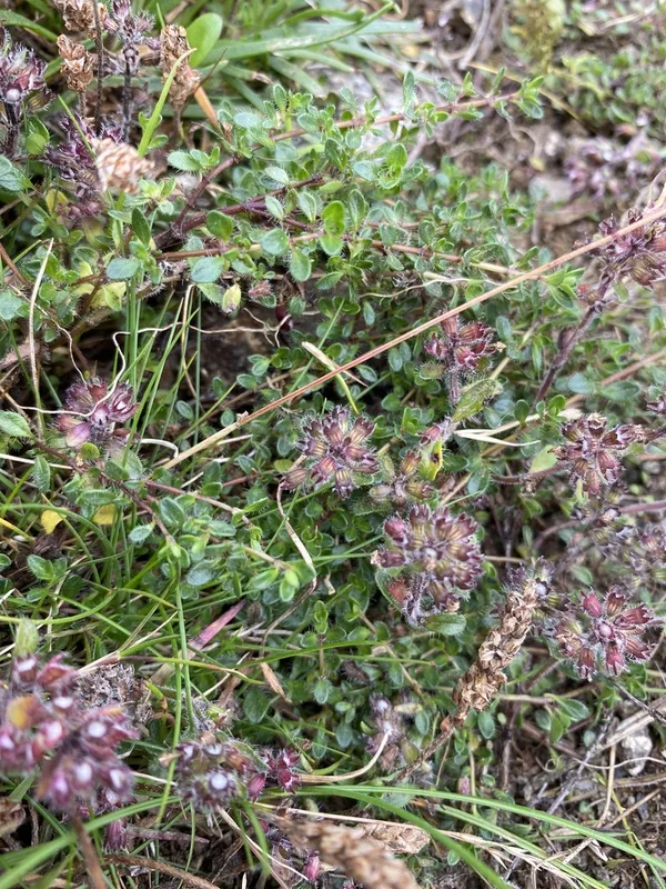
Mother of Thyme Thymus praecox -
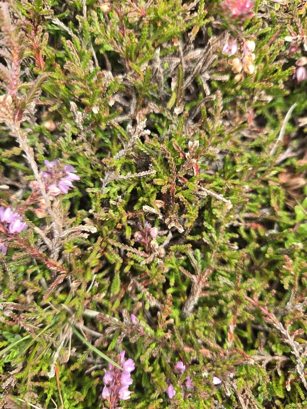
common heather Calluna vulgaris -
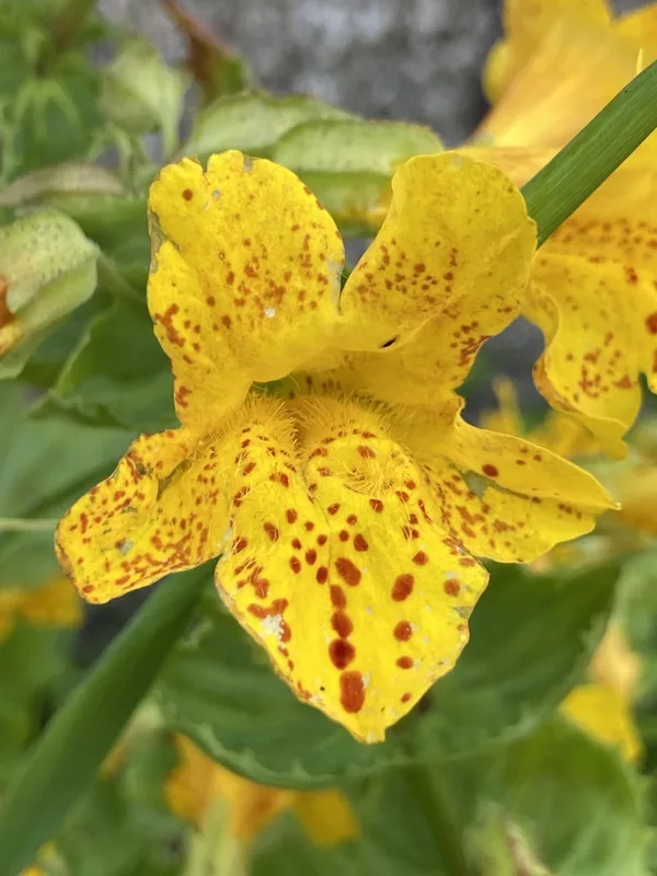
seep monkeyflower Erythranthe guttata -
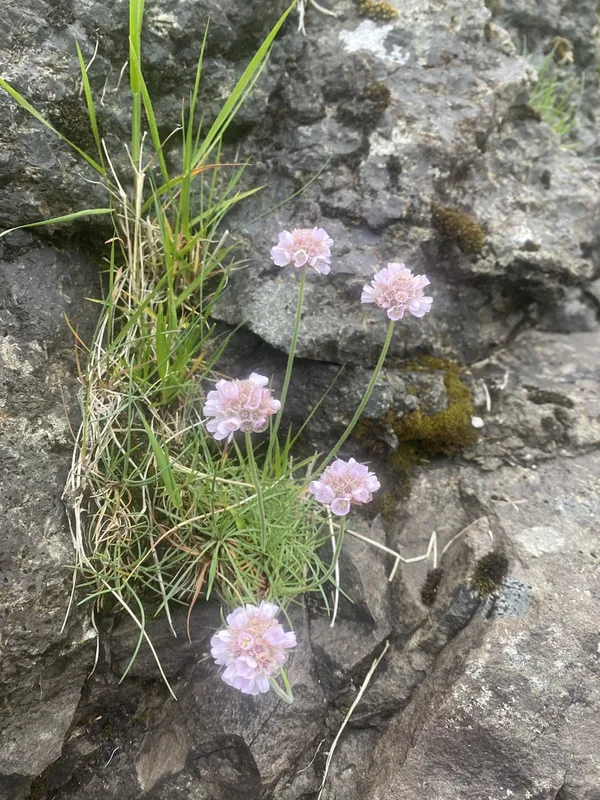
Sea Thrift Armeria maritima -
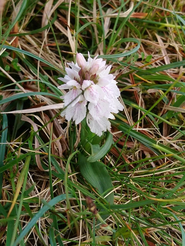
heath spotted orchid Dactylorhiza maculata
Field Notes · Fog Coast lens · The Faroe Islands · 62.1237, −7.0159