The Farallones
Farallon Islands · California, USA
Thirty miles offshore, the mainland's rules about who gets to live somewhere stop applying — every legal resident here is a research permit or a pair of wings.
Why here
Thirty miles past the Golden Gate, a cluster of bare granite islands breaks the surface of open ocean — and almost nobody has ever set foot on them. The Farallones are closed to the public; the only residents are a handful of researchers who share the rock with everything that flies, dives, or hauls out here. That isn’t an accident of policy so much as geography. For many miles in every direction, this is the only solid ground above the water, a hard shelf rising out of one of the more productive stretches of the Pacific. Cold water wells up from the deep offshore, carrying the nutrients that feed the small fish and plankton everything else depends on, and every bird or fish that needs to rest, nest, or hunt near that food eventually needs somewhere dry to do it. The islands are that somewhere. Come for a single seabird and you leave having watched a dozen different lives converge on the same few acres of rock, each one here for a slightly different reason, all of them here because there is nowhere else to be.
The story
The rock under the Farallones is old — granite formed deep in the earth during the age of dinosaurs, long before there was an ocean here to surround it. It has sat mostly still since, worn down slowly by weather and waves until only its highest points still break the surface as islands. Everything living on that rock today lives there because there is so little of it: seabirds crowd every ledge because bare granite far from shore is safe from predators that would raid a mainland colony, and species that elsewhere compete for space instead stack themselves floor by floor. People came for the same reason the birds did: abundance concentrated in one place. A lighthouse went up on the tallest island in the mid-1800s, warning ships away from the shoals nearby. In the 1860s, rival companies fought — sometimes violently — over the right to collect seabird eggs here to sell in San Francisco, a conflict remembered as the Egg War, until the federal government eventually closed the islands to egging altogether. Today the same isolation that once drew egg collectors and lighthouse keepers keeps almost everyone else away, and the islands are protected as part of a much larger marine sanctuary that reaches far beyond their shores.
The sites
The one island with people on it
Southeast Farallon Island
37.6760, −123.0299
Southeast Farallon is the only island in the group that anyone lives on, and even that population is small: a handful of researchers from Point Blue Conservation Science and the U.S. Fish and Wildlife Service, who share the rock with the wildlife they are here to study. A lighthouse went up on the island’s high point in the mid-1800s to keep ships away from the shoals nearby, one of the highest lighthouse beacons in California, and though its lamp has since been retired the tower still stands. Below it, the cliffs do the real work: ledge after ledge of nesting seabirds, sorted by species the way a crowded building sorts itself by floor. The islands are closed to visitors, so this one is seen from the water, not on foot — but a boat circling the base of the cliffs gets close enough to watch the sorting happen in real time, and to notice the one predator built to hunt birds this fast: a peregrine falcon working the updrafts along the rock face.
Scan the cliff ledges below the lighthouse from the boat. The birds sort themselves by species, each holding its own stretch of ledge or crevice. Bring binoculars; the pattern holds up on every pass.
- AccessExpedition
- ExertionModerate
- TimeA full day
Maintop Island
37.6990, −123.0111
Maintop sits a short stretch of open water from Southeast Farallon, close enough to share the same colony but far enough to have its own weather and its own light. It is smaller and lower than its neighbor, with no flat ground and nothing built on it that the record mentions — no lighthouse, no station, nothing but bare rock and whatever is nesting on it that season. That bareness is the point: on a rock this size, with no researchers stationed on it, the birds that use it have never had to compete with people for space. From a boat it reads almost as an afterthought next to the larger island, but it is a useful measure of scale — watch how a swell that barely registers on Southeast Farallon breaks clean over Maintop’s low shoulder, and it becomes obvious how little margin these islands have between habitable rock and open ocean. Nothing here has ever needed to be permanent to matter; it only had to be dry at low tide and close enough to the food offshore to be worth the trip.
Watch the swell as it passes Southeast Farallon and then meets Maintop a few boat-lengths on. Notice how much more of the smaller island disappears under white water with each wave — a quick way to see how little dry ground these birds actually have to work with, even at the heart of the colony.
- AccessExpedition
- ExertionModerate
- TimeA full day
The outer rocks
Middle Farallon
37.7279, −123.0324
Middle Farallon sits between the main cluster and the more distant North Farallon, a steep spur of the same granite ridge with even less shelter than its neighbors. Mariners had good reason to fear this stretch of coast long before anyone charted it properly — sailors called the whole group the Devil’s Teeth for the underwater shoals scattered around them, and the rough water around Middle Farallon makes the nickname easy to believe. It is one of the least visited pieces of the archipelago, passed more often than approached, which makes it a useful stop for a different reason than the busier islands: a chance to see how much of this place is really about what is underwater rather than what breaks the surface. The rock itself is unremarkable next to the cliffs of Southeast Farallon — no real colony to speak of, no lighthouse, nothing built. What it offers instead is a clean look at the shoals themselves, the hazard that shaped how ships have treated this whole stretch of coast for as long as they have sailed past it.
Watch how the swell breaks unevenly around Middle Farallon, well before it reaches any visible rock. The white water marks shoals just under the surface — the same hazards that earned the whole group its old sailor’s name, the Devil’s Teeth.
- AccessExpedition
- ExertionModerate
- TimeA full day
North Farallon
37.7715, −123.1076
North Farallon is the far edge of the group, set apart from the rest by a longer stretch of open water than separates any of the other islands from each other. That distance alone makes it the clearest place to feel how far this sanctuary actually extends past the postcard image of the main island and its lighthouse. There is nothing built here and nothing meant to be seen up close — the value of North Farallon is distance itself, a reminder that the working core of this place is a scattered set of high points on one long undersea ridge, not a single island with a few smaller ones nearby. Reaching it takes a longer, rougher crossing than the rest of the trip, and the payoff has less to do with what is standing on the rock than with recalibrating your sense of how much of this stretch of ocean counts as the Farallones at all.
Look back toward the rest of the group from North Farallon. The stretch of open water between here and the nearest island is wider than any gap within the main cluster — a plain way to feel how far this archipelago actually reaches before it runs out of rock.
- AccessExpedition
- ExertionStrenuous
- TimeWorth two days
The archipelago as a whole
Farallon Islands
37.7333, −123.0344
This is the group seen whole — the point on a boat trip where the individual islands stop reading as separate stops and start reading as one thing: a single ridge of old granite, formed deep underground long before there was a coastline anywhere near here, mostly drowned, its higher points the only parts still dry. From offshore you can take in Southeast Farallon’s lighthouse, Maintop’s low shoulder, and the rougher outer rocks in a single sweep, and see how consistent they all are — the same gray-white granite, the same guano staining, the same crowded ledges wherever there is room for a nest. The islands are closed to the public, which means this whole-group view from the water is, for almost everyone, as close as it gets. It is worth treating as its own stop rather than a transit between the others: the scale only becomes clear once you can see the whole ridge at once, instead of one island at a time.
From wherever you can see the whole group strung out together, notice that every island and exposed rock shares the same low, humped shape and the same guano-streaked gray granite. What looks like several separate islands is really one ridge of old rock, mostly underwater — only its high points break the surface.
- AccessExpedition
- ExertionModerate
- TimeA full day
When it's best
The Farallones don’t really have an off season so much as a rotating cast of who’s on the rock. Nesting seabirds — murres, auklets, storm-petrels, puffins — crowd the ledges through spring and into summer, when the colony is at its fullest and most active. Wide-ranging ocean birds like shearwaters and albatross tend to turn up in those same warmer months, pulled toward the same offshore food as everything else out there. Winter brings rougher seas and fewer boats willing to make the crossing, which thins out both the wildlife you’ll see and the company you’ll see it with. There is no wrong season to try for a trip here — only a different, quieter version of the same crowded rock waiting on the far side of a rough one.
Go deeper
The names behind what you saw The bedrock across the islands is Cretaceous granite — continental basement rock roughly 66 to 145 million years old, laid down long before there was a California coastline to speak of; search Macrostrat’s regional geology for the full unit record. Among the recorded birds, the ledge-nesters crowding Southeast Farallon are Common Murres (Uria aalge); the crevice-dwellers include the Ashy Storm-Petrel (Hydrobates homochroa). The oystercatcher working the tideline is the Black Oystercatcher (Haematopus bachmani).
To read next Only two sourced readings back this note, and both cover the same unusual footnote in the islands’ history rather than their ecology — worth including for the surprise, not the range. - “Geotechnical, geological, and selected radionuclide retention characteristics of the radioactive waste disposal site near the Farallon Islands” (Marine Geotechnology, 1989) — a direct technical survey of a waste disposal site near the islands and how well the surrounding seafloor holds its radioactive material. - A companion paper on the same site and question, published the following year in the International Journal of Rock Mechanics and Mining Sciences & Geomechanics Abstracts (1990) — useful if you want the geomechanics framing of the same survey rather than the marine-geotechnology one.
The names behind what you saw
What lives here, and what it's called. Photographs from open collections — an aid to identification, not decoration.
-
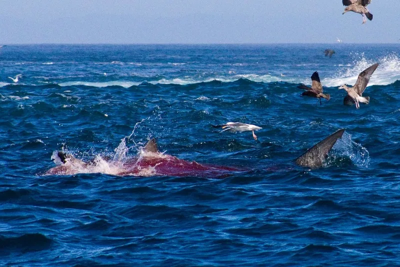
California Sea Lion Zalophus californianus -
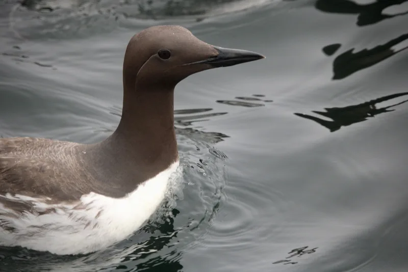
Common Murre Uria aalge -
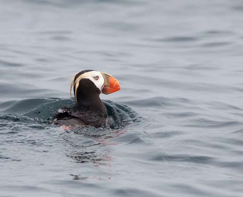
Tufted Puffin Fratercula cirrhata -
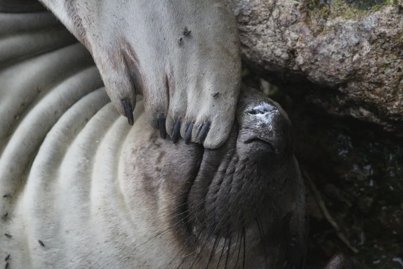
Northern Elephant Seal Mirounga angustirostris -
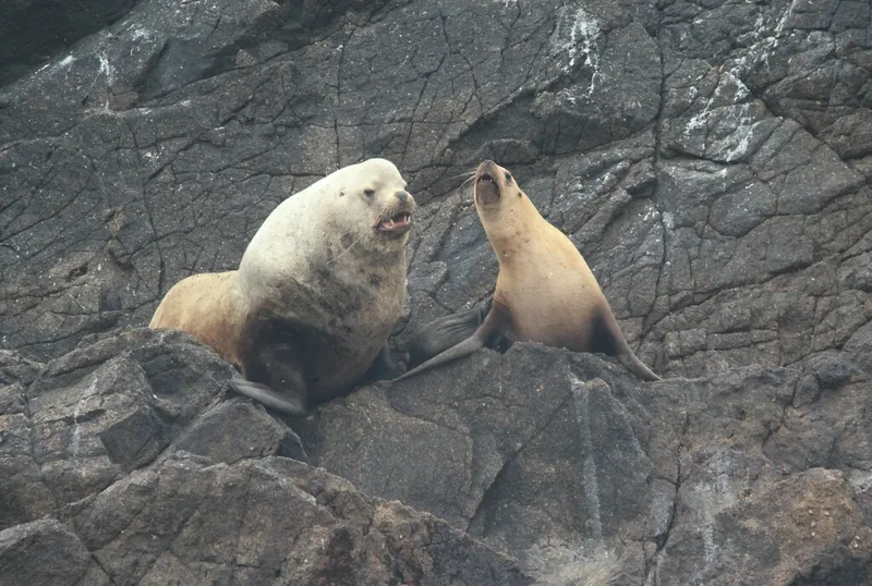
Steller Sea Lion Eumetopias jubatus -
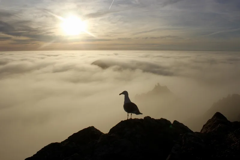
Western Gull Larus occidentalis -
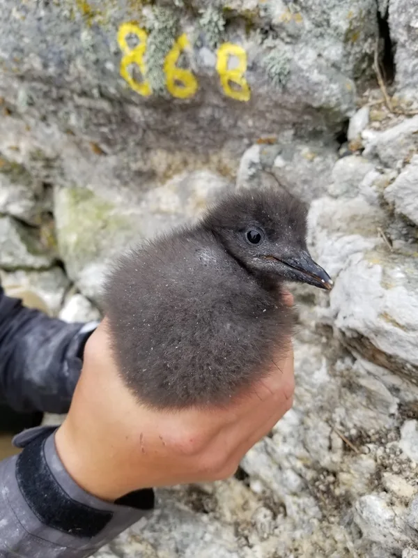
Pigeon Guillemot Cepphus columba -
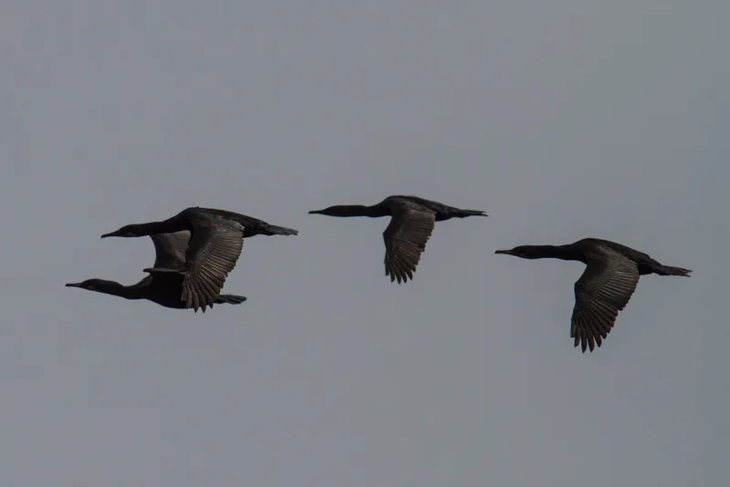
Brandt's Cormorant Urile penicillatus -
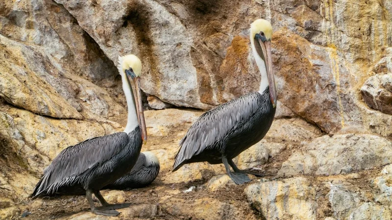
Brown Pelican Pelecanus occidentalis -
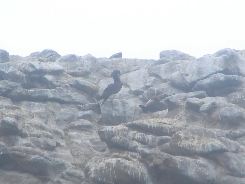
Cocos Booby Sula brewsteri -
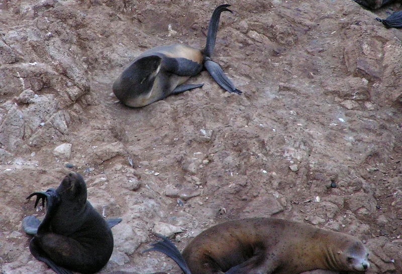
Northern Fur Seal Callorhinus ursinus -
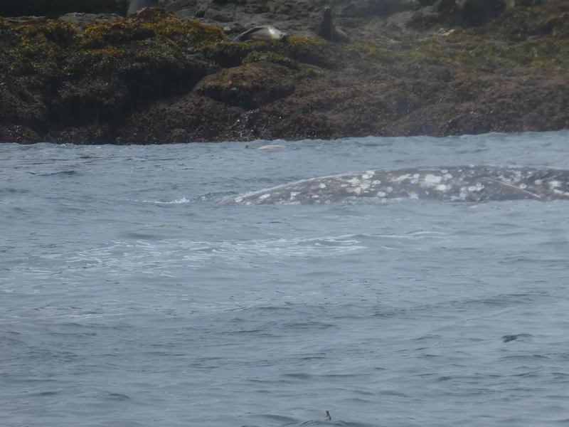
Grey Whale Eschrichtius robustus
Field Notes · Marine lens · Farallon Islands · 37.7237, −123.0593