Grand Staircase-Escalante
Where the desert keeps no soil, the rock keeps everything.
Why here
This was among the last land in the country that anyone managed to put on a map. The reason is underfoot. In wetter places, soil and forest bury the ground and soften every route; here the desert keeps almost no soil, so the rock lies open — layer on layer of sandstone and older stone, stacked into a broad staircase you can read across the cliffs. That openness cuts both ways. It makes the deep past legible: you can follow a single band of rock with your eye and know it as one page in a very old book. It also made the country nearly impossible to cross, because bare stone offers a wagon no gentle grade and no easy way around. The same rock that hides nothing from a geologist hid no mercy from a traveler. Everything in this note comes back to that one fact — the rock is an open book, and it has always asked to be read, whether by someone learning how the land was made or by someone simply trying to get through it.
The story
Start with the rock, because here the rock starts everything. The desert keeps almost no soil, so the layers lie open — bands of sandstone and older stone stacked into a broad staircase you can read across the cliffs. Where wind and dry washes strip the surface, even older rock appears.
Little grows on bare stone, so life gathers where water lingers. Lizards work the warm rock and vanish into its cracks; in spring the drainages carry firecracker penstemon and the feathery seed heads of Apache plume, and a canyon wren’s falling song marks a cliff with a seep. A golden eagle rides the updraft where the rock stands highest.
People followed the same water. The Southern Paiute planted corn, squash, beans, and melons on the floodplains, leading water onto the ground where the rock allowed it. The name on the land came later, borrowed after the fact from a Spanish expedition that searched for a route west across the region. Later still, a wagon expedition tried to cross the bare rock directly, and the panels here remember how hard that was. The surrounding monument stayed so difficult to read that it was among the last land in the country to be mapped. The rock has kept every chapter in plain sight.
The sites
Reading the bare rock
The Lay of the Land
37.7623, −111.5786
This roadside panel points you at the country before you walk into it, and the country is mostly rock. In wetter places, soil and forest bury the ground’s history; here the desert keeps little soil, so the layers lie open — sandstone laid down grain by grain, then stacked into bands you can follow with your eye. The land is built as a broad staircase of these layers, each step a different age of stone. From this overlook the staircase is not an idea but a shape: pale cliffs rising in steps, one rock layer capping the next. Standing at the panel, you are reading the same open pages that every traveler before you had to read, because nothing green hides the way the land is put together. Take a moment here before anything else. The rest of this country makes more sense once you have seen, from one spot, how plainly it lays itself out.
From the panel, pick a single pale band in the cliffs and follow it sideways with your eye until it slips out of view. That continuous layer is one page of sandstone, laid down flat long ago and now lifted into the staircase you stand below.
- AccessDrive-up
- ExertionEasy
- TimeAn hour
The country that resisted crossing
The Hole in the Rock Expedition
37.7623, −111.5785
This panel tells the story of a wagon expedition that set out to cross this rock country. The reason it became a story worth a panel is written in the ground all around you. With almost no soil and few gentle grades, bare rock gives a wagon nothing easy — no soft valley to follow, no forest track worn smooth, only stone that has to be met head-on. Where a wetter landscape offers a traveler a dozen ways through, this one offered almost none. That difficulty is not a detail of one expedition; it is the character of the whole region, which stayed so hard to move through and to map that it was among the last land in the country anyone charted. Read the panel for the human side of the crossing, then look up at the nearest cliff and ask the question the expedition had to answer: how would a loaded wagon ever get past that? The rock has not changed its answer since.
After reading the panel, find the steepest bare rock face in view and trace the line a wagon might have taken up or down it. The lack of any soft, soil-covered route is the whole difficulty the crossing faced, still plain in the stone.
- AccessDrive-up
- ExertionEasy
- TimeAn hour
The Longest Mile
37.7625, −111.5786
Named for the hardest stretch of the crossing, this panel marks a mile that earned its name from the rock itself. In country this bare, distance is measured less in miles than in what the stone will allow. A single mile of broken ledges and steep sandstone can cost more than a long, level day on open ground, because there is nothing to soften the climb — no soil to grade a road into, nothing to grip, only the layers you must go over or through. The desert’s habit of keeping no soil, the same habit that leaves the rock so readable, is exactly what makes such a mile so slow. One thing that helps the deep past stand open here works flatly against anyone trying to move. Stand at the panel and let its account of the longest mile settle against the hardness of the ground it describes; the two explain each other.
Read the panel’s account of the longest mile, then look for a place where the rock rises in a set of bare steps. Each step is a separate layer of harder or softer stone — the reason a short distance here can swallow a whole day.
- AccessDrive-up
- ExertionEasy
- TimeAn hour
The Story of Last Wagon
37.7625, −111.5785
The last wagon through is the one this panel remembers. A crossing measured in bare rock does not end when the first wagon comes down; it ends only when the final one is safely past, because every wagon has to face the same stone with no easier route held in reserve. That is the quiet lesson of an open landscape. It treats each traveler alike, laying the same pages and the same hard grades before the first wagon and the last. Nothing about the rock made an exception for anyone. Read the panel for the human end of the story, then turn back to the layers, which look much as they did when that final wagon passed. In a wetter place, brush and soil would have crept over the route within a lifetime; here, where the desert keeps the rock swept bare, the ground still shows plainly what the crossing meant.
From the panel, look at the layered rock and notice how little soil or brush has gathered on it. That bareness is why the ground the last wagon crossed still reads clearly today, long after the wagons were gone.
- AccessDrive-up
- ExertionEasy
- TimeAn hour
Where water writes the green
The Lay of the Land
37.7623, −111.5786
Come back to the same overlook and read it a second way, this time for green. On bare rock, life does not spread evenly the way it does across a meadow; it gathers wherever water lingers — a seep in a cliff, a wash holding damp sand after a storm, the floodplain of a creek. The Southern Paiute planted exactly these places, raising corn, squash, beans, and melons on the floodplains where water could be led onto the ground. Look from the panel toward any thread of brighter green and you are almost certainly looking at water, or the memory of it. The pattern is the whole logic of living here: the rock decides where water can rest, and water decides where anything can grow. Once you can pick out those green threads, you can read the country the way its first farmers did — not as scenery, but as a map of where life is possible.
From the overlook, scan the tan slopes for a streak of darker green low in a drainage. That green marks water held in rock or sand — the same thread of moisture that once decided where people could plant and where they could not.
- AccessDrive-up
- ExertionEasy
- TimeAn hour
When it's best
Spring and fall are the kindest seasons on bare rock, when the days warm without the deep summer heat that the open stone throws back at you. Early spring days can be mild while the nights still drop below freezing, so come prepared for both. As the ground warms, lizards reappear on sunny rock and the desert’s flowers open along the wetter drainages — firecracker penstemon, Apache plume, kingcup cactus — earlier after a warm winter, later after a cold one. Summer is hot and exposed; winter is quiet and cold. The rock itself reads the same in any season.
Go deeper
The names behind what you saw. The open layers are Jurassic and older Mesozoic sedimentary rock — sandstone and conglomerate laid down before and during the age of dinosaurs; the loose gravel and sand in the washes is much younger alluvium, and the region’s deep rock column reaches down to old sea-floor limestone. The lizards on the warm rock are the plateau fence lizard, Sceloporus tristichus, and the common side-blotched lizard, Uta stansburiana. The spring flowers are firecracker penstemon, Penstemon eatonii, Apache plume, Fallugia paradoxa, and kingcup cactus, Echinocereus triglochidiatus. Overhead, the golden eagle is Aquila chrysaetos, and the falling song belongs to the canyon wren, Catherpes mexicanus.
To read next. The published geology close to this ground is thin, so this is a short list. - Geology of the Escalante–Boulder area, Garfield County, Utah (1973) — the layered rock immediately around Escalante, mapped bed by bed. - Geology, structure, and uranium deposits of the Escalante Quadrangle, Utah and Arizona (1973) — how those layers are folded and faulted across the wider region.
The names behind what you saw
What lives here, and what it's called. Photographs from open collections — an aid to identification, not decoration.
-
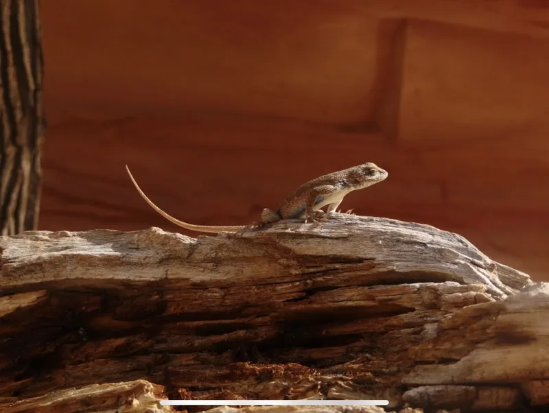
Plateau Fence Lizard Sceloporus tristichus -
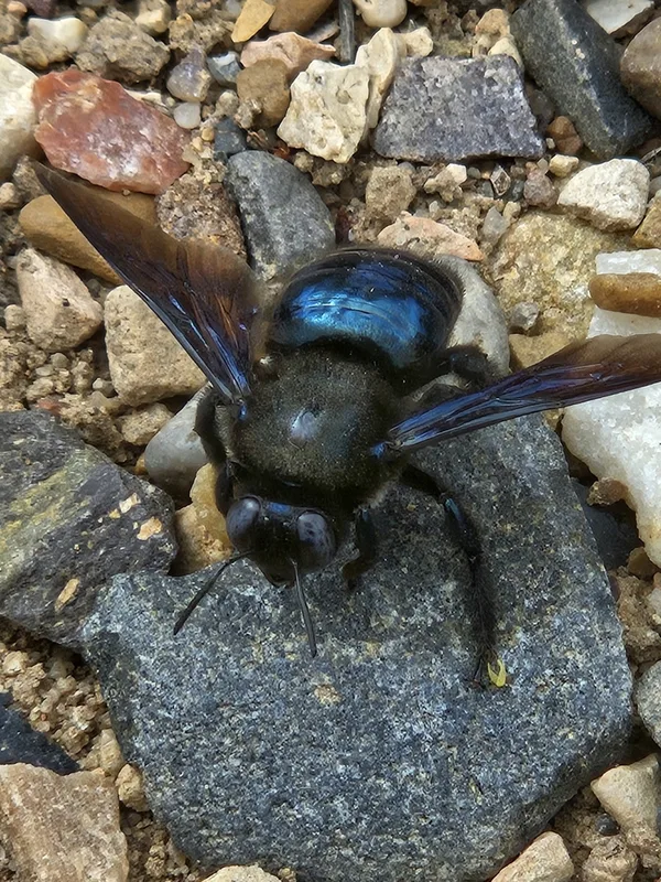
Western Carpenter Bee Xylocopa californica -
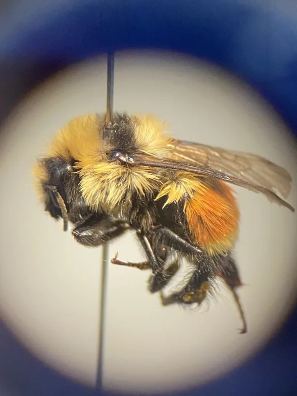
Hunt's Bumble Bee Bombus huntii -
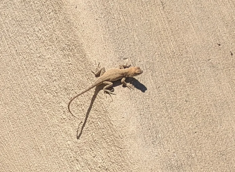
Common Side-blotched Lizard Uta stansburiana -
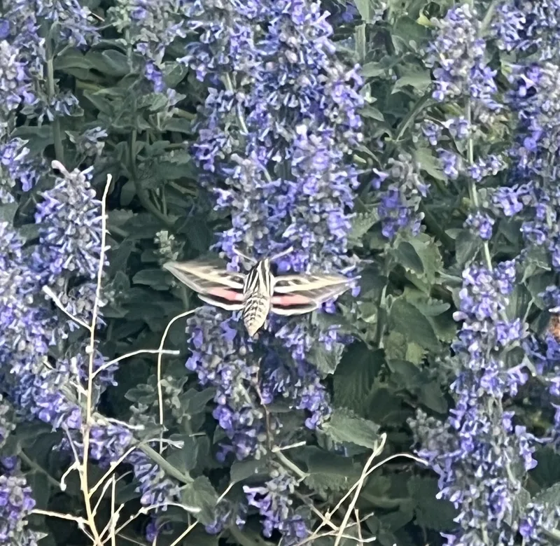
White-lined Sphinx Hyles lineata -
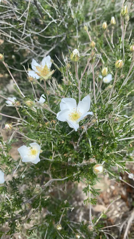
Apache plume Fallugia paradoxa -
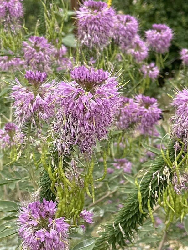
Rocky Mountain Beeplant Cleomella serrulata -
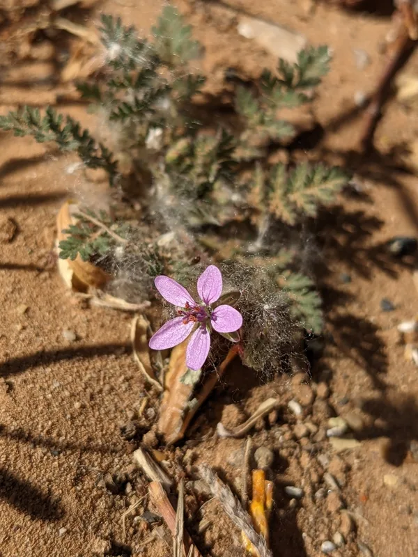
Redstem Stork's-bill Erodium cicutarium -
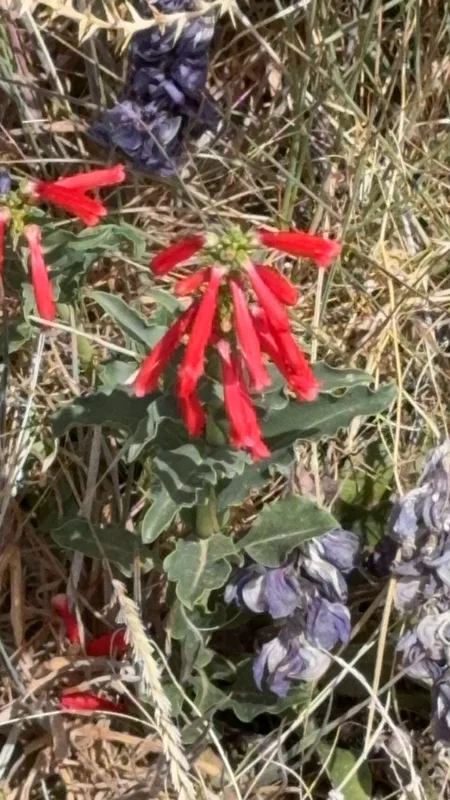
firecracker penstemon Penstemon eatonii -
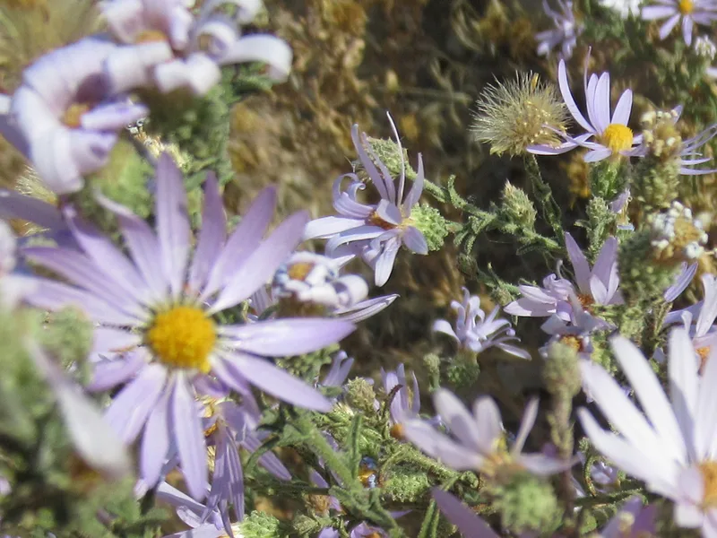
Hoary Tansyaster Dieteria canescens -
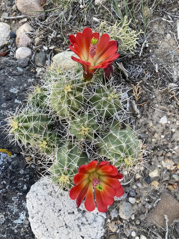
Kingcup Cactus Echinocereus triglochidiatus -
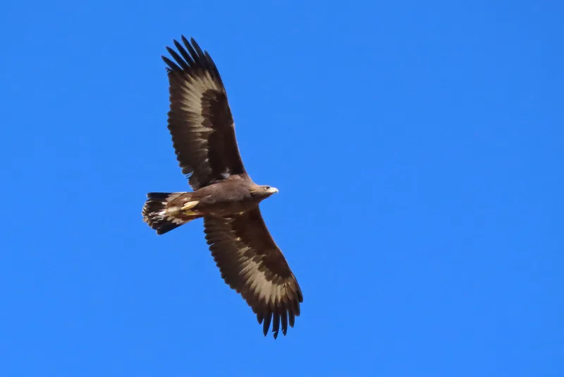
Golden Eagle Aquila chrysaetos
Field Notes · Desert & Deep Time lens · Escalante · 37.7703, −111.6022