El Nido
El Nido · Palawan, Philippines
Off El Nido, the sea doesn't wait at the horizon — it starts at your ankles and keeps going.
Why here
Wade a few steps off almost any beach in the Bacuit archipelago and the sand drops away into color before you’ve stopped noticing your feet are wet. That’s the thing about El Nido: its reefs don’t hide behind a long boat ride or a deep certification dive. They start close — right off the beaches, along the bases of the limestone islands, under the lighthouses built to keep boats clear of them. Survey after survey pulls up the same crowded cast working these shallow edges: an anemonefish holding its ground in a swaying anemone, a nudibranch working its way across bare rock in slow motion, a blunt-faced puffer nosing into a crevice, a sea star resting flat on sand in improbable blue. None of it is rare here. It’s just close, and visible, if you slow down enough to look. The islands themselves — jagged towers of rock rising straight out of the water — aren’t only scenery for the reef below; they’re landmarks for reading it, points from which to judge where the shallows end and the channel begins. This note keeps returning to that closeness: land and reef, sharing the same short distance from your eye.
The sites
Where the shallows start
Talisay Beach
11.1949, 119.2718
Talisay sits within reach of the reef edge that makes island-hopping out of El Nido worth the boat ride: step off the sand and the bottom drifts from pale shallow to a darker, textured reef within a short swim. Growth sits in patches, not solid cover, which is exactly the mix a slow snorkel over Talisay tends to turn up in one pass: an anemonefish holding tight to its anemone, a blue sea star resting flat on a sand patch nearby, a blackspotted puffer working the edge of a coral head. None of these are hiding; they’re doing what they always do, in water shallow enough to watch without diving gear. The beach itself is unremarkable in the way that’s useful here — it’s a plain, easy entry point rather than a destination in its own right, which is part of why it earns a stop on a lens built around the reef rather than the shoreline. Go slow on the swim out. The animals working this shallow strip aren’t spooked by a shadow passing overhead once, but they will scatter from one that lingers.
Wade or swim a short distance out and look for a swaying cluster of tentacles anchored to the reef — a sea anemone. If it’s occupied, an orange-and-white anemonefish will be darting in and out of it, using the anemone’s sting for cover it’s immune to. Watch without touching: the fish rarely strays more than a body-length from home.
- AccessExpedition
- ExertionEasy
- TimeHalf a day
Matinloc Shrine
11.2030, 119.2752
The shrine sits above a cove on the same stretch of coast as Talisay, and the climb up to it does something the beach can’t: it lets you read the reef from height instead of from inside it. Looking down, the water breaks into bands of color — pale where sand sits close to the surface, darker and mottled where coral and other growth cover the bottom. It’s a useful habit to build before or after a swim here, since the same reef that looks like abstract shading from above turns into a nudibranch working across bare rock, or a butterflyfish probing a crevice with its long snout, once you’re back at the surface looking down instead of across. The shrine itself is a quiet, minor stop — the point isn’t the structure but the vantage it gives on the water working beneath it. Give the cove a few minutes of actual looking rather than a glance and a photo; the color bands hold more detail than they show at a first pass, and picking them apart is most of the exercise this stop is for.
From the terrace, look down at the cove and separate the water into bands by color: pale for sand, darker and mottled for live reef. Trace the darker patches with your eye from one edge of the cove to the other — that boundary is where the growth, and the animals living in it, concentrate.
- AccessExpedition
- ExertionModerate
- TimeAn hour
Towers that mark the reef
Taraw Peak
11.1776, 119.3887
Taraw rises directly behind El Nido town, a peak, and the reward at the top is a single, uncluttered view: the bay laid out below, its water breaking into the same pale-to-dark color bands visible from Matinloc, but at a scale that makes the whole reef system readable in one look. From here you can trace where the shallow reef flat gives way to a channel of noticeably darker water — the drop-off, seen from directly above rather than guessed at from a boat. The climb is a genuine scramble in places, steep enough that it earns its reputation, and it isn’t a stop for everyone. But for a lens built on the living sea, it does something none of the water-level stops can: it turns the reef into a map you can hold in your head before you go back down and swim through it. Time the climb for clear morning light if you can manage it — haze and glare later in the day flatten the color contrast that makes the view worth the effort.
From the summit, trace the line where pale, sunlit reef flat gives way to noticeably darker water. That color change marks the drop-off — the boundary is simply a matter of how much light still reaches the bottom on each side of it.
- AccessHalf-day hike
- ExertionStrenuous
- TimeHalf a day
Shark Fin Peak
11.0562, 119.4622
Shark Fin Peak is a single limestone tower rising out of the water south of the main island cluster, distinctive enough that boat crews use it as a running landmark on the way between snorkel stops. Its outline changes fast as a boat passes — from some angles it’s an unremarkable spike, from others the fin-like profile that gave it the name snaps into place. That instability is worth paying attention to: it’s a small lesson in how much a single vantage point shapes what you think you’re looking at, on land or underwater. The peak itself isn’t a landing stop — there’s no trail, and the point of this entry is what you see from the water around it rather than from its summit. Use it instead as a marker for orienting yourself among the reefs and channels nearby: boats, and before them generations of people navigating this coast by sight rather than instrument, would have leaned on landmarks exactly like it. Keep an eye on it as your boat moves and note how quickly its shape resolves and then dissolves again.
Watch the peak’s outline as your boat moves past it. The shark-fin profile that gives the peak its name only lines up from certain angles — note where your boat is when it resolves clearly, and where it stops looking like anything in particular.
- AccessExpedition
- ExertionEasy
- TimeAn hour
Lights over the channel
Cabuli Lighthouse
11.4365, 119.5016
Cabuli sits at the northern edge of El Nido’s island cluster, a working light built to mark water that would otherwise be read only by depth and color. Lighthouses like this one exist because reefs and channels can look identical from a boat deck at the wrong angle and the wrong hour — the structure itself is a plain, functional answer to a problem the sea creates. Approaching it by boat is a good chance to practice the same reading skill the other stops in this note keep coming back to: watch how the water’s surface changes texture as you near the light, a light chop and paler color usually sitting over shallow reef, smoother and darker water marking the deeper channel the lighthouse was placed to define. It’s a quiet, workmanlike stop rather than a dramatic one, and that’s the point — infrastructure built directly in response to what’s under the surface, still doing its job. Give the water around the light a slow pass rather than motoring straight up to it; the contrast it’s marking is easiest to see at a bit of distance.
As you approach by boat, watch the water’s surface texture change: a lighter, choppier patch usually sits over a shallow reef top, while smoother, darker water marks the deeper channel the light was built to define.
- AccessExpedition
- ExertionEasy
- TimeAn hour
Lalutaya Lighthouse
11.3621, 119.4110
Lalutaya stands a short distance south of Cabuli, on the same stretch of coast where lighthouses were placed to keep boats out of water too shallow to cross safely. Where Cabuli marks the edge of a cluster of islands, Lalutaya sits over more open water, closer to a passage boats use to move between the northern islands and the rest of the archipelago — a different hazard, but the same underlying logic. Waves offer a readable clue here worth watching for: a swell crossing a shallow reef flat slows and flattens noticeably before it reaches open water beyond, a visible signature of hard structure lying just under the surface. It’s a small, transferable skill — once you’ve picked it out here, you’ll start noticing the same flattening pattern anywhere a reef sits close enough to the surface to interrupt a wave. Like Cabuli, this isn’t a stop with much to do beyond looking, but it rewards a slow pass and a bit of patience with the water rather than a quick photo and a turn back toward the next stop.
Watch the waves as they cross the water near the light. A swell passing over a shallow reef flat slows and flattens noticeably before reaching open water beyond — an easy way to read where hard coral lies just beneath the surface.
- AccessExpedition
- ExertionEasy
- TimeAn hour
When it's best
El Nido runs on the same rhythm as the rest of the Philippines: a drier arc that typically holds through the first several months of the year, and a wetter one that settles in by mid-year and runs into the later months. In the dry stretch, seas tend to lie calmer and the water usually clears enough to make the reef readable from the surface without much effort; during the wetter months, runoff and rougher chop can cloud things sooner. Time a visit near a new or full moon if reef walking or shallow snorkeling interests you — tides swing wider around those two points, exposing more of the reef flat at low water and making it easier to see where hard coral sits versus open sand. There’s no single best week for this lens; the reef itself is a year-round draw, since the fish, nudibranchs, and sea stars that make up the shallow-water cast here don’t migrate off it.
Go deeper
The names behind what you saw The clownfish sheltering in the anemones at Talisay is Amphiprion ocellaris (ocellaris clownfish); a deeper-orange relative recorded on the same stretch of reef is Amphiprion frenatus (tomato clownfish). The blue sea star resting on open sand is Linckia laevigata. Two nudibranchs turn up repeatedly on this reef: Chromodoris lochi and Chromodoris annae. The blunt-snouted puffer with the dark false-eye patches is Arothron nigropunctatus (blackspotted puffer), and the long-snouted fish working coral crevices for food is Chelmon rostratus (copperband butterflyfish).
To read next The payload’s readings here lean general rather than reef-specific, so this list stays short: - Palawan (Wikipedia) — background on the province El Nido sits inside, useful for placing the reef in its wider archipelago. - El Nido, Palawan (Wikipedia) — the municipality itself: scale, standing, and the community that lives along this coast. - Tagbanwa (Wikipedia) — one of Palawan’s oldest documented peoples, for readers curious about the longer human history along these waters.
The names behind what you saw
What lives here, and what it's called. Photographs from open collections — an aid to identification, not decoration.
-
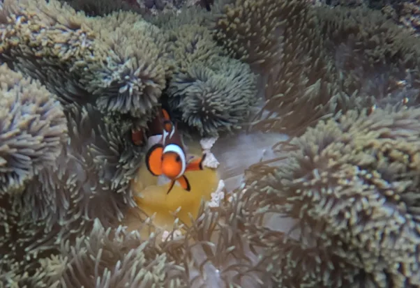
Ocellaris Anemonefish Amphiprion ocellaris -
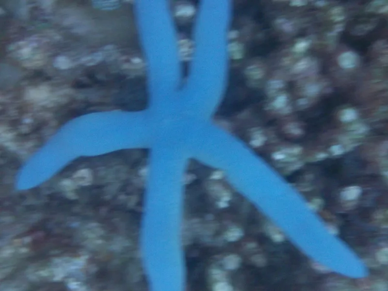
Blue Linckia Linckia laevigata -
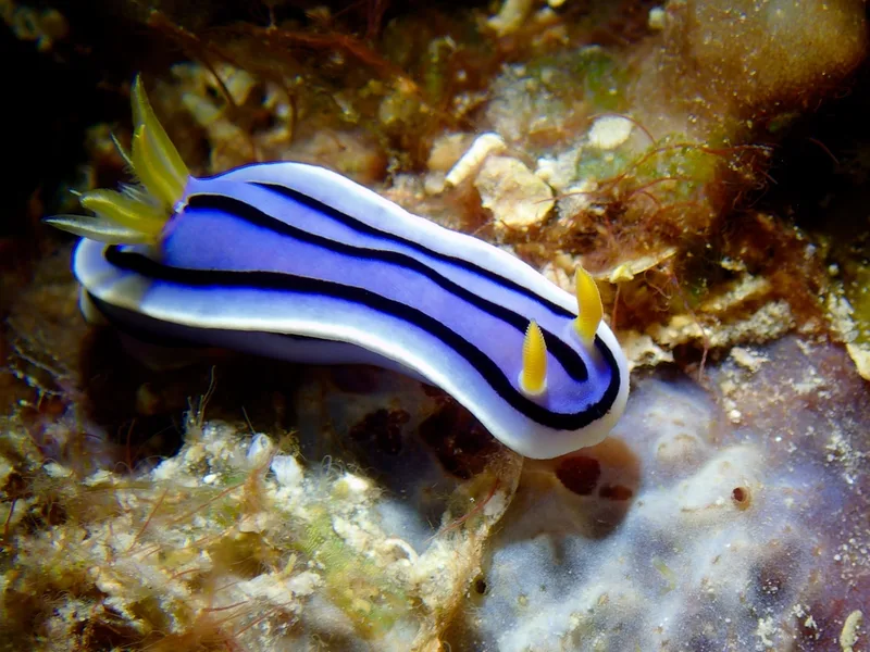
Loch's Chromodoris Chromodoris lochi -
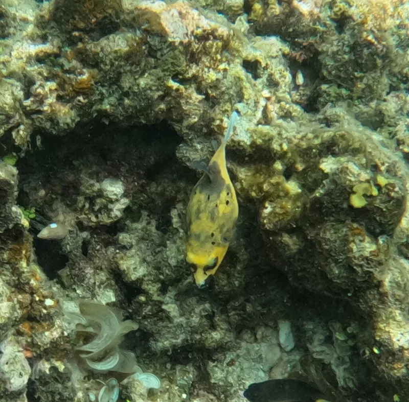
Blackspotted Puffer Arothron nigropunctatus -
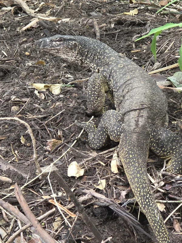
Palawan Monitor Varanus palawanensis -
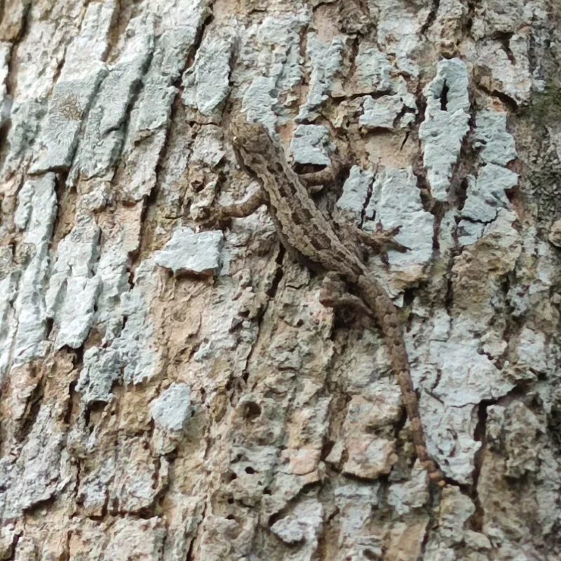
Flat-tailed House Gecko Hemidactylus platyurus -
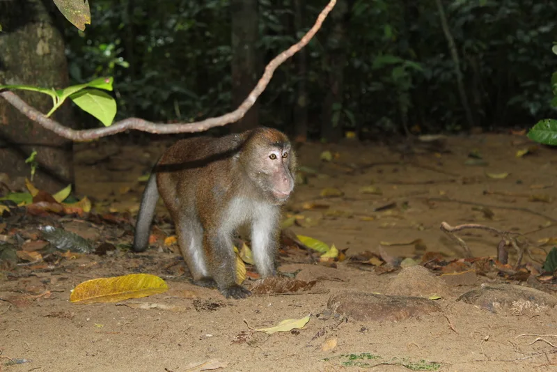
Long-tailed Macaque Macaca fascicularis -
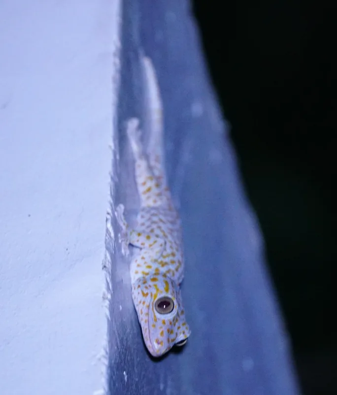
Tokay Gecko Gekko gecko -
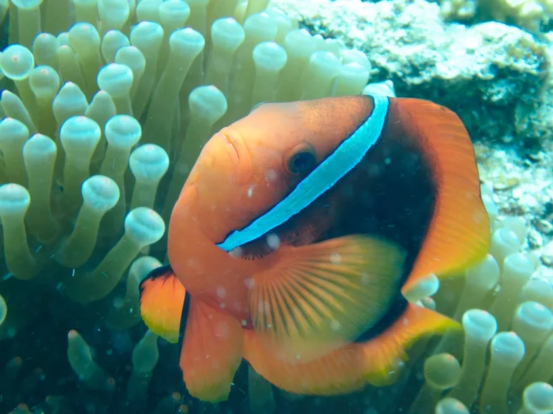
Tomato Clownfish Amphiprion frenatus -
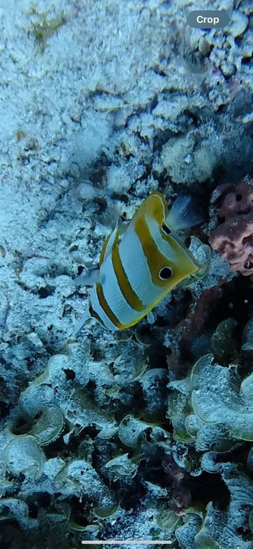
Copperband Butterflyfish Chelmon rostratus -
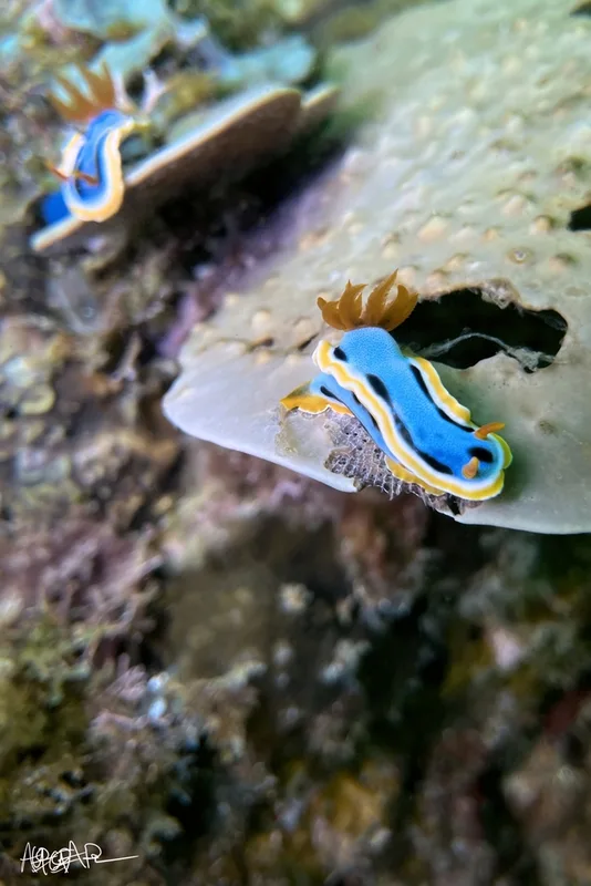
Anna's Chromodoris Chromodoris annae -
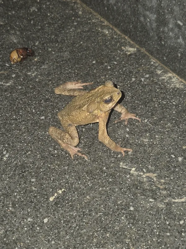
Philippine Toad Ingerophrynus philippinicus
Field Notes · Marine lens · El Nido · 11.1800, 119.3905