Durmitor
Durmitor · Žabljak, Montenegro
Long before anyone named this rock, the water had already decided where it would go.
Why here
Some of the lakes in Durmitor keep a secret: they fill with the spring melt, hold water through summer, and then, without warning, sink back into the ground they sit on — gone until the following year. It looks like a magic trick. It is really just water finding the easiest path through rock that dissolves as readily as it erodes. That is the pattern behind almost everything worth noticing here: water does not so much attack this mountain as outlast it. Where the rock resists, water goes around, over a long stretch of time carving the deep gash of a canyon wide enough to swallow a view. Where the rock is weaker, water goes through it, dissolving channels no eye can follow. Every peak, every rim, every quiet hollow in this massif is really a scoreboard in one long, patient argument between moving water and old marine rock. This note follows that argument to some of its clearest moments — places where you can stand and watch, in something close to real time, water simply continuing to win.
The story
The rock under Durmitor was laid down on an old sea floor, bed after bed of sediment settling for tens of millions of years through the Jurassic and into the Cretaceous. Mountain-building later folded and lifted that seabed into the peaks standing today — rock that started out flat and level now stands on end in places, plainly visible where the layers have been tipped nearly vertical. Water has been arguing with that rock ever since: cutting the canyon that rims the massif, and, in the softer stretches, dissolving its way underground instead, filling and draining small lakes on a rhythm no calendar quite predicts. Life here keeps time with that water. Willow gentian and spring gentian flower on the meltwater calendar; mountain pine and old stands of beech hold the thin soil together on slopes where there is otherwise little to stop it; chamois move along ledges shaped as much by frost and water as by their own hooves. Of the people who first climbed these ridges, named these lakes, and learned which streams could be trusted, the record kept here is quiet — it is the water and the rock that have left the clearest account of themselves.
The sites
The canyon rim
видиковац кањон Таре
43.1916, 19.0567
This viewpoint puts you right at the edge of the argument. Below, the canyon opens wide enough that the far wall reads as its own landscape — terraced rock, patches of forest holding on to whatever ledge offers enough soil, and somewhere down in the shadow, a river doing the actual work. The canyon did not appear all at once. It is the accumulated result of the river refusing, for a very long time, to go around anything: wherever the water met rock, it simply kept cutting, and the walls you see are what is left standing on either side of that decision. Look for the way the rock face is banded — pale layers stacked one on another, laid down flat on an old sea floor long before there was a canyon to expose them. The river has cut straight through beds that took a slow, patient stretch of time to build, which is the whole point of standing here: you are looking at a cross-section of an argument, most of which already happened, with the visible evidence simply left in place for anyone who stops to look.
Pick one pale band of rock on the far wall and follow it with your eye as far as you can along the canyon — notice where it disappears around a bend or drops out of sight; that single layer once ran flat and unbroken before the canyon cut through it.
- AccessShort walk
- ExertionEasy
- TimeAn hour
Каньон
43.1883, 19.0615
A short walk from the main overlook, this second rim spot offers a narrower, steeper-feeling view straight down into the gorge. From here the river itself is often more heard than seen — a faint sound rising from a long way below, evidence of just how much air sits between the rim and the water doing the cutting. That gap is worth sitting with. A canyon this deep did not get that way through any single flood or storm; it is the sum of countless ordinary days, the water simply lower than the rock and unwilling to accept that arrangement. Depth, more than width, is the easiest way to read how long this argument has run: the deeper the cut, the more time the river has had to keep winning. Visit this second viewpoint after the first one and the contrast does some of the explaining for you — different angle, same river, same long habit of getting its way.
Stand still and listen before you look — try to pick out the sound of the river rising from the gorge floor, then judge by ear alone how far below it must be; the distance sound has to travel is a rough measure of how much rock the water has already removed.
- AccessShort walk
- ExertionEasy
- TimeAn hour
Peaks that answer to the water
Bobotov Kuk
43.1281, 19.0347
This is the highest ground in the massif, and from the top the reason the canyons run where they do becomes a lot easier to read. Ridgelines fall away in several directions at once, and each one marks a boundary: rain or melt landing a step to one side goes toward one valley, a step to the other side goes somewhere else entirely. Nothing about where the water ends up is arbitrary once you are standing at the point where all those decisions start. Most of the mountains visible from up here are themselves shaped by the same rule — high ground gathering water and handing it off, ridge by ridge, to whichever drainage lies downhill. It is a long climb to a summit that rewards patience rather than speed, and the payoff is less a single view than an entire drainage system laid out at once, legible in a way it never quite is from lower down. Come with a full day, good weather, and no plan to rush the descent.
From the summit, trace one ridgeline downhill with your eye until it drops out of sight, and try to guess which valley the water running off either side of it would end up in — you are reading a watershed boundary, not just a view.
- AccessExpedition
- ExertionStrenuous
- TimeA full day
Crvena Greda
43.1610, 19.0523
Crvena Greda does not draw attention to itself the way the taller peaks do, but its slopes do quiet, steady work: meltwater running off this mountain gathers at its foot in a small glacial lake, held in place by a dense, old stand of conifer forest that has had a long time to settle in around a reliable water source. Stand on the upper slopes and the relationship is visible in outline — forest cover thickening exactly where the ground holds water longest, thinning out again on the drier, more exposed ground above. It is a modest example of the same rule at work everywhere in this note: high ground decides where water goes, and everything downhill — forest, lake, the animals that use both — arranges itself around that decision. There is no dramatic overlook here, just a working demonstration, which is its own kind of worth seeing.
Look downslope toward the tree line below and notice where the forest grows noticeably denser — that band marks roughly where meltwater collects longest through the season, well before it reaches the lake at the bottom.
- AccessHalf-day hike
- ExertionModerate
- TimeHalf a day
Rock the river exposed
Prutaš
43.1267, 19.0014
Most mountains show their rock in gentle, near-horizontal bands, the way sediment settled in the first place. Prutaš does not. Its layers stand nearly on end, tilted up almost vertical by the same slow mountain-building that raised this whole massif out of what was once open sea floor. That tilting is what makes this one of the more striking viewpoints in the park: rather than reading as a stack, the rock reads as a set of ribs, each one a former sea-floor bed now standing edge-on. None of that would be visible if erosion — rain, frost, snowmelt working the slopes over a very long time — had not stripped away enough loose material to expose the bedrock underneath. In that sense Prutaš belongs on this list less for what it overlooks and more for what it is: a rock face doing the water’s advertising for it, showing exactly how much bending old, flat sediment can take before it starts looking like something else entirely.
Step back far enough to see the whole ridge at once and look for the vertical ribbing in the rock — each rib is a bed that was once flat and horizontal; try to count how many you can pick out before they blur together.
- AccessHalf-day hike
- ExertionStrenuous
- TimeHalf a day
Galev krš
43.0037, 19.4353
“Krš” is the local word for bare, broken rock ground, and this site earns its name honestly: the surface here is pitted, grooved, and fissured in a way that has nothing to do with a river cutting a canyon and everything to do with water dissolving the rock it sits on. Rain and snowmelt work into any weakness in this kind of rock and slowly widen it from the inside, which is also, elsewhere in the park, how a lake can fill every spring and vanish again by late summer without anyone seeing where the water went — it simply finds its way down through channels too narrow and too hidden to follow with the eye. Standing here, the argument between water and rock looks nothing like the canyon rim: no dramatic drop, no visible river, just quiet, patient dissolution happening at a scale too small and too slow to watch directly. It is worth including for exactly that reason — it is the same contest, fought by entirely different rules.
Look down rather than out — trace one groove or pit in the exposed rock with a finger, and notice how it narrows and deepens toward one end; that shape is water finding and widening the rock’s weakest line, the same process that empties the park’s disappearing lakes each year.
- AccessHalf-day hike
- ExertionModerate
- TimeHalf a day
When it's best
Late spring through midsummer is when the water argument is easiest to watch: snowmelt is still running off the peaks, the seasonal lakes are at their fullest, and the canyon rim viewpoints are usually clear of ice. By late summer the smaller karst lakes have often started to shrink or vanish for the year, sometimes earlier after a dry spring. Winter here turns hard and closes in early — deep cold settles over the massif and rim trails can be difficult or unsafe to reach — so the canyon and its viewpoints reward a visit once the snow has properly let go, typically well into the warm months.
Go deeper
The names behind what you saw The rock under the canyon rim and the karst ground to the south is mapped as Jurassic undifferentiated and Mesozoic sedimentary rocks — old marine sediment, Jurassic into Cretaceous in age. The chamois seen on these slopes is Rupicapra rupicapra; the two gentians that flower on the meltwater calendar are Gentiana asclepiadea (willow gentian) and Gentiana verna (spring gentian); the pine holding thin soil on exposed ground is Pinus mugo, and the old forest lower down is largely Fagus sylvatica, European beech.
To read next - Wikipedia’s entry on Durmitor — the massif’s basic shape and highest point, the frame everything else here sits inside. - Wikipedia’s entry on Škrčko Lakes — two glacial lakes set inside Sušica Canyon, the canyon-and-water pairing at its most direct. - Wikipedia’s entry on Zeleni Vir — the periodic lake, for the underground half of the argument this note keeps returning to. - Wikipedia’s entry on Prutaš — more on the peak’s tilted, vertical rock layers and its standing as one of the park’s premier viewpoints. - Wikipedia’s entry on Bobotov Kuk — the roof of the range, and how much of Montenegro it lets you see once you are standing on it. - Wikipedia’s entry on Debeli Namet — a small glacier tucked below Mount Šljeme, a reminder that ice, not only running water, still argues with this rock.
The names behind what you saw
What lives here, and what it's called. Photographs from open collections — an aid to identification, not decoration.
-
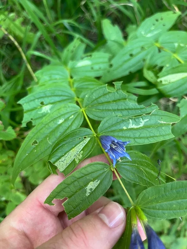
willow gentian Gentiana asclepiadea -
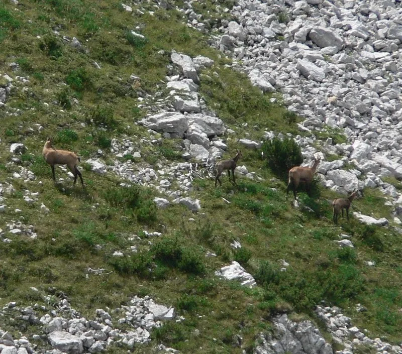
Northern Chamois Rupicapra rupicapra -
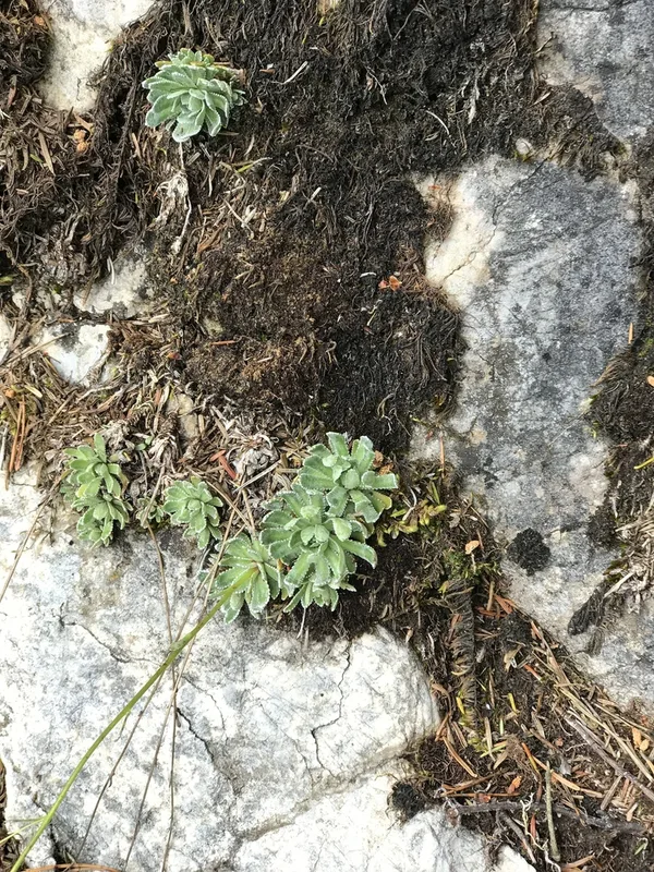
Livelong Saxifrage Saxifraga paniculata -
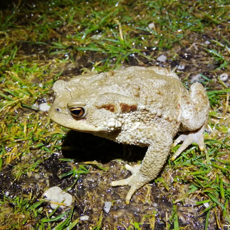
European Toad Bufo bufo -
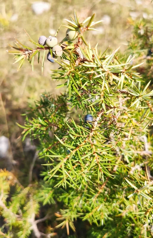
common juniper Juniperus communis -
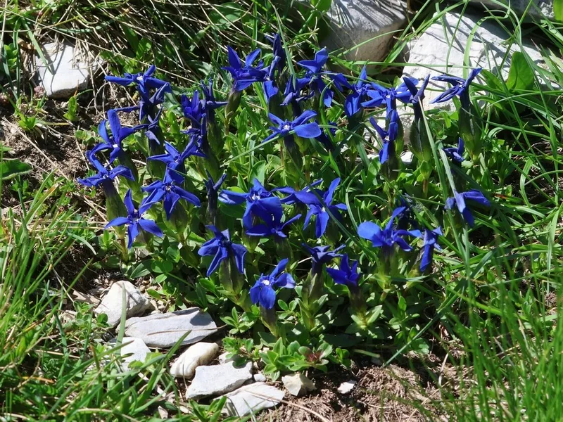
spring gentian Gentiana verna -
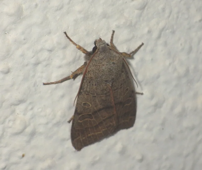
Agrochola humilis -
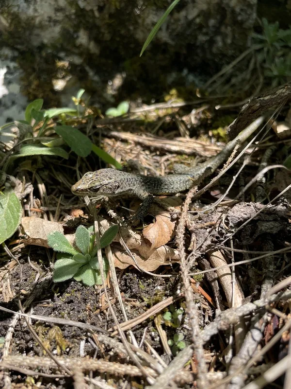
Mosor Rock Lizard Dinarolacerta mosorensis -
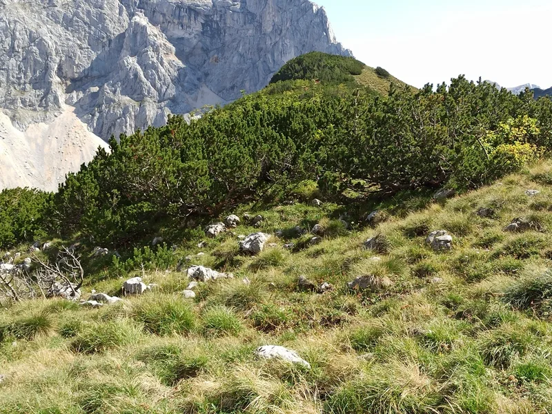
mountain pine Pinus mugo -
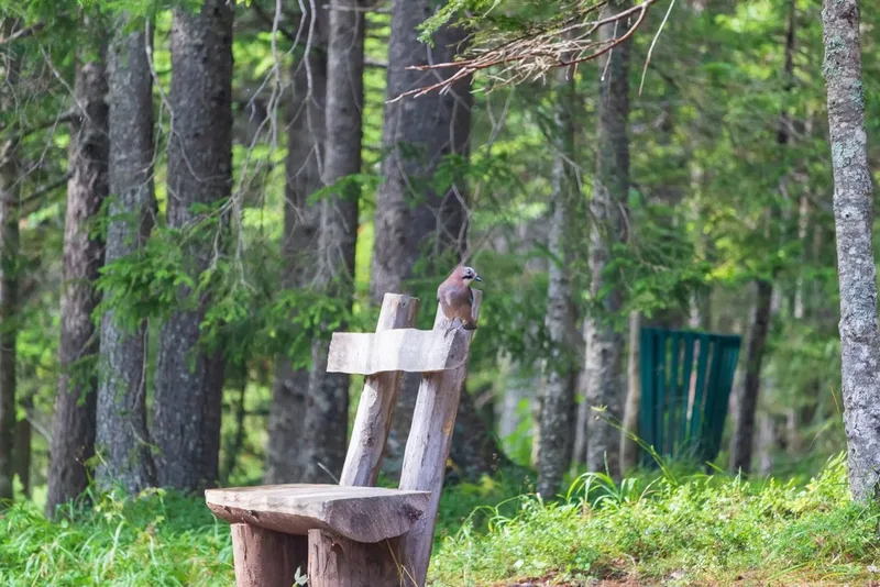
Eurasian Jay Garrulus glandarius -
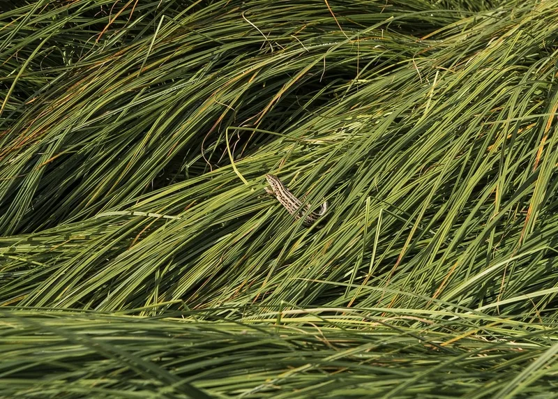
Sand Lizard Lacerta agilis -
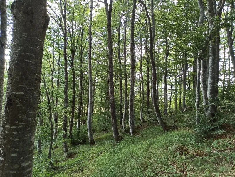
European beech Fagus sylvatica
Field Notes · Rivers & Canyons lens · Durmitor · 43.1382, 19.0302