Denali
Denali Park Road · Alaska, USA
The mountain is tall enough to make its own weather, and its own ice.
Why here
Stand anywhere in the low country here and look up. The peak that owns this horizon is tall enough to make its own ice: its highest slopes are permanent glacier, snow, and bare rock, with tundra filling the middle ground and forest held down in the valleys. That ice is not just scenery on a summit. It is a slow machine. Snow packs into ice, the ice creeps downhill and grinds the rock beneath it to powder, and meltwater carries the ground-up mountain away — down into gravel bars, braided rivers, and the flat, water-holding ground below. Even the gold that once drew people into these hills is part of the same handoff: heavy metal, sorted out of the rubble by moving water. Almost everything you can reach from the road is the mountain in transit, taken apart by cold and ice and stacked back up in the lowlands. This note follows that handoff, from the ice up high to the gravel and water it leaves behind — and keeps pointing at the same quiet fact: down here, you are standing in the mountain, rearranged.
The story
Start with cold. On slopes this high, snow outlasts the summer, packs into ice, and begins to move, grinding the peaks to rubble and powder. Meltwater and streams take that debris downhill and sort it as they go, rounding the stones and dropping the heavy grains first. Among those heavy grains is gold. For a long time this was only a mountain coming apart in the usual way — until, in the early years of the last century, people walked into the Kantishna Hills and found the gold that moving water had already gathered in the creek gravels. A camp went up where Eureka Creek meets Moose Creek, close to the source, and it outlasted the other diggings nearby for the plain reason that it sat nearest the richest ground. The miners were, without quite meaning to, reading the end of a conveyor belt that begins as snow on the summits. And the living country fills in around all of it: moose working the willow thickets along the creeks, a brief, bright tundra summer of dwarf fireweed and low berry shrubs, ptarmigan and eagles over the ridgelines. Ice makes the ground; the ground feeds the life; the gold, for a while, brought the people. One telling, from the top of the mountain down.
The sites
The ice on the mountain
Kahiltna Glacier
63.0182, −151.0548
Far to the south, on the other side of the range from the park road, lies Kahiltna Glacier — the longest glacier of the mountain, a river of ice that gathers the snow of the high peaks and carries it slowly downhill. This is the ice itself, the engine behind everything else in this note. Snow piles on the heights faster than it can melt, packs into ice under its own weight, and begins to flow — not fast, but without stopping, grinding against the rock beneath it and the walls on either side. What comes out the lower end is meltwater heavy with ground stone, and the rock the ice has plucked and dragged along. Reaching it is a serious undertaking, far from any road and approached only by air or a long expedition across the range; most who stand on it are there to climb the mountain above. But it is worth knowing this ice exists even if you never set foot on it, because its smaller cousins do the same work all across these mountains, and their leavings are what fill the valleys you can reach. The glacier is the verb; the gravel downstream is the result.
Look along the ice for the long, dark stripes running down its length. Those are lines of rock rubble — stone plucked from the peaks and carried on the moving ice like freight on a belt; where two ice streams merge, two stripes join into one. Trace a stripe back up-glacier and you can pick out the ridge it was torn from.
- AccessExpedition
- ExertionStrenuous
- TimeWorth two days
Iron Dome
63.5228, −150.9896
Iron Dome is a rock peak standing over the low country at the west end of the park road, one of the modest summits of the Kantishna Hills rather than a giant of the main range. It earns a place in an ice story precisely because it is bare: up here, above the reach of forest, the rock takes the full brunt of the cold. Water works into every crack, freezes, expands, and pries the stone apart, then thaws and does it again — season after season, the surest way high country comes down. The mountain that owns the horizon to the south is tall enough to hold permanent ice; this smaller peak shows the same forces at a size you can take in with one look. Stand below it and the whole slope reads as a machine for making rubble: broken blocks near the top, a skirt of loose stone fanning out at the base, and finer and finer material the farther it travels downhill. Everything you will see lower down — the gravel bars, the braided rivers, the flats the miners dug — begins as a peak like this one, coming apart in the cold.
From below, follow the peak’s skyline where rock meets sky. Notice how the summit is broken and blocky rather than smooth — frost prying the rock apart, freezing and thawing in the cracks, is still taking it down grain by grain. Look for a fan of loose rubble spilling from the base of the steepest face; that is the mountain, disassembling.
- AccessHalf-day hike
- ExertionStrenuous
- TimeA full day
The low ground the meltwater fills
Wonder Lake
63.4771, −150.8788
Wonder Lake lies in open, low ground near the far end of the park road, a long sheet of water in the flats below the high peaks. After a day of gravel rivers and bare rock, it is a place where the country goes quiet. The lake sits where the land is low and level — the sort of ground that meltwater and the debris carried by ice tend to leave behind once the slope runs out and the water slows. It gathers the drainage of the surrounding country and passes it on downstream. What makes the spot worth the long ride is the line of sight: from the shore the ground opens straight toward the mountain, so on the rare clear, calm day the whole massif stands mirrored in the water. That view is a gamble — cloud hides the peak far more often than it shows it — but the openness that makes the reflection possible is itself part of the ice story, the flat, water-holding low ground that a landscape of ice and meltwater builds at the foot of steep country.
Come to the shore on a still morning and look across the water toward the high peaks. When the air is clear and the surface calm, the mountain stands twice — once in the sky and once upside down in the lake. Clouds win most days; wait out a gray morning and, now and then, the reflection rewards the patience.
- AccessShort walk
- ExertionEasy
- TimeHalf a day
Lake Creek
63.5032, −150.9012
Lake Creek is the small stream that drains Wonder Lake, running north and west a short way before it joins Moose Creek. It is easy to overlook, and worth a few minutes precisely because it is small enough to read. Streams like this are how the high country moves downhill in pieces: every stone in the bed was once part of a peak, broken loose by frost and ice, then rolled and tumbled along until its edges wore round. Watch the water sort its load — heavy gravel where the current runs quick, fine sand where it pools and slows. In the cold months the creek goes silent under ice and snow; in summer it runs full and cloudy with meltwater off the high ground. The clear, tea-dark stretches and the gravel bars are the same system that, on a bigger scale, built the braided rivers and the mining flats nearby. A creek you can step across is the whole mountain-to-lowland handoff, shrunk to a size you can hold in your hand.
Crouch at the creek’s edge and pick up a handful of the streambed gravel. Turn the stones over: most are rounded, not sharp, each one tumbled smooth on its way down from the high country. Look for how the current sorts them — coarse gravel where the water runs fast, fine sand gathering in the quiet pools.
- AccessShort walk
- ExertionEasy
- TimeAn hour
The mountain, ground fine and carried down
Kantishna
63.5253, −150.9581
Kantishna sits at the end of the park road, where Eureka Creek meets Moose Creek — an old gold camp founded in the early years of the last century, and one that outlasted its neighbors because it was built nearest the source of the gold. The gold is the ice story’s payoff. Glaciers and frost break high rock into rubble; meltwater and streams carry it down and sort it; and gold, being far heavier than the stone around it, drops out first and settles low in the gravel of the creek beds. Miners did not chase the gold up the peaks — they worked the creeks, because moving water had already done the gathering for them, concentrating flecks and grains into the gravel bars where the current slackened. Walking the old workings, you are reading the end of a long conveyor belt that starts as snow on the summits. The camp endured here, at the junction of two creeks near the mouth of the Kantishna River, because this was as close to that concentrated gravel as anyone could get. The mountain came apart in the cold; the water sorted the pieces; the people followed the heaviest ones down.
Walk the creek gravels near the old workings and look at the bars of cobbles the water has stacked. Gold, being heavy, settles low in gravel exactly like this, which is why the diggings followed the creeks. Look for where the gravel coarsens and the channel bends — the places moving water drops what it can no longer carry.
- AccessDrive-up
- ExertionEasy
- TimeHalf a day
Alpha Ridge
63.5252, −151.0194
Alpha Ridge is a low ridge rising just west of Kantishna, high enough to lift you above the flats and give the whole system a shape. From a creek bank you see gravel; from a ridgeline you see the pattern. Gaining the crest is an off-trail effort over open ground, but the reward is the long view north and west across the low country, where the rivers spread into many pale, shifting channels at once. A river braids like that when it carries more loose gravel than it can keep moving in a single channel — it keeps splitting, dropping its load, and finding new paths across its own debris. That debris is the mountain, ground fine and delivered here by ice and meltwater. Stand on the ridge and you can trace a braided channel with your eye from the flats back up toward the peaks, following the exact road the rock travels as it comes apart and moves down. The ridge asks something of your legs, but it turns a hundred separate details into one legible picture of a landscape still being taken apart uphill and stacked up down here.
Gain the ridgeline and look out over the low country to the north and west. Pick out the pale, braided rivers threading across the flats — a single river split into many shifting channels because it carries more gravel than it can hold in one. Follow a channel with your eye toward the peaks and you are looking up the whole path the rock takes down.
- AccessHalf-day hike
- ExertionModerate
- TimeHalf a day
When it's best
There is no gentle season here, only a long cold one and a short bright one. By late winter the country is locked down — the March air rarely climbs anywhere near freezing, the rivers run silent under ice and snow, and the park road belongs to skis and dog teams rather than wheels. The glaciers do their most visible work in summer, when meltwater fills the braided channels and the gravel rivers run high and gray with ground rock; that is also when the tundra greens, the berry shrubs and dwarf fireweed flower for their few weeks, and the migrant birds crowd back in. Through all of it the high peak keeps its own counsel, hidden in cloud far more often than not. A clear, still morning that shows the mountain is a thing to hope for and time your patience around, never something to count on.
Go deeper
The high ice is Kahiltna Glacier, the mountain’s longest. Much of the range’s backbone is pale, coarse rock of the granite family — granodiorite, diorite, monzonite, and darker gabbro — the kind of deep-cooled rock frost and ice pry apart into the gravel you see downstream; the flats and river bars are mapped as young, unconsolidated flood-plain deposits, geologically very recent. The living cast: dwarf fireweed (Chamaenerion latifolium), bog bilberry (Vaccinium uliginosum), lingonberry (Vaccinium vitis-idaea), and twinflower (Linnaea borealis) in the tundra; moose (Alces alces) in the willows; rock ptarmigan (Lagopus muta) and golden eagle (Aquila chrysaetos) over the high ground.
For further reading:
- USGS, Assessing geohazards to the Denali National Park road with geologic mapping (2020) — how ice, thawing ground, and moving slopes threaten the single road, and what that reveals about a landscape still in motion.
- Field guide to the geology of the Denali National Park Road and the Parks Highway from Cantwell to Healy (2013) — a stop-by-stop reading of the rock along the road you travel.
- The Wikipedia overview of Denali National Park and Preserve — a clear short account of the elevation bands, from valley forest through tundra to permanent ice.
- Any general introduction to placer gold — why heavy metal collects in stream gravels, the process the Kantishna miners were quietly relying on.
The names behind what you saw
What lives here, and what it's called. Photographs from open collections — an aid to identification, not decoration.
-
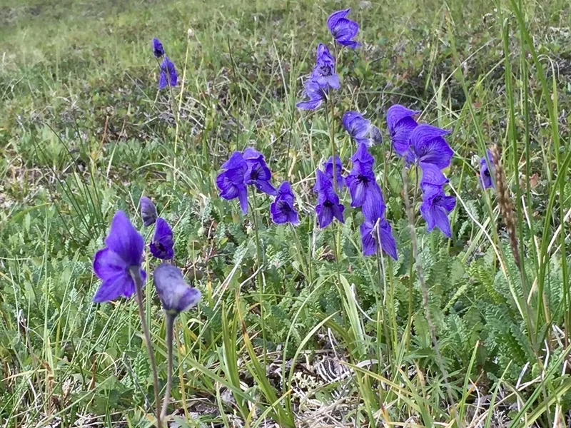
Larkspurleaf Monkshood Aconitum delphiniifolium -
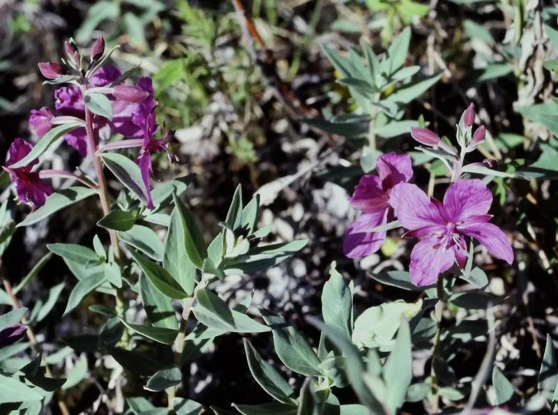
Dwarf Fireweed Chamaenerion latifolium -
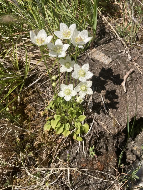
marsh grass-of-Parnassus Parnassia palustris -
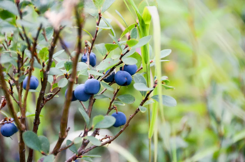
bog bilberry Vaccinium uliginosum -
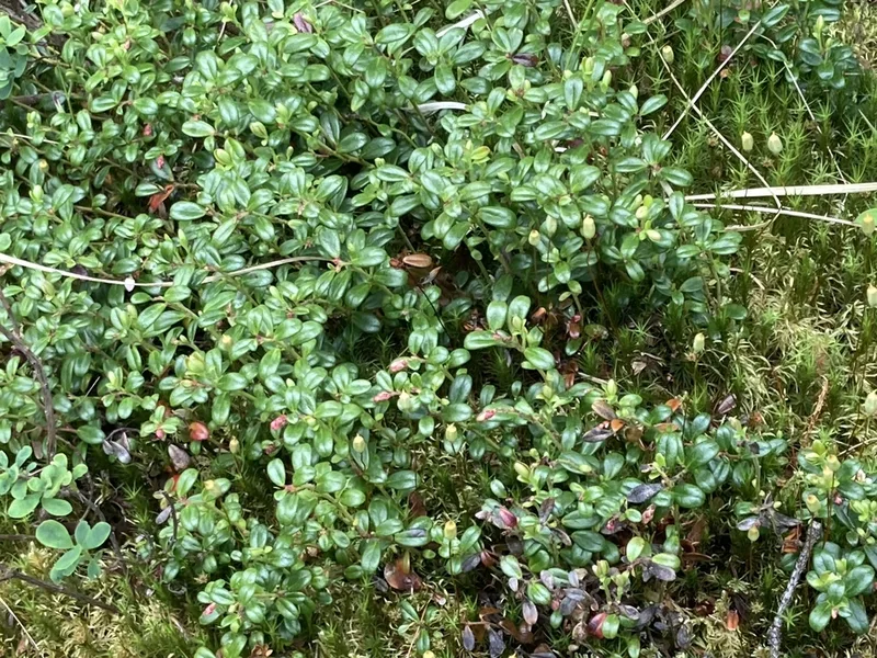
Lingonberry Vaccinium vitis-idaea -
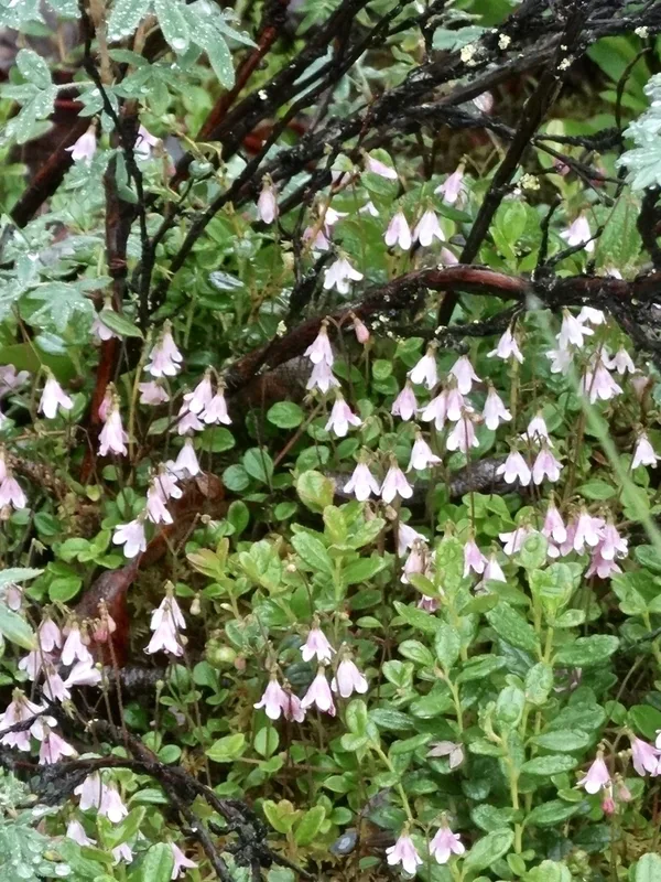
Twinflower Linnaea borealis -
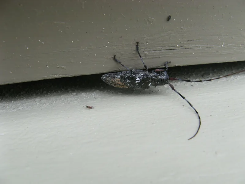
White-spotted Sawyer Monochamus scutellatus -
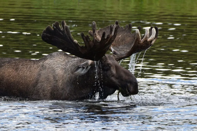
Moose Alces alces -
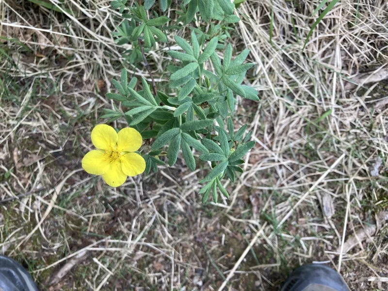
shrubby cinquefoil Dasiphora fruticosa -
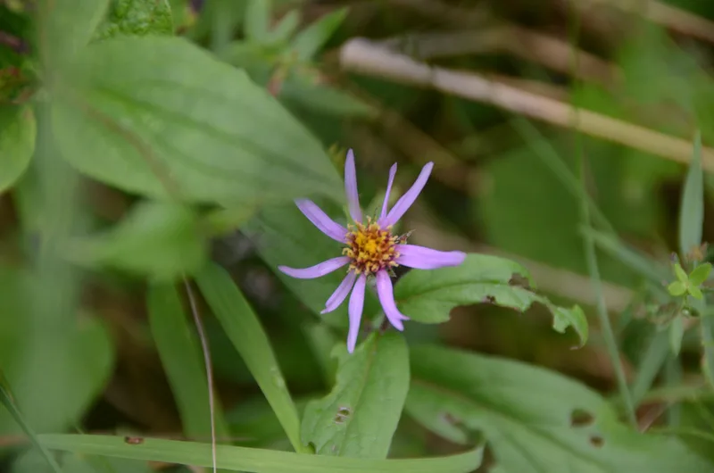
Siberian Aster Eurybia sibirica -
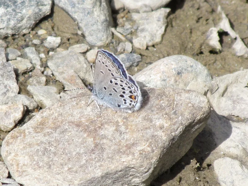
Cranberry Blue Agriades optilete -
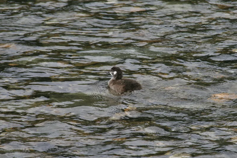
Harlequin Duck Histrionicus histrionicus
Field Notes · Ice & Glaciers lens · Denali Park Road · 63.2717, −150.9668