Cordillera Blanca
Cordillera Blanca · Áncash, Peru
The range is called White for what sits on top of the rock, not for the rock itself.
Why here
Every peak in this park wears the same signature: a cap of ice, however far it has shrunk back this year. Huascarán National Park takes its name from the mountain at its center, and mountaineers have long been drawn here for precisely the feature the range’s Spanish name describes — white, from ice sitting over rock that would otherwise look much like its unglaciated neighbors. That whiteness is not decoration. It is a slow machine: ice grinding down through rock long enough to leave behind knife-edge ridges, sheer faces, and the meltwater that fills the valleys below with lakes and high wetlands. Some summits here hold ice through every season of the year; others, lower and more exposed, are visibly losing that argument, retreating and leaving bare rock further up the slope each year. Walk this range with your eyes on where the white stops and the bare rock starts. That boundary is the whole story here, written a little differently on every mountain, and it keeps moving.
The sites
Peaks the ice carved
Huascarán Sur
−9.1212, −77.6043
This is the peak Huascarán National Park takes its name from, and its ice sits at the center of everything protected here. Like several of its neighbors, Huascarán is really two summits rather than one — Norte and Sur, separated by a long connecting ridge — the kind of twin-topped massif that happens when a single mountain mass gets carved from more than one direction at once. Tropical glaciers like these are an odd category: close enough to the equator that the sun never drops low or weak, but high enough, and cold enough at that altitude, that ice holds on anyway. That balance is delicate, and it is why a mountain like this one draws mountaineers rather than casual hikers — the approach alone crosses terrain shaped entirely by ice working on rock, moraine underfoot before any technical climbing starts. You do not need to summit to feel the scale of it. Even from a distance, the mountain reads as a single idea worked out twice, in mirror image, by the same slow tool.
Look across the ridge connecting the two summits and notice how each side holds ice differently — one face usually carries more snow and ice than the other. That asymmetry is the sun’s doing: the side that gets less direct light through the day loses less ice to melt, season after season.
- AccessExpedition
- ExertionStrenuous
- TimeWorth two days
Alpamayo
−8.8789, −77.6536
Few summits in this range show the work of ice as plainly as this one. Its faces run in even, vertical flutes — the record of countless small avalanches sliding down the same lines, smoothing and regrooving the ice each time until the whole face reads almost like a corrugated sheet. That fluting is temporary in the way all ice surfaces are temporary; storms, sun, and gravity keep re-writing it, so the mountain looks slightly different from one season to the next even though its shape as a whole has held for a very long time. Reaching this peak means days of approach through a valley the same ice once filled and then abandoned, leaving behind the moraine ridges hikers now walk on top of. The mountain is a working demonstration of two timescales at once: the slow one that built the shape of the peak, and the fast one, visible in the flutes, that keeps resurfacing it week to week.
Study one face of the peak for its vertical grooves. Trace a single flute from top to bottom with your eyes — it marks the path where snow and ice have slid, over and over, wearing the same line smoother each time.
- AccessExpedition
- ExertionStrenuous
- TimeWorth two days
Artesonraju
−8.9521, −77.6327
A mountain becomes a sharp pyramid, rather than a rounded dome, when glaciers cut into it from several sides at once. Each glacier grinds its own bowl-shaped cirque into the rock; where two cirques meet, they leave a knife-edge ridge, and where three or more meet, they leave a horn — a peak with no gentle side left. This summit is close to that ideal shape, its faces dropping away steeply in more than one direction. Below it, the same process runs in reverse in miniature: meltwater carries the ground-up rock the ice has produced down into the valley, where it settles as fine grey silt in the streams and lakes. That silt is one of the more reliable signs, anywhere in this range, that a glacier is still actively working somewhere upstream — clear water usually means the ice above has stalled or is a long walk further up the valley. Getting close to this peak means walking that same drainage from bottom to top, watching the water change as the glacier gets nearer.
Where the trail crosses a stream fed from above, look at the water color. Cloudy, pale grey-green water carries rock flour ground fresh by moving ice; clear water usually means you are drawing from snowmelt or an older, quieter source instead.
- AccessExpedition
- ExertionStrenuous
- TimeWorth two days
Chacraraju
−8.9946, −77.6156
Ice does not usually sit on very steep rock — gravity sheds snow off anything close to vertical before it can compact into glacier ice. This peak is the exception that makes the rule visible: its walls hold ice at angles steep enough to intimidate even experienced climbers, which only works because the cold here is severe and constant enough to freeze new snow into the wall faster than gravity can pull it off. The result is one of the more technical objectives in the range, better viewed than attempted by anyone without serious mountaineering experience. From below, the mountain’s twin, sharply separated summits and near-vertical faces make it one of the more legible glacial horns in the Cordillera Blanca — a shape built entirely by ice attacking rock from multiple sides until almost nothing gentle was left standing. Even a long look through binoculars from a safe valley vantage rewards the patience; the ice on faces this steep visibly changes texture and color through the day as the sun moves across it.
Watch one ice face through binoculars as the sun crosses it. Note how the surface shifts from dull white in shadow to a wet, almost blue sheen once direct light hits it — meltwater briefly filming the surface before the cold reclaims it after sunset.
- AccessExpedition
- ExertionStrenuous
- TimeWorth two days
Where you can stand and see it
Mirador Alpamayo
−8.9107, −77.6239
Not every way to experience this range’s ice involves technical climbing. This viewpoint sits along one of the standard trekking routes through the northern part of the park and gives a full, unobstructed look at a fluted, glaciated peak from a comfortable distance — no ropes, just the walk in. The reward is a wide-angle version of what climbers see only in fragments: the whole ice-covered face at once, valley to summit, with the moraine-covered slopes below it giving a rough sense of how far the glacier has pulled back from where it once ground rock directly. Weather decides most of what you actually see here — cloud can wrap the summit for hours before lifting all at once. Patience earns better views here than persistence does; there is no trail shortcut around waiting out the sky. Bring a warm layer regardless of the forecast lower down, since a clear window can close again within the hour at this elevation.
While you wait for cloud to clear, look at the slope beneath the ice for a distinct line where vegetation stops and bare, disturbed ground begins. That line marks roughly how far the glacier’s edge has retreated — the ground below it was under ice more recently than the ground below that line has been ice-free.
- AccessExpedition
- ExertionModerate
- TimeWorth two days
Mirador Laguna Querococha
−9.7278, −77.3307
This viewpoint looks down over a lake fed by glacial meltwater, reachable without a long approach — one of the easier ways in this range to see, in a single stop, what happens to water once it leaves the ice behind. Lakes like this one typically hold a distinctive milky turquoise color, caused by extremely fine rock particles — ground up by moving ice and too light to settle out — staying suspended in the water and scattering light. The color is a rough, honest signal: a lake running clear rather than milky is usually drawing on older, settled water rather than fresh glacial input. Because the route here follows a road rather than a trail, this is a good stop for travelers who want the visual evidence of glacial activity without the days of approach the higher peaks require. It also makes a useful orientation point before heading further into the range — a chance to see, at a comfortable distance, the kind of terrain the more remote sites in this note ask you to walk into.
Look at the lake’s color rather than its shape. A cloudy, pale blue-green tint means the water is still carrying fine rock flour from ice somewhere upstream; compare it, if you can, to any nearby stream or puddle fed by rain rather than glacial melt — the difference in clarity is usually obvious side by side.
- AccessDrive-up
- ExertionEasy
- TimeAn hour
What the melt leaves behind
Pastoruri
−9.9300, −77.1893
This is the most direct place in the range to see glacial retreat rather than infer it. A short walk from the road leads up to ice that has been thinning and pulling back for decades, leaving a widening apron of bare, scoured rock and loose moraine between the current trail and the current edge of the ice — ground that was under the glacier within living memory and now is not. The retreat is not a single dramatic event but a slow accounting, one season’s melt outrunning one season’s snowfall, repeated for long enough that the difference becomes obvious on the ground rather than just on paper. The altitude here does most of the physical work for you — the walk is short in distance but genuinely demanding in thin air, so pace it slower than the distance alone suggests. Standing at the current ice edge and looking back down the walked-in trail gives a rare, legible timeline: the farther you have walked from the road, the further back in the glacier’s retreat you are standing.
Look for old moraine ridges below the current ice edge, sometimes with faint bands of different-colored rock or lichen growth. Each ridge marks a place the glacier’s edge once held steady long enough to pile up rock debris before retreating again — read them like rings, oldest and outermost first.
- AccessShort walk
- ExertionModerate
- TimeHalf a day
Bofedal
−9.8812, −77.2877
A bofedal is a high-altitude wetland, and in a range like this one, its water usually traces back to snow and ice further upslope rather than to rainfall alone. The ground here stays saturated even through drier stretches of the year, cushioned by dense mats of low, tightly packed plants built to hold water rather than shed it. That permanence is exactly what makes these wetlands valuable well beyond their own footprint — they act as a kind of natural reservoir, releasing meltwater slowly into streams below rather than letting it run off all at once, which keeps water flowing through the dry months long after the last storm passed. Birds and grazing animals concentrate here for the same reason travelers should slow down and look: water and food both stay reliable on this ground when they are scarce elsewhere in the surrounding rock and scree. It is an easy stop, but not a throwaway one — this is where you can watch, in slow motion, what the ice higher up eventually becomes.
Kneel at the wetland’s edge and press a hand into the cushion plants growing there. Notice how much water the mat holds and releases under light pressure — that spongy give is the mechanism keeping streams below running between storms.
- AccessShort walk
- ExertionEasy
- TimeAn hour
When it's best
This is high tropical mountain country, so the two seasons that matter are wet and dry rather than warm and cold — nights stay near or below freezing most of the year regardless of the calendar. The dry months usually bring the clearest, most settled weather for seeing and approaching the ice, with skies more likely to hold open for days at a stretch; the wetter months bring cloud that can sit on the summits for a week without lifting, so plan for patience rather than a fixed itinerary if you visit then. None of this affects the ice itself on any schedule a single trip will notice — glacial retreat here runs on a clock measured in years and decades, not seasons, so the mountains look much the same from one visit to the next even as they are quietly, steadily changing underneath.
Go deeper
The names behind what you saw The bedrock recorded under this park includes marine sedimentary rock from the Cretaceous period, laid down roughly 145 to 66 million years ago — long before any ice sat on top of it (Macrostrat unit 3184231). Huascarán National Park itself carries a formal identifier in Wikidata (Q917369), useful if you want to trace its protected-area status and boundaries further.
To read next - Huascarán National Park (Wikipedia) — the park’s own portrait: its size, its 1985 UNESCO World Heritage designation, and the biodiversity its ice and altitude protect alongside the mountains themselves. - Pucaranra (Wikipedia) — a profile of one of the range’s tallest summits, useful for feeling the scale these glaciers sit on beyond the peaks named in this note. - Lake Palcacocha (Wikipedia) — a glacier lake profile, and the clearest single case of what retreating ice leaves behind once it pulls back from ground it used to cover. - Tullpacocha (Wikipedia) — another lake tucked at the head of a glacial valley, worth reading alongside Palcacocha to see how often the lake-behind-retreating-ice pattern repeats across the range.
The names behind what you saw
What lives here, and what it's called. Photographs from open collections — an aid to identification, not decoration.
-
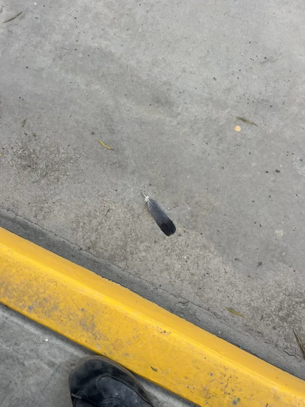
Rock Pigeon Columba livia -
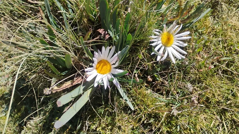
Rockhausenia nubigena -
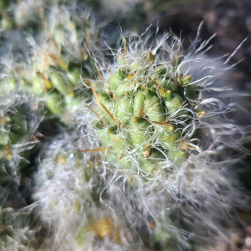
waraqu Austrocylindropuntia floccosa -
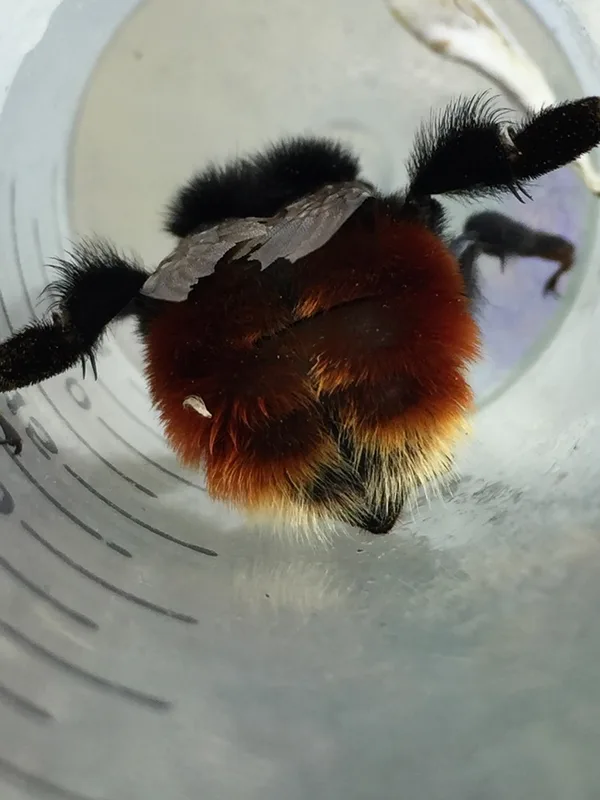
Scarlet-tailed Bumble Bee Bombus coccineus -
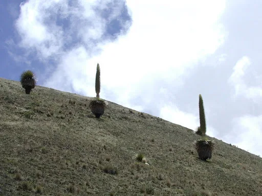
Queen of the Andes Puya raimondii -
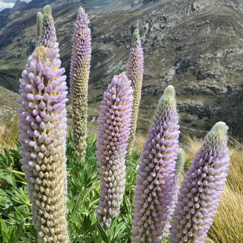
Lupinus weberbaueri -
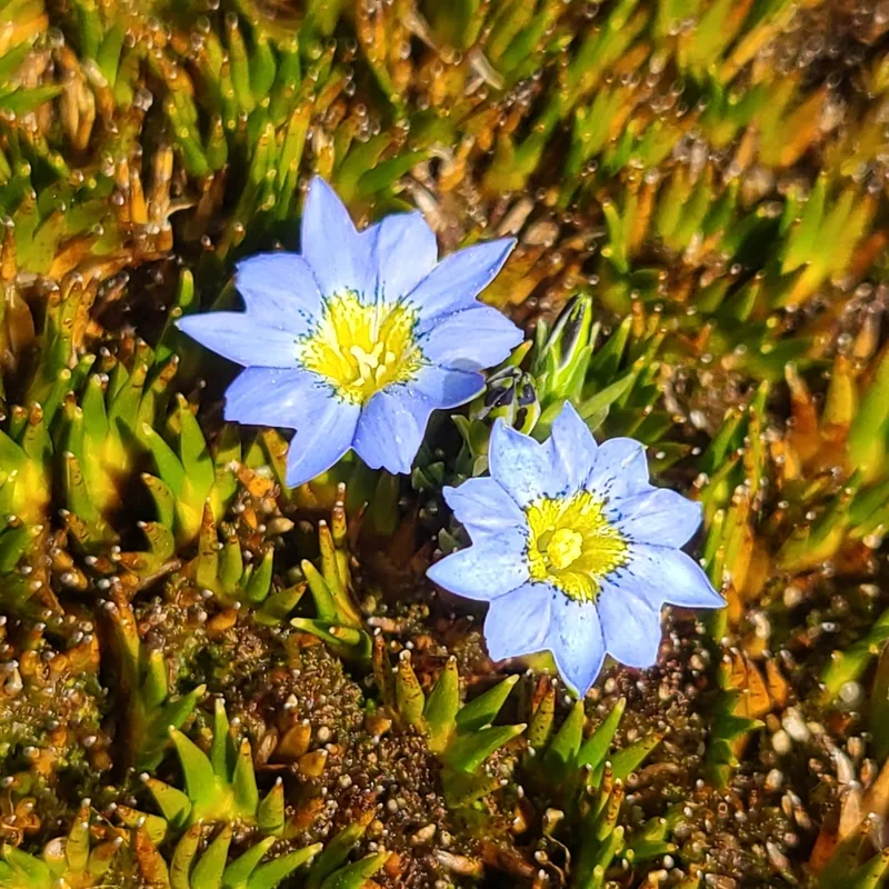
Gentiana sedifolia -
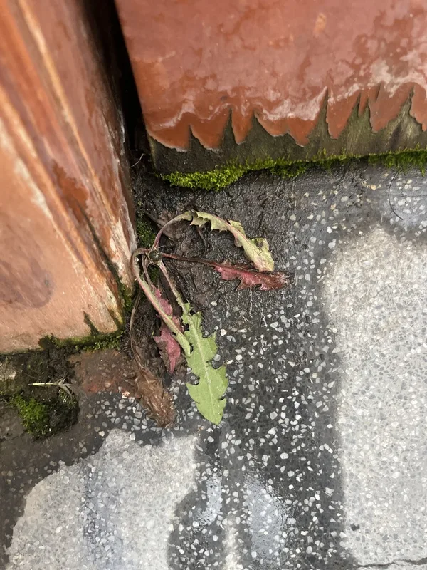
common dandelion Taraxacum officinale -
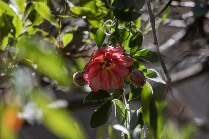
Passiflora trifoliata -
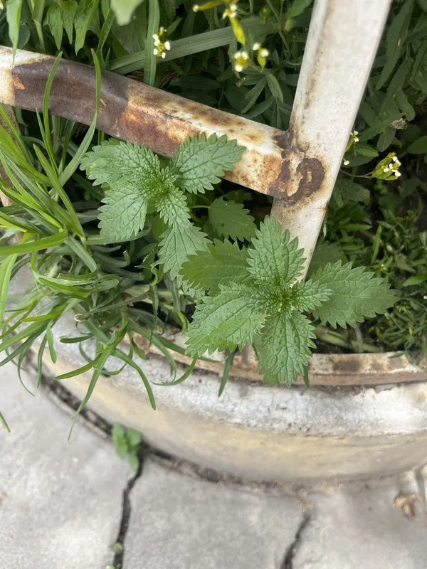
Dwarf Nettle Urtica urens -
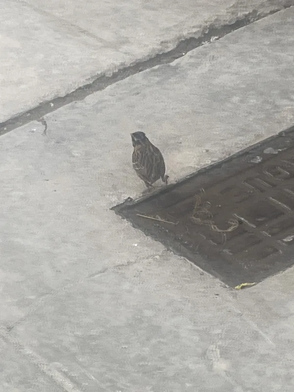
Rufous-collared Sparrow Zonotrichia capensis -
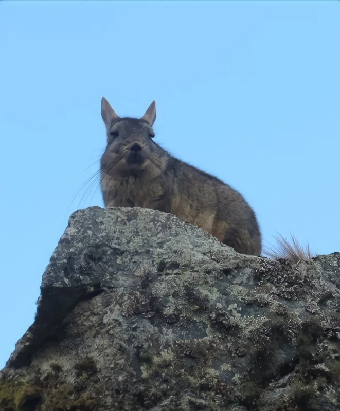
Mountain Viscacha Lagidium viscacia
Field Notes · Ice & Glaciers lens · Cordillera Blanca · −9.4257, −77.3731