Cherry Springs
Cherry Springs State Park · Pennsylvania, USA
Some of the deepest dark on this side of the country, and held in it, the oldest light there is.
Why here
Look up on a clear night at Cherry Springs and you are looking into the past. The light landing in your eye left its star long ago — some of it before there was a plateau here to stand on. What makes that ordinary miracle visible is almost accidental. The park is a small clearing high on a broad plateau, cut from a surrounding state forest, in a corner of the state that holds a great deal of forest and very few people. No city throws its glow across the horizon. The stand of black cherry that gave the place its name is beside the point; the real feature overhead is the dark itself, some of the deepest on this side of the country. Everything in this note comes back to that one inheritance — height, emptiness, and a clean line to the sky. Stand in the open field after the last car has gone, give your eyes time to adjust, and the plain night sky unfolds into something far older than the ground under your boots.
The story
Start with the rock, because it set the stage. The plateau here is built of hard gray sandstone and conglomerate — old river and swamp deposits, thin coal seams threaded through them, later lifted and slowly cut apart by streams into the ridges and hollows you drive through today. High ground, thin soil, hard to farm.
On it grew forest, and forest is still most of what this region is. The park takes its name from a stand of black cherry, one kind of tree among many in a northern woods that rings by day with vireos, wrens, and the deep croak of ravens.
The people came first for the timber. When the big cutting was finished, the state took the cutover land back and let it grow again as forest. During the Depression, a flat clearing on the plateau was pressed into service as an emergency landing field; small planes used it for decades. The planes are long gone. In the 2000s the airfield’s ground passed to the park — not for aircraft, but for telescopes: flat, open, and far from any glow. It is a rare thing, a piece of land kept deliberately dark and empty so that people could see. The whole trip is the sky, and the sky is here because the land beneath it was left alone.
The sites
Standing in the open
Cherry Springs State Park
41.6628, −77.8222
This is the field the whole note is about — a small clearing of mowed grass and open sky, high on the plateau, with the state forest closing in dark on every side. By day it is unremarkable: a parking area, a few signs, black cherry woods at the edges. Its value arrives after sunset, when the last headlights leave and the sky above the opening turns as deep as it gets on this side of the country. Give your eyes a full half-hour in the dark to open up, and keep any light dim and red — a single white phone screen resets everyone’s night vision, including your own. Then simply look up. Stars you never see from a town appear in the gaps between the bright ones, until the sky feels crowded. There is nothing to buy and nothing to climb here. The whole experience is standing still in the open and letting the dark do its slow work on your eyes.
On a moonless night, after your eyes have had a full half-hour to adjust, look for a faint pale band arching across the sky. That is the massed light of our own galaxy’s stars, too far and dim to tell apart — visible here only because no town glow washes it out. Trace it from one horizon to the other.
- AccessDrive-up
- ExertionEasy
- TimeHalf a day
Where the field came from
Cherry Springs State Park
41.6628, −77.8222
Stand in the same clearing and you are standing on old airfield ground. From 1935 to 2007 this spot was Cherry Springs Airport, a Depression-era emergency landing field for small planes, carved from the surrounding Susquehannock State Forest. It saw light traffic for decades. In 2006 the land passed from aviation to astronomy: the state park absorbed the old airfield to give stargazers the flat, open, light-free ground they needed, and the runway closed for good the year after. Nothing marks the change today but the openness itself — the same flatness that once let small planes land now lets the whole sky in.
Look for the flatness under your feet — mowed, level, treeless. That is the old runway’s legacy: a Depression-era landing field repurposed, in the 2000s, as the open ground astronomers needed for a clear shot at the sky.
- AccessDrive-up
- ExertionEasy
- TimeAn hour
The wild that keeps it dark
Susquehannock State Forest
41.6368, −77.9143
The park is a small opening; the forest around it is the real expanse, and the park was carved out of it. Unbroken woods run for miles in every direction, with few roads and fewer towns, and that emptiness is exactly what keeps the sky overhead dark — darkness above needs darkness on the ground for a long way out. By day the forest is worth entering on its own terms. It has a northern feel: a floor of clubmoss and, in season, the nodding white of painted trillium, and birdsong from a cooler kind of woods than you find down in the valleys. Walk a short way in from a pull-off and the trees close over the road behind you. The same quiet that lets this forest grow unbroken is what leaves the field at its center one of the darkest places to stand after nightfall on this side of the country.
Step a little way into the forest and look down at the ground: low, stiff, evergreen clubmoss spreading across the floor, and in spring the single nodding white flower of painted trillium. These are plants of cool northern woods, a sign of how high and how far north in feel this plateau sits — the same remoteness that keeps its nights so dark.
- AccessShort walk
- ExertionEasy
- TimeHalf a day
Susquehannock Trail System
41.6145, −77.7798
A long backpacking loop threads the country around the park — the oldest such trail in the state, running some eighty miles through the surrounding forest and passing near several parks along the way. You need not walk the whole thing; a stretch near Cherry Springs makes an easy day sample. What the trail lets you feel on foot is the one quality that makes the night sky here what it is: roadlessness. The loop crosses some of the least-broken country in the state, including a large wild area with no roads at all, and it is known for its solitude and its long stretches with no sign of people. By day that means quiet walking; by night, back at the field, that same absence of roads and towns is why no glow rises anywhere on the horizon. The full loop is a multi-day trip with shelters along the way, but a short out-and-back is plenty to take the point.
Walk a stretch of the loop and pay attention to what you do not hear — no engines, no road hum, no far-off town. This is some of the most roadless country in the state, and that same emptiness, carried out for miles in every direction, is precisely why the sky back at the field stays dark.
- AccessHalf-day hike
- ExertionModerate
- TimeA full day
Down off the plateau
West Branch Pine Creek
41.6870, −77.7636
For a change of element, drop off the plateau to running water. The creek here is a small one, gathering in the valleys below the high flat ground where the dark-sky field sits. That height is quietly part of the story overhead. On still nights, haze and the glow of distant towns tend to pool in low valleys like this one, while the plateau rides clear above them; up top you are looking at the sky from above the murk, not through it. By day the creek is simply a pleasant place along the road — moving water, streamside woods, a lower and gentler world than the exposed plateau. It makes a good midday counterpart to a night spent up top, and standing beside it you can look up at the wooded rim and see, in daylight, the high ground you will return to after dark.
Stand by the creek and look up to the wooded rim above the valley — the dark-sky field sits on that high, flat ground. On a calm night, haze and the faint glow of far-off towns settle into low valleys like this one, while the plateau above stays clear of them. That is one reason the sky is darker and sharper up on the plateau than down here by the water.
- AccessDrive-up
- ExertionEasy
- TimeHalf a day
When it's best
The sky rewards any clear, moonless night, so plan around the dark nights near a new moon whatever the season. The long nights of the cold months give you the most sky, but the plateau runs cold — even in early spring the temperature drops below freezing after dark, so dress for winter whenever you come. Summer nights are short and often soft with haze. The clearest, steadiest air usually arrives behind a cold front, when the wind swings around and scrubs the sky. Spring brings back birdsong at dusk, blackbirds and bluebirds among the first to return, before the stars come out.
Go deeper
The names behind what you saw. The hard gray rock that holds the plateau up is the Pottsville Formation — sandstone and conglomerate laid down by ancient rivers and swamps, with thin coal seams running through it. The low evergreen carpet on the forest floor is interrupted clubmoss, Spinulum annotinum; the nodding white spring flower is painted trillium, Trillium undulatum; the deep croak overhead by day belongs to the common raven, Corvus corax.
To read next. - The DCNR and Pennsylvania Wilds material on Cherry Springs and the Susquehannock State Forest — for how one plot of the plateau went dark and was kept that way. - The history of Cherry Springs Airport — how a Depression-era emergency landing field became a field for telescopes. - Any overview of the Susquehannock Trail System — for the roadless country whose emptiness is the sky’s real source. - A general introduction to the Pottsville Formation and the Allegheny Plateau — for the sandstone, conglomerate, and coal beneath your feet. - Any beginner’s star chart for the season — the simplest tool for turning all that dark into names.
The names behind what you saw
What lives here, and what it's called. Photographs from open collections — an aid to identification, not decoration.
-
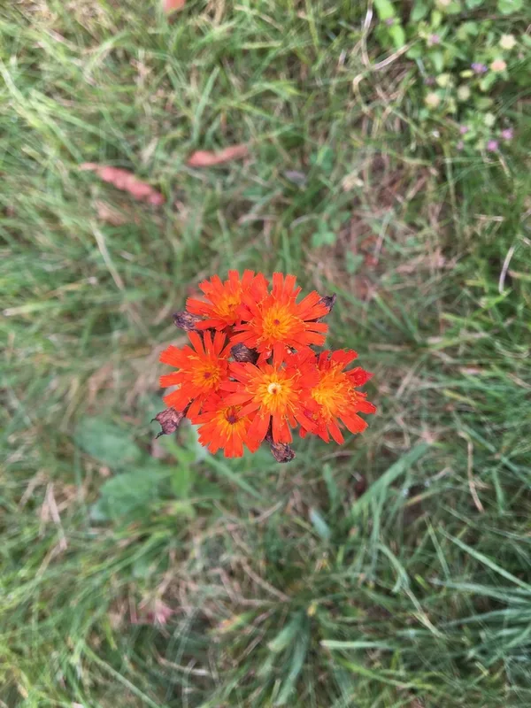
orange hawkweed Pilosella aurantiaca -
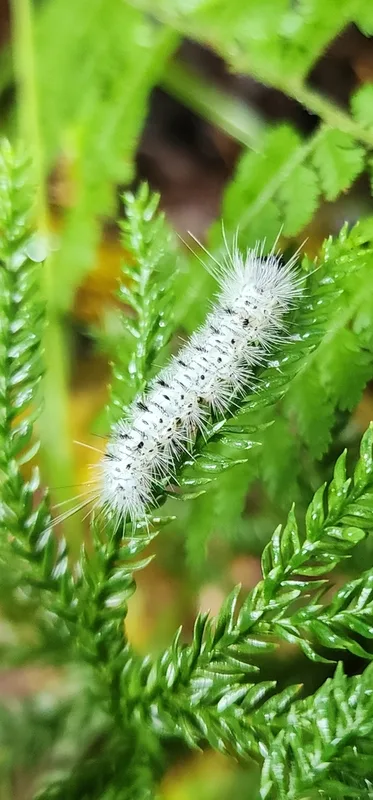
Hickory Tussock Moth Lophocampa caryae -
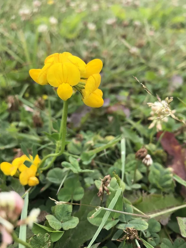
bird's-foot trefoil Lotus corniculatus -
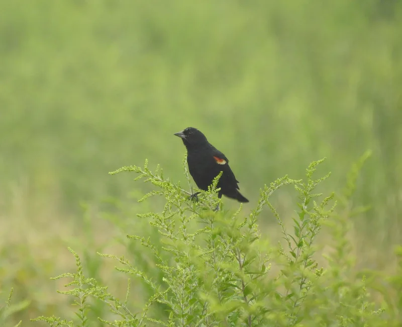
Red-winged Blackbird Agelaius phoeniceus -
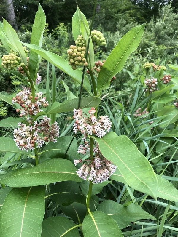
common milkweed Asclepias syriaca -
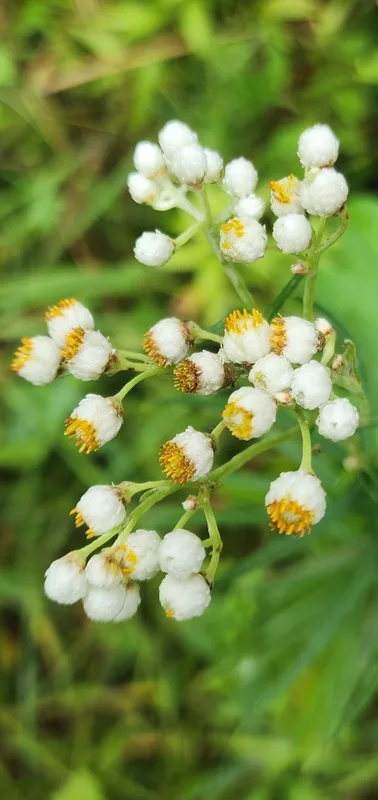
pearly everlasting Anaphalis margaritacea -
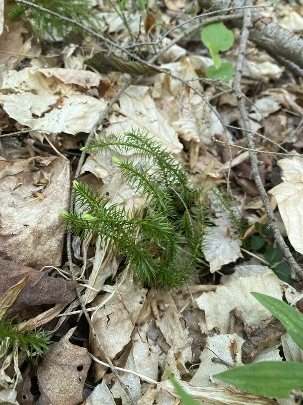
interrupted clubmoss Spinulum annotinum -
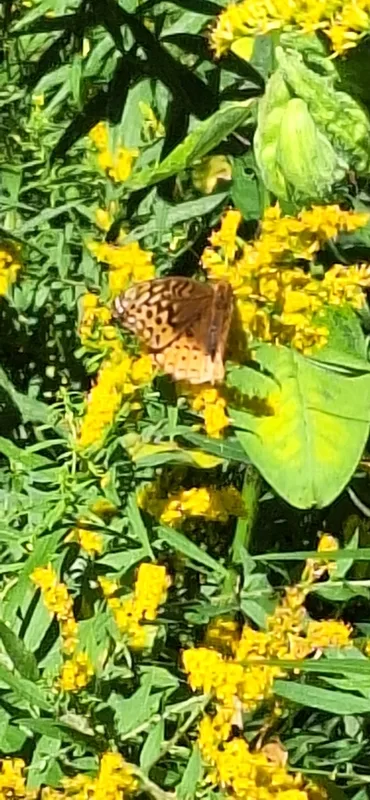
Great Spangled Fritillary Argynnis cybele -
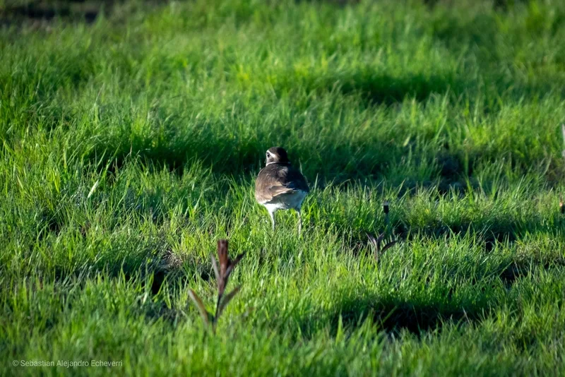
Killdeer Charadrius vociferus -
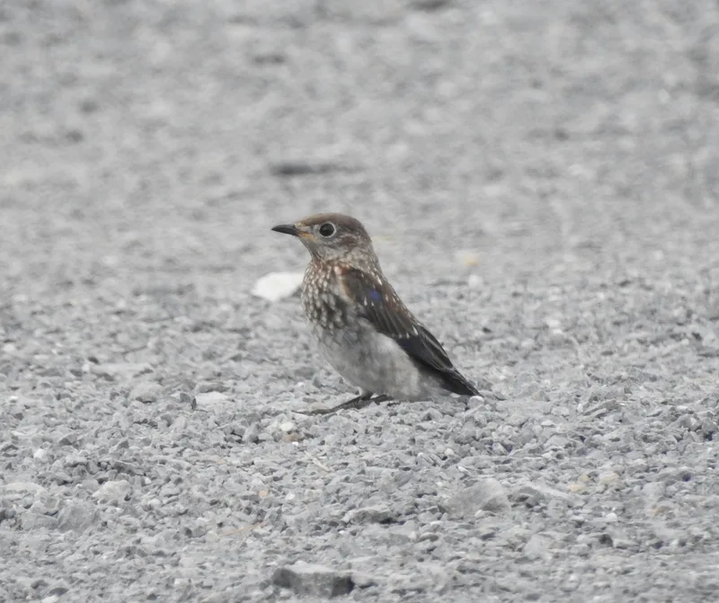
Eastern Bluebird Sialia sialis -
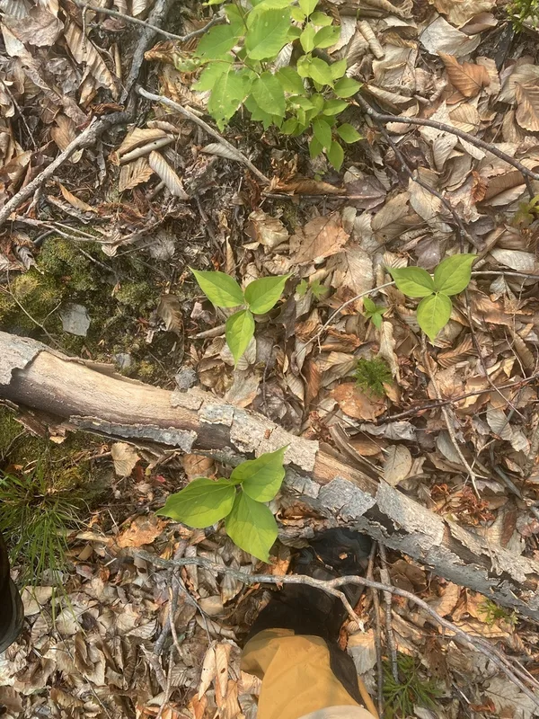
painted trillium Trillium undulatum -
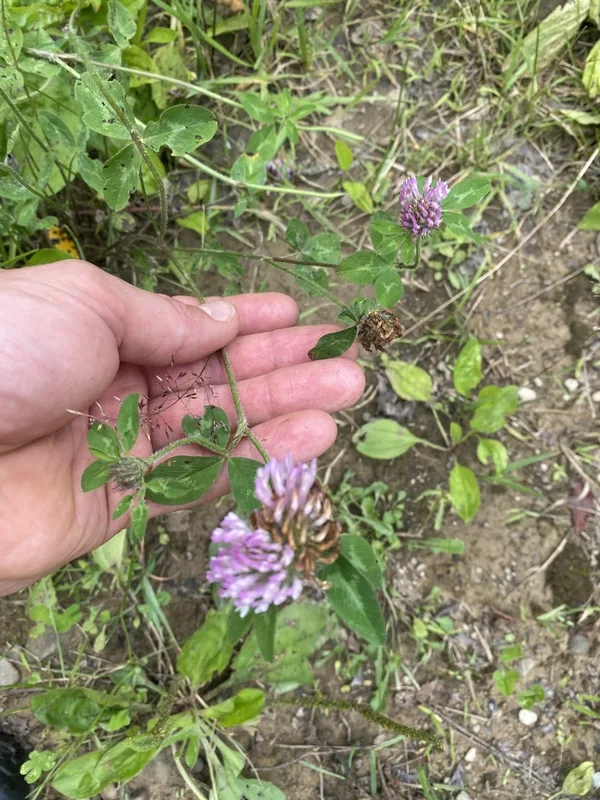
Red Clover Trifolium pratense
Field Notes · Night Sky lens · Cherry Springs State Park · 41.6507, −77.8390