Chapada Diamantina
Chapada Diamantina · Bahia, Brazil
Somewhere below every one of these summits is the flat, unbroken country they used to belong to.
Why here
Stand on almost any high point in Chapada Diamantina and the land around you breaks into islands. Flat-topped mountains rise alone above valleys and grasslands, each one close to the exact height of its distant neighbors, though nothing connects them anymore. That matching height is the whole story: this was once one continuous sheet of ancient river sand, hardened into rock and lifted skyward, and then rivers went to work again, cutting down through it for a very long time. Where the rock held, a summit remains standing. Everywhere else, water carried the stone away grain by grain until only open, low country was left. The mesas, the sheer-walled morros, and the canyons between them are all the same argument playing out at different speeds - water against rock, over and over, with water winning almost everywhere except the handful of places built to resist it a little longer. Every site below is one of those places, or a seat with a clear view of the argument still in progress.
The story
The oldest rock here is crystalline basement, folded and hardened long before there was anything alive to notice. On top of that basement, ancient rivers laid down thick beds of sand, later cemented into the sandstone that caps most of the high ground today. That cap was lifted, and rivers immediately began cutting back into it - a process that has not stopped since, only slowed and sped up with the climate.
Life took hold in the cracks that erosion left behind. Thin soil and bare rock became a specialty rather than a hardship: cushion cacti wedge into stone joints, bromeliads root in gaps barely wider than a shoe, and the Hooded Visorbearer, a hummingbird at home in exactly this kind of high, rocky ground, feeds on flowers that ask for almost no soil at all. Marmosets keep to the gallery forest that follows the water lines through otherwise dry country.
People followed the rivers too, for a different reason. Long before any mining began, this land belonged to peoples including the Kariri, whose own name is thought to mean quiet or reserved. Later arrivals panned the same river gravels for gold and diamonds - stone the rivers had already spent ages freeing from the rock upstream and carrying downhill. One nearby town still carries the nickname City of Gold from that era. The rivers did the concentrating; people simply followed them to collect what was left behind.
The sites
Where the tableland breaks open
Morro do Pai Inácio
−12.4594, −41.4715
Of all the isolated summits in Chapada Diamantina, this flat-topped mountain is the one most people come to see, and it earns the attention because it makes the whole argument visible at once. Stand at the edge and look out: other tabletop summits sit scattered across the valley at nearly the same height as the ground you’re standing on. That is not a coincidence. All of it was once one continuous plateau, capped by the same resistant sandstone. Where a fault line or a river found a weakness, it cut a valley; everywhere the cap held, a summit like this one was left standing above the new low ground. The mountain isn’t a monument that was built up - it’s what remains after everything around it was carried away. Give it time on a clear afternoon and the geometry starts to make sense: the flat tops line up like the deck of a table sawn into separate islands. It rewards patience more than height, since the story here is legible in outline and elevation rather than in any single dramatic feature.
From the flat summit, sight along the tops of the distant mountains on the horizon. Where they line up level with each other, you’re looking at pieces of one former plateau; the low ground between them is simply what water has removed since.
- AccessShort walk
- ExertionModerate
- TimeAn hour
Mirante do Pati
−12.7816, −41.4785
This overlook faces into one of the deeper valleys cut through the plateau, and it rewards a slower kind of looking than a summit does. Instead of scanning the horizon for matching heights, look down: the valley floor carries a darker, denser line of vegetation tracing exactly where water still gathers, even in drier months, while the slopes above stay pale and open. That contrast is the valley’s whole personality. Rivers did not just carve this cut long ago and leave; they still run through it, still support a strip of gallery forest that would not survive on the exposed rock ten steps away. Reaching this vantage takes real effort, following trail through remote high country rather than a road to an edge, which is part of why the valley below still feels less worked over than country closer in. Come with time rather than a schedule. The valley does not resolve into one photograph; it opens slowly as the trail gains height, and the deepest parts of the cut stay hidden until you are nearly on top of them.
Trace the darker band of trees along the valley floor with your eye from one end of the view to the other; it marks the route of the water below, still doing the work that carved the valley in the first place.
- AccessHalf-day hike
- ExertionStrenuous
- TimeHalf a day
Sossego
−12.5940, −41.4153
Sossego means calm, and this viewpoint is a good place to test whether the name is deserved: less visited than the plateau’s best-known overlooks, it gives an unhurried view across canyon walls rather than one dramatic foreground feature. What rewards attention here is the rock itself. Look at the cliff faces opposite and you can pick out horizontal bands, each a slightly different shade and texture, running level across the whole scarp. Those bands are old layers of sediment, laid down one on top of the last long before any of this was lifted into mountains, and erosion has since sliced through all of them at once, exposing the sequence like the pages of a closed book seen from the edge. Nothing here moves quickly enough to watch happen, which is exactly the point: the view holds still long enough to actually read the rock, layer by layer, rather than simply take it in. Bring more time than you think you need and let your eyes adjust to the pattern before moving on to a busier overlook.
Follow one colored band across the cliff face opposite you until it disappears around a corner or fold. Each band is one layer of old sediment, and following it teaches you to read the rock as a sequence rather than a single wall.
- AccessShort walk
- ExertionEasy
- TimeAn hour
Mirante da Serra do Candombá
−12.6490, −41.4955
This overlook faces a mountain range rather than a single summit, and it is the best place on this list to count rather than admire. From here, separate ridgelines march off toward the horizon in a loose row, each one its own island of resistant rock, each one separated from its neighbors by a valley that water has already finished cutting. Counting them is not just an exercise - it is the fastest way to grasp how much of the original plateau is actually gone. Every gap between ridges is rock that used to be here and is not anymore, carried downhill grain by grain over a very long time. The serra itself is simply the surviving fraction, still standing because it happened to sit on ground the water found harder to remove. There is no single feature to focus on, no waterfall or cave mouth, which is why this stop rewards a slower visit than most: give the eye time to separate one ridge from the next, and the whole view starts to read less like scenery and more like a record of exactly how far erosion has gotten.
Count the separate ridgelines visible from the overlook, left to right. Each one is a surviving remnant of the same original plateau; the valleys between them are the record of everything erosion has already carried away.
- AccessShort walk
- ExertionEasy
- TimeAn hour
What outlasted the argument
Morrão
−12.5262, −41.4899
Morrão simply means big hill, an honest, unromantic name for a summit that stands apart from the main ridgelines nearby, rising alone above lower, more worn-down ground. Peaks like this one are the plainest evidence in the whole region for how erosion actually proceeds: not evenly, but unevenly, favoring whichever rock resists longest. Look at the slope profile as you climb. Where more resistant sandstone is exposed, the face tends to hold a steeper, more angular line; where softer mudrock shows through, the slope rounds off and slumps instead of holding a cliff. Morrão shows both in the same short climb, which makes it a useful teaching hill even without any interpretive sign to explain it. The summit itself offers a wide, uncluttered view precisely because so little else nearby reaches the same height anymore. Expect a real climb rather than a stroll, loose footing in places, and a summit worth the effort mostly for how clearly it demonstrates the region’s single organizing idea rather than for any one dramatic feature at the top.
As you climb, compare the slope angle where you’re walking to the slope a short distance away. Steeper, more angular ground marks harder rock; rounder, slumped ground marks softer rock giving way faster to the same erosion.
- AccessHalf-day hike
- ExertionStrenuous
- TimeHalf a day
Morro da Lapinha (Castelo)
−12.7766, −41.4475
Castelo, the local nickname, fits the moment you see the summit’s profile: sheer, squared-off walls that look built rather than worn, more like ramparts than a natural slope. The resemblance is not an accident of imagination. Resistant caprock like this tends to fail along vertical cracks rather than wearing down smoothly, so instead of a gentle round summit, the rock breaks off in blocks, leaving straight walls behind and a jumble of fallen stone at the base. Look down before you look up: the boulders scattered around the foot of the mountain are the evidence, block by block, of exactly how a wall like this retreats over time. It does not erode from the top down so much as collapse from the outside in, one crack and one block at a time, while the resistant summit above stays intact until its turn comes. Give yourself real time for the approach; the reward is less a single view than an unusually clear demonstration of how a fortress-shaped mountain is actually built by the opposite of construction.
At the base of the walls, look for large, roughly square blocks of stone lying apart from the cliff. Each one broke away along a vertical crack in the rock face above - the mountain’s slow way of losing ground one block at a time.
- AccessHalf-day hike
- ExertionStrenuous
- TimeHalf a day
Morro do Manoel Vítor
−12.7111, −41.4641
This peak stands apart from the busier viewpoints nearby, closer to the valleys where water still concentrates than to the open plateau top, and it shows a different side of the same story: what actually manages to live on bare, eroded rock. The cracks and shallow pockets across its slopes hold just enough soil for plants that ask for almost nothing - cushion-shaped cacti wedged directly into stone joints, and bromeliads growing in loose rosettes wherever a little grit and rainwater collect. None of it depends on deep ground; all of it depends on the rock having been broken down just enough to trap a handful of soil, and no more. That is erosion’s other job here: not only carving canyons and leaving summits standing, but grinding just enough material to give plant life somewhere to hold on. Come slowly and look close rather than wide. The view from partway up is honestly more interesting than the summit itself, since it puts you at eye level with the rock crevices doing the actual work of hosting life on a mountain that offers almost no soil anywhere else.
Look closely at any crack or shallow pocket in the rock face nearby. If it holds a cactus or a rosette of stiff leaves, it also holds a small patch of soil - the only kind of ground this mountain has to offer.
- AccessHalf-day hike
- ExertionModerate
- TimeHalf a day
When it's best
Rain here follows a fairly plain rhythm: fuller months arrive roughly from late in the year through the early months of the next, drier the rest of the way, with water in the rivers and waterfalls easing off as the dry stretch wears on. Time a visit toward the wetter half of that cycle to see the canyons and valleys with more water actually moving through them, or toward the drier half for easier walking on trail and rock that stays firmer underfoot. Neither season empties out the argument between water and stone, since the summits and canyon walls that took ages to shape are just as legible wet or dry. If one thing here rewards no particular season, it is the rock itself - read correctly, it tells the same long story whichever month you show up.
Go deeper
The names behind what you saw: the resistant caprock that holds up most of these summits is mapped as the Tombador Formation - a Mesoproterozoic sandstone, mudrock, and conglomeratic mudstone unit, laid down and hardened somewhere in the neighborhood of a billion and a half years ago. Beneath it sits an older crystalline metamorphic basement of similar antiquity, the foundation the sandstone was later deposited onto and lifted along with. The hummingbird working flowers on exposed rock is the Hooded Visorbearer (Augastes lumachella); the lizard sunning on bare stone is the Striped Lava Lizard (Tropidurus semitaeniatus); the small primate in gallery forest along the water lines is the Black-tufted-ear Marmoset (Callithrix penicillata). The cactus wedged into rock cracks on these peaks is Micranthocereus purpureus, and the rosetted bromeliad doing the same is Aechmea bromeliifolia.
To read next: - Chapada Diamantina National Park (Wikipedia) - for the caatinga terrain and rugged relief that frames every viewpoint on this list. - Gruna da Parede Vermelha (Wikipedia) - a cave within the park’s Sincura mountain range, formed in the Proterozoic, a reminder that the same ancient rock hosts hollows as well as canyons. - Jacobina (Wikipedia) - the nearby town nicknamed City of Gold, for the plainest account of how people followed these rivers to what they carried downhill. - Kariri people (Wikipedia) - background on one of the peoples with the longest history on this land, well before any mining began. - Geological heritage and geodiversity of the historic mines of Chapada Diamantina, in the context of the proposal of the Morro do Chapéu geopark, Bahia (OpenAlex, 2021) - the formal geological case for reading this landscape’s mining history as part of its deeper structure, for readers who want the technical version.
The names behind what you saw
What lives here, and what it's called. Photographs from open collections — an aid to identification, not decoration.
-
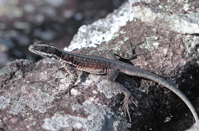
Striped Lava Lizard Tropidurus semitaeniatus -
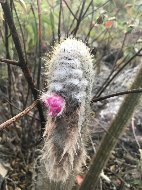
Micranthocereus purpureus -
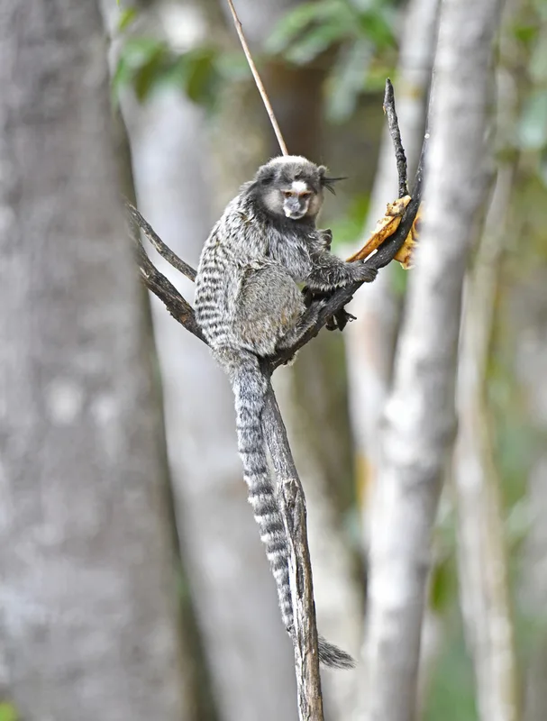
Black-tufted-ear Marmoset Callithrix penicillata -

Hooded Visorbearer Augastes lumachella -
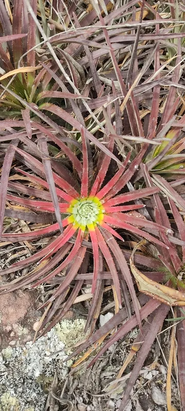
Sincoraea albopicta -
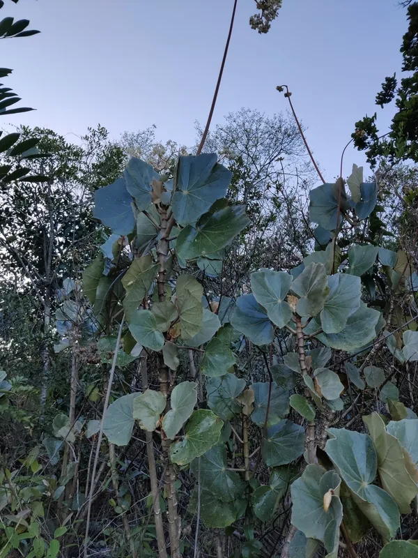
Begonia grisea -
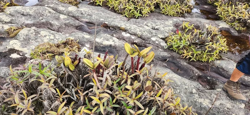
Cattleya elongata -
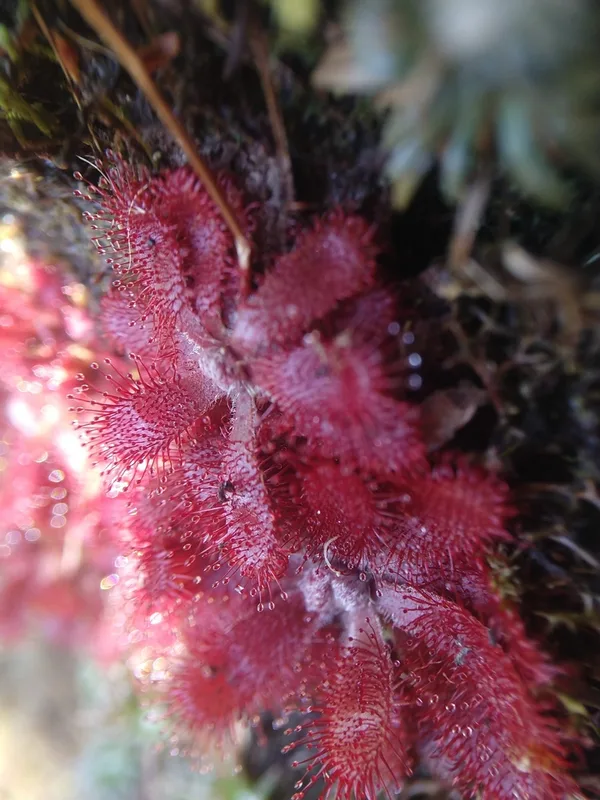
Drosera tomentosa -
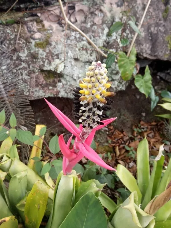
Aechmea bromeliifolia -
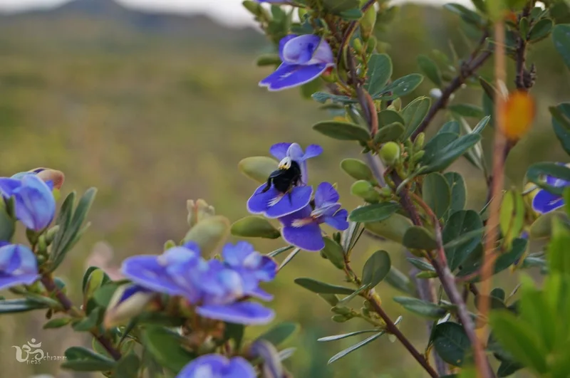
Periandra mediterranea -
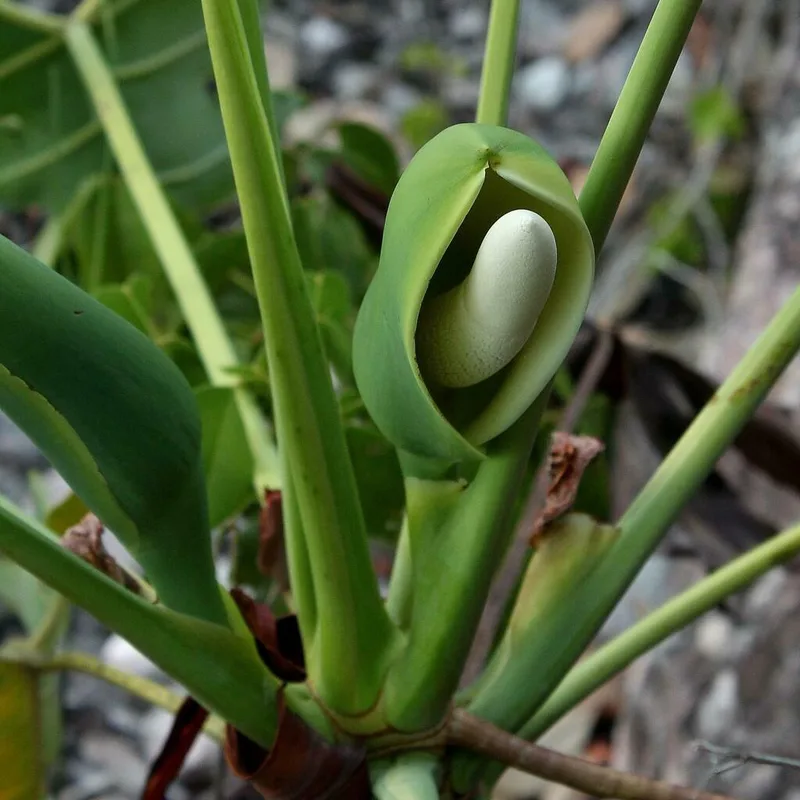
Thaumatophyllum saxicola -
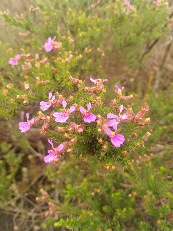
Cuphea ericoides
Field Notes · Rivers & Canyons lens · Chapada Diamantina · −12.8841, −41.3983