Chamonix
Chamonix-Mont-Blanc · Haute-Savoie, France
The valley is the shape the ice left for people to enter.
Why here
Chamonix is a valley with a glacier’s handwriting still visible in every direction. High peaks crowd the horizon, ice occupies the upper folds, and the low route between them is broad enough to carry a town, a river, and a long human history. The bedrock is older than the ice, but the valley’s present scale belongs to glacial movement. Look from the floor upward and then down the valley. The mountains are not a wall around the town; they are the sources of the rock, snow, and water that keep the valley alive. These stops follow the connection from high ice to lower ground.
The sites
The valley and its ice
Aiguille du Midi
45.8787, 6.8876
Aiguille du Midi lifts the valley’s glacial structure into a single view. Peaks rise around the high ice, while the valley floor lies far below as a long, usable corridor. From here, follow the direction of the lower ground and identify the routes where snow and water descend. The glacier is not a separate white object. It is the upper part of a system that ends in the valley’s river and soil.
Trace a snowfield downward until it meets darker rock and then the valley. The changing surface shows the route from ice to meltwater to living ground.
- AccessDrive-up
- ExertionEasy
- TimeAn hour
Mont Blanc / Monte Bianco
45.8327, 6.8652
Mont Blanc is the high reference point for the country around Chamonix. Its summit is the visible source of a much larger system of snow, rock, and water. Look at the peak as a beginning rather than a destination. The valley below exists in relationship to that height, receiving material and meltwater from the mountain and the glaciers around it. A clear view makes the connection immediate; cloud still leaves the lower contours available to read.
Find the highest visible snow and follow the slope down to the valley. The continuous line is the mountain’s connection to the lower landscape.
- AccessDrive-up
- ExertionEasy
- TimeAn hour
Rock above the valley
Aiguille Verte
45.9346, 6.9700
Aiguille Verte shows the sharp side of an ice-shaped landscape. Its rock rises above steep faces and snow, while the lower valleys are broader and softer. Ice can carve a wide route through lower ground and leave resistant peaks standing above it. The result is not a smooth mountain range but a collection of points and walls with a shared base. Stand back and look for both forms at once.
Compare the pointed summit with the broad valley below. The contrast shows resistant high rock beside ground widened and lowered by ice.
- AccessHalf-day hike
- ExertionStrenuous
- TimeA full day
Grandes Jorasses / Pointe Walker
45.8682, 6.9890
The Grandes Jorasses carry the eye along a complex high wall. Snow and rock divide the face into routes, while the valley below gathers what weather and ice release from above. Look for the smaller landscape inside the large one: gullies, ledges, and patches of alpine plants. Yellow-billed choughs cross the open air, making movement visible above a surface that appears still. The mountain is a structure, but the weather keeps working through it.
Watch the face for falling snow or moving cloud, then look at the ledges where plants can hold. High rock and small life share the same fractures.
- AccessDrive-up
- ExertionEasy
- TimeAn hour
Life at the snowline
Signal Forbes
45.9285, 6.9125
Signal Forbes is a place to look for life where the glacier’s influence is strongest. Snow, rock, and short growing seasons limit the ground, but alpine ibex use the steep terrain and alpenrose occupies sheltered patches. The plants and animals are not outside the glacial story. They are responding to the temperature, slope, and snowmelt that ice helps create. Stay with one patch of ground and notice how much the mountain’s large scale is made from small refuges.
Find a sheltered ledge below the snowline and look for low flowering plants. The ledge holds soil and warmth longer than the exposed face around it.
- AccessShort walk
- ExertionModerate
- TimeHalf a day
When it's best
Summer gives the most open access to high routes and alpine flowers, while early fall brings cooler air and clear mountain light. Winter changes the valley into a snow landscape and makes the high ice harder to approach. Cloud and wind can close a peak quickly in any season. Read the valley from below when the upper mountains disappear; the glacial shape remains.
Go deeper
The names behind what you saw. The geology includes Quaternary loose deposits and Paleozoic intrusive rocks. The high-country life includes yellow-billed chough, Pyrrhocorax graculus, alpine ibex, Capra ibex, and rusty-leaved alpenrose, Rhododendron ferrugineum.
To read next. - Chamonix’s geological material — for the valley, peaks, and glacier routes. - Alpine ecology resources — for animals and plants living at the edge of the ice.
The names behind what you saw
What lives here, and what it's called. Photographs from open collections — an aid to identification, not decoration.
-
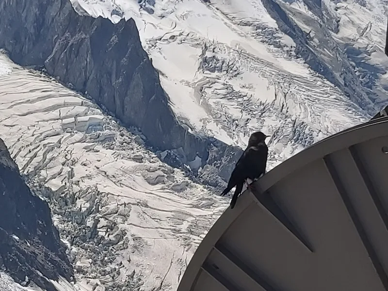
Yellow-billed Chough Pyrrhocorax graculus -
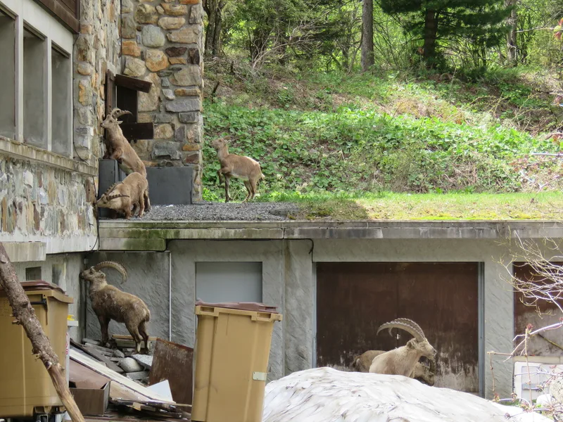
Alpine Ibex Capra ibex -
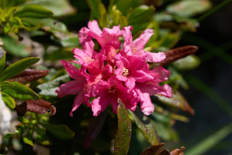
Rusty-leaved Alpenrose Rhododendron ferrugineum -
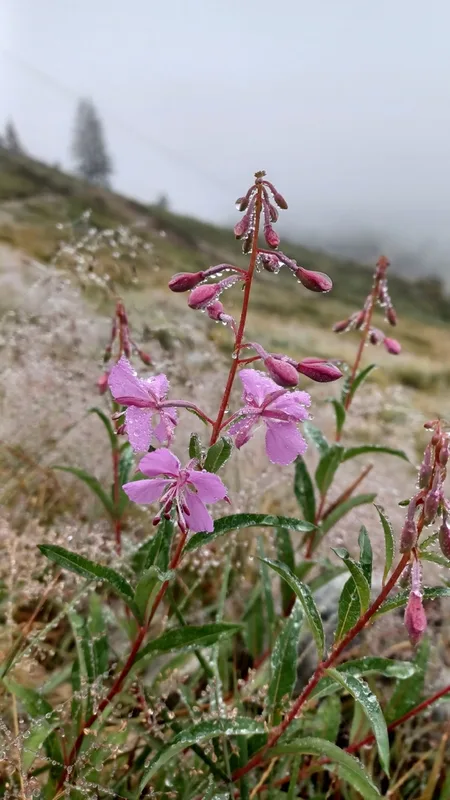
fireweed Chamaenerion angustifolium -
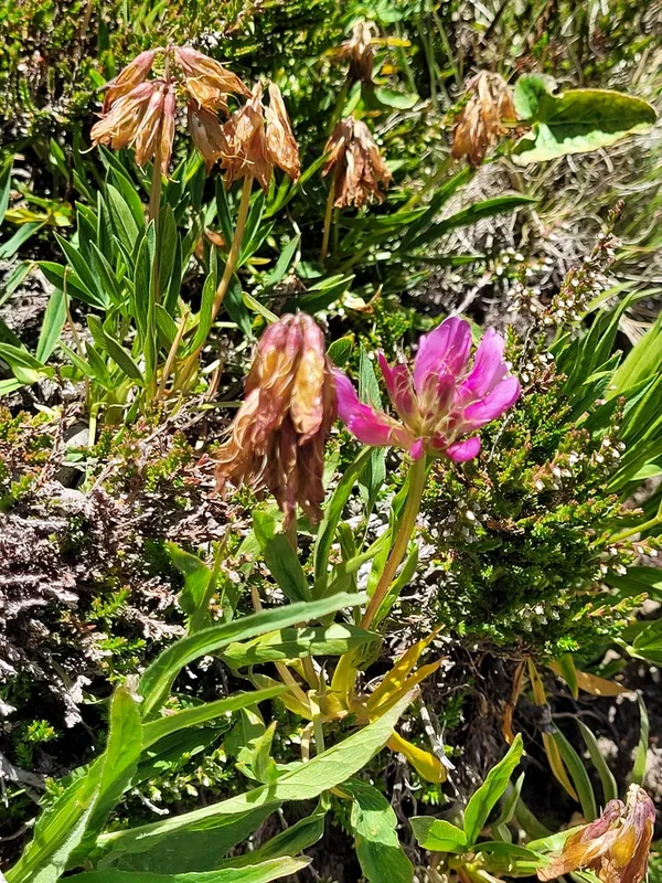
Alpine Clover Trifolium alpinum -
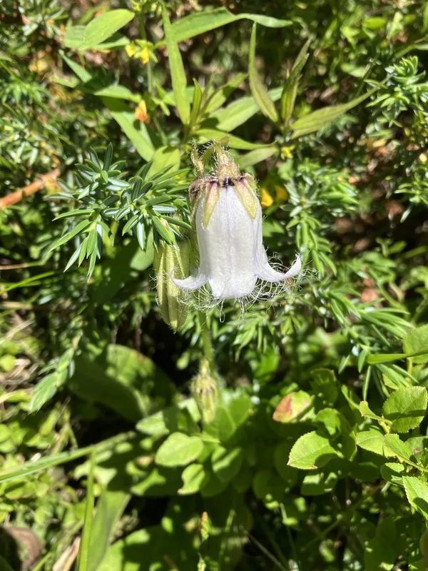
Bearded Bellflower Campanula barbata -
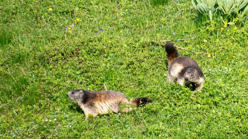
Alpine Marmot Marmota marmota -
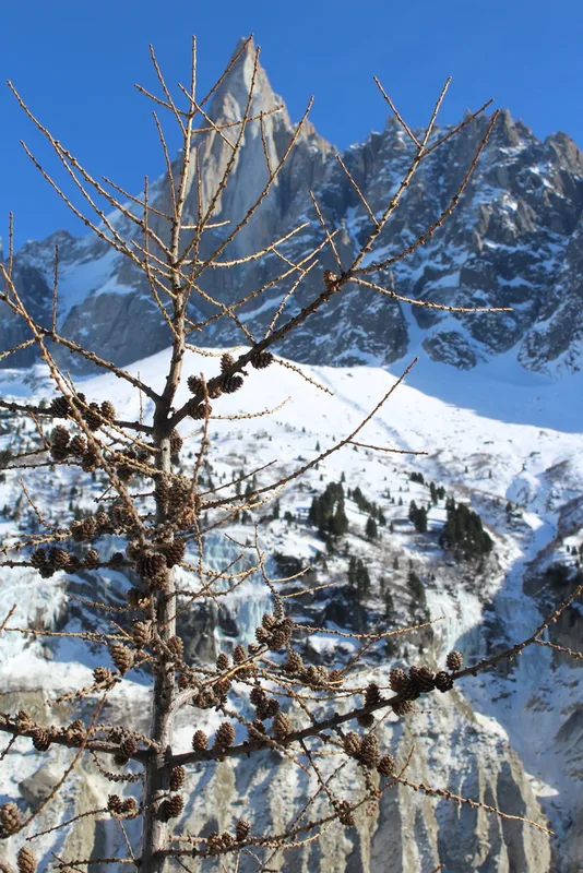
European larch Larix decidua -
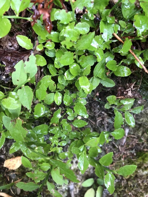
common bilberry Vaccinium myrtillus -
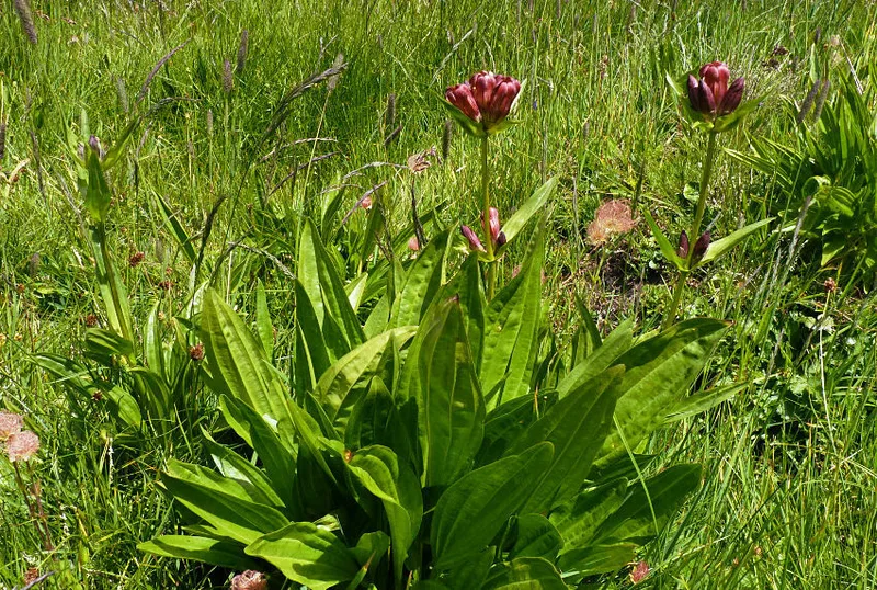
Purple Gentian Gentiana purpurea -
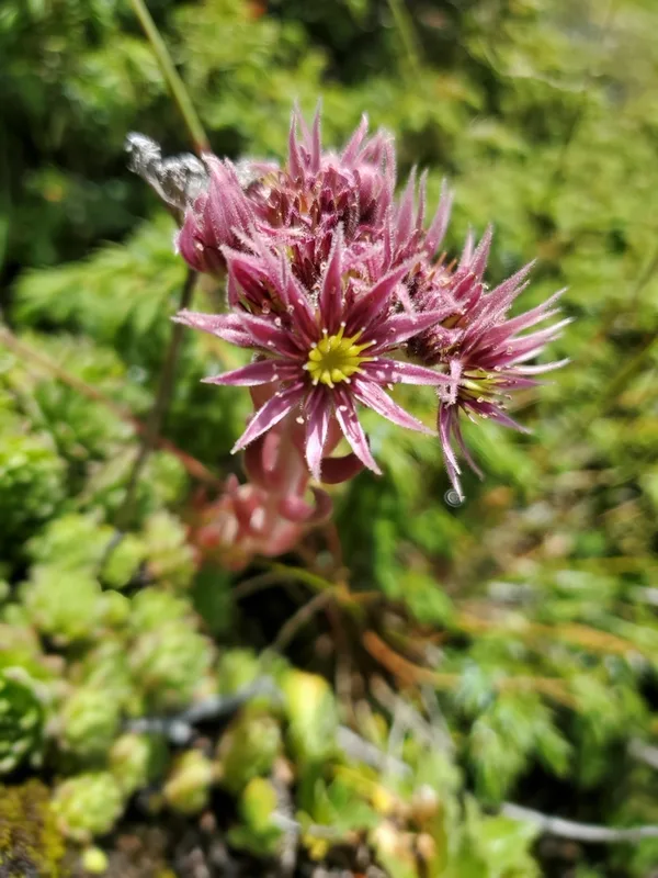
Mountain Houseleek Sempervivum montanum -
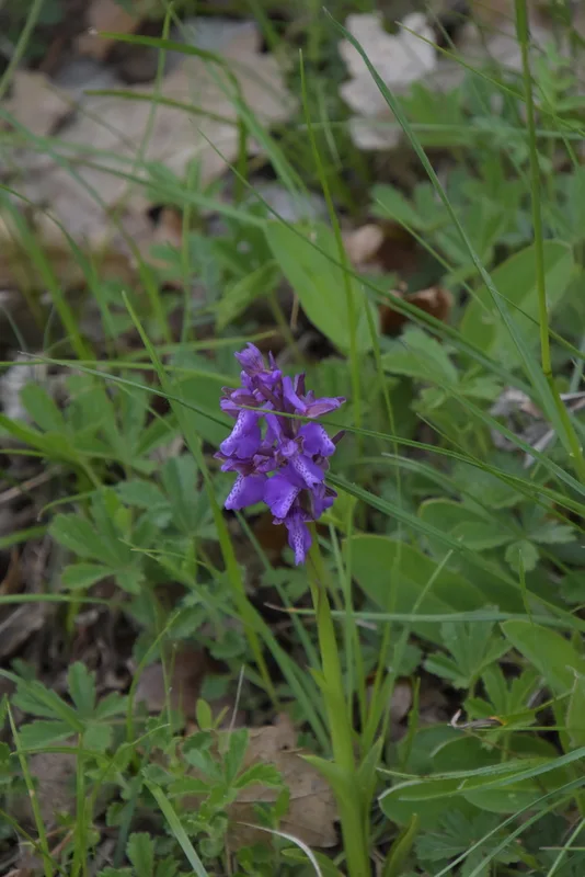
green-winged orchid Anacamptis morio
Field Notes · Ice & Glaciers lens · Chamonix-Mont-Blanc · 45.9231, 6.8700