Carlsbad Caverns
Carlsbad Caverns National Park · New Mexico, USA
The desert has a second landscape below it, built drop by drop in the dark.
Why here
Carlsbad Caverns turns the desert inside out. Above ground, sedimentary rock meets dry air, cactus, and open slope. Below it, water moves through cracks and leaves mineral forms behind in the dark. The cave is not separate from the desert. Rain enters the surface, travels downward, and slowly changes the rock below. That connection is the one idea to carry through the note. Look at the hills, then imagine their hidden drainage. The visible desert is the roof of another landscape, one that grows more slowly and keeps its own weather. Here deep time is not only in the fossil rock. It is in the shape of a drop after it has fallen thousands of times.
The sites
The desert above
The Pinnacle
32.1926, −104.6322
The Pinnacle is a surface view of the rock that hides the cave below. Sedimentary layers hold the desert’s slopes, and water can enter through cracks even when the ground looks dry. Look for the difference between exposed wall and lower wash. The surface tells you where rain can collect, where it can disappear, and how the underground landscape begins above your head.
Find a crack or shallow drainage in the rock and trace it downhill. Water entering such openings is the first step in the cave’s long underground work.
- AccessShort walk
- ExertionEasy
- TimeAn hour
Walnut Canyon
32.1831, −104.4339
Walnut Canyon carries water through the desert in a more visible way. A canyon concentrates runoff, soil, and shade, making a greener line through dry country. Below the surface, some of the same water continues through limestone cracks. The canyon is therefore both a surface habitat and a clue to the cave system beneath it. Stand at the edge and look for the route water follows after a storm.
Compare the canyon floor with the dry slope beside it. Water collects in the floor, making a corridor where plants and animals can use shade and moisture.
- AccessShort walk
- ExertionModerate
- TimeHalf a day
Life over the dark
C P Hill
32.0710, −104.4166
C P Hill keeps the desert plants in the foreground. Ocotillo and Texas mountain laurel occupy the surface above the hidden cave, showing that the underground landscape begins with roots, dust, and rain. Look closely at the ground around each plant. A desert plant changes the soil and shade beneath it, just as a cave changes the rock below. Both are small environments inside a larger dry country.
Find an ocotillo beside a patch of bare ground and compare the shade beneath it. The plant changes the surface conditions that water and small animals can use.
- AccessShort walk
- ExertionEasy
- TimeAn hour
Dinner Hill
32.1434, −104.6541
Dinner Hill gives a wide desert view over limestone country. From above, washes and slopes show the routes where water enters the ground, while the cave below remains hidden. That hiddenness is part of the lesson. A landscape can be active without being visible at the surface. Look for the places where rock, soil, and vegetation make water more likely to pause before it goes down.
Trace a drainage toward a lower crack or hollow. The point where surface water slows is where more can enter the rock below.
- AccessShort walk
- ExertionEasy
- TimeAn hour
The long work of water
Thayer Hill
32.1946, −104.6358
Thayer Hill is a place to hold the surface and underground stories together. The dry slope looks still, but every rain can send a little water through the sedimentary rock. Below, that water leaves deposits and changes passages by degrees. Above, ocotillo and other plants take advantage of the same brief moisture. The cave is the desert’s hidden record of water that the surface only sees in passing.
Look for a small hollow where rain can gather. Imagine the same water continuing through a crack after the surface has dried again.
- AccessShort walk
- ExertionEasy
- TimeAn hour
When it's best
The desert surface is easiest to explore in cooler seasons, while the cave remains a refuge from heat year-round. Rain can change the surface trails and the water entering the cave. Spring and fall offer comfortable walks above ground, while the underground formations are readable in every season. Give your eyes time to adjust when moving between bright desert and dark cave.
Go deeper
The names behind what you saw. The surrounding rock includes Paleozoic sedimentary rocks. Ocotillo, Fouquieria splendens, and Texas mountain laurel, Dermatophyllum secundiflorum, occupy the desert above the cave.
To read next. - Carlsbad Caverns’ geology material — for limestone, groundwater, and cave formation. - The park’s cave ecology material — for life adapted to darkness and the desert surface above it.
The names behind what you saw
What lives here, and what it's called. Photographs from open collections — an aid to identification, not decoration.
-
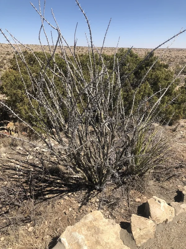
ocotillo Fouquieria splendens -
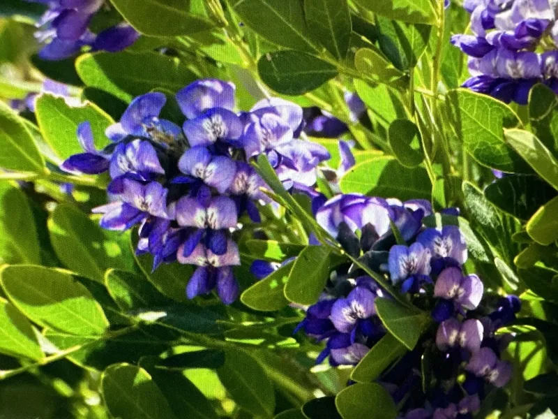
Texas mountain laurel Dermatophyllum secundiflorum -
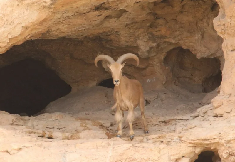
Aoudad Ammotragus lervia -
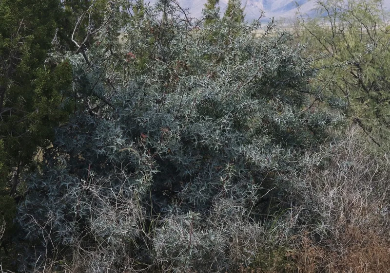
Agarita Berberis trifoliolata -
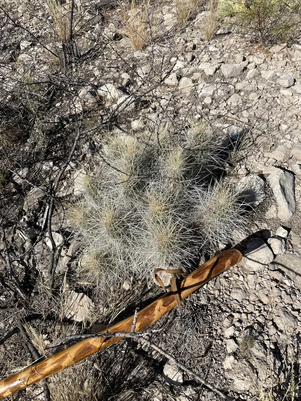
strawberry hedgehog cactus Echinocereus stramineus -
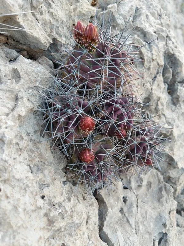
scarlet hedgehog cactus Echinocereus coccineus -
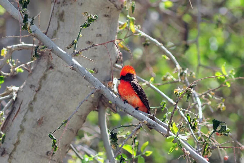
Vermilion Flycatcher Pyrocephalus rubinus -
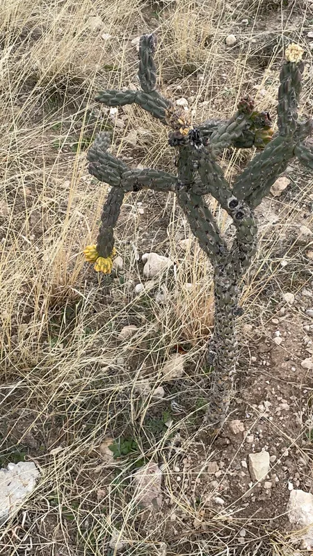
tree cholla Cylindropuntia imbricata -
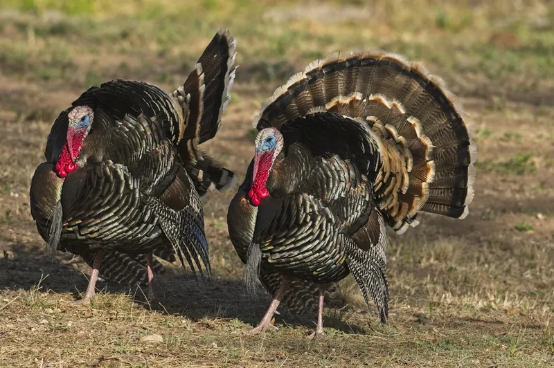
Wild Turkey Meleagris gallopavo -
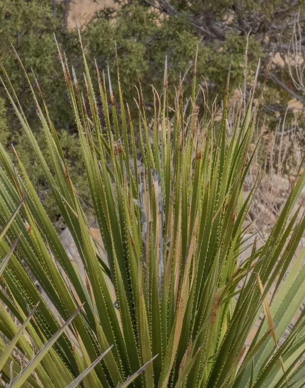
Smooth Sotol Dasylirion leiophyllum -
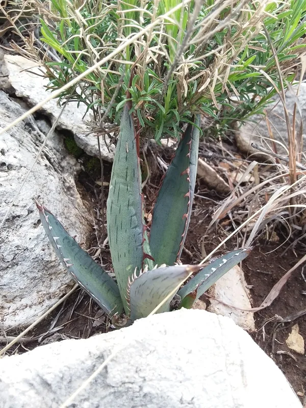
lechuguilla Agave lechuguilla -
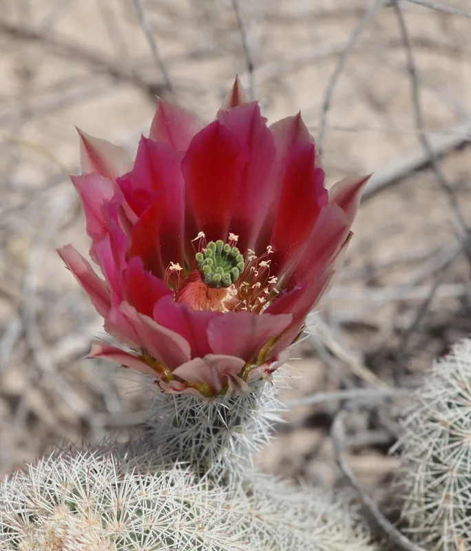
Texas rainbow cactus Echinocereus dasyacanthus
Field Notes · Desert & Deep Time lens · Carlsbad Caverns National Park · 32.1212, −104.6012