Cappadocia
The mountain went off once; the wind has been finishing the sentence ever since.
Why here
Cappadocia looks like a landscape assembled by hand, but no one built it. Roughly two and a half million years ago, the volcano now called Erciyes buried a stretch of central Turkey under ash and lava. That blanket cooled into a rock soft enough to scratch with a fingernail in places — and wind and rain went to work on it immediately, and never really stopped. Where a harder cap of rock happened to sit on top, the softer stone beneath it survived a little longer than its neighbors, and the result is the region’s whole vocabulary of cones, fins, and hollowed towers: not sculpture, but geometry worked out by erosion one storm at a time. People noticed how easily the rock gave way long before anyone could explain why, and carved into it for centuries — houses, churches, whole underground towns. This note follows that one idea through the landscape: a soft, breakable rock, still being written on, that happened to be easy to live inside. Everything else about Cappadocia follows from it.
The story
The story starts with Erciyes, off to the east, erupting with enough force to bury a stretch of the country under ash and lava roughly two and a half million years ago. What it left behind was soft enough that wind, snow-melt, and the occasional hard rain could shape it in a human lifetime rather than a geological one — cutting valleys, leaving isolated columns standing wherever a harder cap protected the rock beneath, and steadily lowering everything else around them. That instability hasn’t stopped: in Çavuşin, homes on the old rock ridge were abandoned in the early 1960s over fears the ground beneath them would give way.
The bare rock became habitat almost as fast as it became scenery. Several kinds of rock-basking lizard use the sun-warmed faces to hunt and thermoregulate, the way lizards do on exposed stone everywhere, and a rock-loving nuthatch works crevices most birds ignore, wedging food into cracks most animals can’t reach.
Then came people, who found rock this soft nearly as easy to remove as to look at. Byzantine-era communities cut churches, storerooms, and whole houses directly into hillsides and standing towers, decorating some interiors with frescoes that have survived far better than exposed stone would have. Later communities kept building the same way, for the same reason: the rock was there, and it gave easily. Little of that first chapter is written down — the rock did the recording instead, and it’s still legible.
The sites
Rock the mountain buried
Ortahisar Kalesi
38.6198, 34.8644
Ortahisar sits near the center of the region, and its rock castle is the clearest single lesson in why this landscape looks the way it does. The outcrop is a survivor: harder rock at its crown protected the softer stone beneath from the wind and rain that stripped away everything around it, leaving this tower standing well above the surrounding town while the ground level dropped elsewhere over a long stretch of time. People later took advantage of what erosion had already done, cutting rooms, passages, and storage chambers straight into the rock face, following the same soft material the weather had been working on. From its base, or partway up, the castle reads almost like a diagram: natural weathering on the upper faces, straight-edged human cuts lower down, and centuries of both layered on top of each other. Because of its central position, it has also functioned for a long time as a lookout — a place from which most of the region’s other valleys and rock formations are visible at once, which is as much a comment on erosion at landscape scale as any single outcrop can offer.
Stand at the base and look for the boundary between rough, weather-pitted rock and smoother, straight-edged surfaces higher up — the first is what wind and rain left, the second is where someone later cut a doorway or room into it.
- AccessDrive-up
- ExertionModerate
- TimeAn hour
Uçhisar kalesi
38.6305, 34.8054
Uçhisar’s outcrop rises abruptly over the valleys around it, a broad cone of the same soft volcanic rock found across the park, left standing while erosion lowered the surrounding land. Look closely at its face and you’ll find it pocked with openings at every level — some natural hollows where softer pockets of rock wore away faster than the stone around them, others clearly cut with straight edges and right angles by hand. The two are easy to tell apart once you know to look: nature’s holes are irregular and rounded, people’s are square. From height, the outcrop works as an observation platform for the wider landscape — from up here you can trace several valleys radiating outward, each one a slightly different stage of the same slow process of softening, cracking, and washing away that shaped the castle underfoot. It is a useful stop early in a visit precisely because it puts the whole mechanism in view at once, before smaller sites make the same point in more specific, closer detail.
From the top, pick out two or three valleys radiating away from the outcrop and compare how deep each one has cut — the differences are a rough map of where water has had the easiest path through the rock.
- AccessDrive-up
- ExertionModerate
- TimeAn hour
Valleys still being cut
Meskendir Valley Viewpoint
38.6398, 34.8562
This viewpoint looks down into a valley still visibly being cut. The walls are fluted rather than smooth — long, vertical grooves and ridges running from rim to floor, the signature of water finding the same easy channels down through soft rock again and again until each channel deepens into its own groove. Between the grooves stand thin ridges and the occasional isolated spire, rock that happened to sit slightly harder or slightly more sheltered and so eroded more slowly than its neighbors. None of this is finished. A hard rain here does visible work in an afternoon that would take other landscapes centuries, because the rock is that easy to move once water gets a start on it. The valley floor is low, flat, and covered in loose debris washed down from the walls — the material this whole landscape sheds continuously, moving downhill in small amounts most years and larger amounts after storms. Looking at Meskendir is less like looking at a finished monument and more like watching a sentence being written partway through.
Trace one vertical groove from the rim down to the valley floor with your eye — that single channel is water’s chosen route down through the rock, worn a little deeper every time it rains hard.
- AccessShort walk
- ExertionEasy
- TimeAn hour
Rose valley viewpoint
38.6536, 34.8590
From here the valley’s walls show their layering plainly — bands of rock stacked one on another, each laid down in a separate event long before erosion carved down through all of them at once to expose the sequence. The layers often weather to different colors and textures as they’re exposed, some paler and chalky, others with a warmer, rust-toned cast, which is part of what gives this valley its name and its reputation as one of the more photogenic vantage points in the park. The color is a byproduct of the same process working on rock of slightly different composition and hardness, not a separate phenomenon — it’s the erosion story from other viewpoints, restated in a way that’s easier to see from a distance. Morning and evening light, low and angled, brings out the banding more clearly than the flat light of midday, when the layers can look like a single undifferentiated slope. Give the view a few unhurried minutes rather than a glance — the layering rewards it, and most of what makes this a distinctive stop is subtle rather than obvious.
Look for horizontal banding across the valley walls — distinct bands of lighter and darker, warmer and cooler rock stacked like a layer cake — and notice how the color shifts track the layering rather than running at random.
- AccessShort walk
- ExertionEasy
- TimeAn hour
Kılıçlar Vadisi
38.6405, 34.8467
Kılıçlar means swords in Turkish, and the valley earns the name with narrow, blade-thin ridges of rock separated by deep, tight clefts — a different erosional outcome than the broad, rounded shapes found elsewhere in the park, though it comes from the same basic ingredients: soft volcanic rock, uneven hardness from point to point, and a long enough stretch of time for water to find every weakness. Where the rock happened to be more uniform, differential erosion favors fins and blades rather than isolated cones; the same rules that build a fairy chimney a short walk away here build something closer to a rock comb. This information point marks the edge of the historical park’s rock-cut landscape and sits close to some of its best-known carved churches, making it a natural point to pause and read the ground itself before or after visiting the human-made sites nearby. The valley continues beyond the marker, narrowing further in places, and it’s worth a slow look along its length rather than a single glance from the entrance.
Compare the width of a rock fin to the depth of the crack beside it — where fins run thin and cracks run deep, water has clearly found and followed a weakness in the stone for a long time.
- AccessShort walk
- ExertionModerate
- TimeAn hour
The long view
Aktepe hill. Sunset point
38.6533, 34.8632
This hilltop gives one of the widest single views over the park’s landscape, and it’s worth using that width deliberately: rather than picking out one formation, let your eye run the whole horizon and notice how much of it sits at roughly the same elevation. That rough uniformity is a clue. The plateau here was, in a broad sense, once a single continuous surface — the ash and lava sheet that covered this stretch of country after it settled and hardened. Everything you see below that skyline, all the valleys, cones, and towers, is material that has already been removed from what was once a more even surface. The valley floors mark how far down erosion has already cut; the high points mark what has managed to resist it so far. Seen this way, the whole park — nearly a hundred square kilometers of it — reads as a single work still in progress rather than a set of separate landmarks. Late in the day, low light exaggerates the height differences and makes the shapes easier to read, which is presumably why this became a known point for watching the sun go down over it.
Run your eye along the horizon and note how many high points sit at close to the same level — that near-common skyline is roughly where the ground surface once stood, before erosion cut the valleys below it.
- AccessDrive-up
- ExertionEasy
- TimeAn hour
Karadağ Tepesi
38.6949, 34.7968
Karadağ sits toward the edge of the park, and the climb up gives a longer, wider view back across the basin than the more central viewpoints allow — useful for seeing where the heavily eroded, pale, bare-rock terrain gives way to gentler, more vegetated slopes at the park’s margins. That boundary isn’t incidental: it roughly tracks where the softest, most erodible rock is exposed versus where older or harder ground holds a covering of soil. From up here the pattern is legible in a way it isn’t from inside any single valley — the eroded core of the park sits lower and paler, ringed by higher ground that has resisted the same processes for longer, or was simply spared the thickest ash cover to begin with. It’s a longer, quieter walk than the park’s more central viewpoints, and it earns that effort mostly through perspective rather than through any single dramatic feature at the top — a chance to see the whole shape of the landscape’s still-unfinished excavation at once, from outside its most intensively carved center.
From the summit, look for the line where pale, bare rock terrain gives way to greener, soil-covered slopes, and notice that the boundary is uneven rather than a clean ring — a rough map of where the softest rock has been exposed.
- AccessHalf-day hike
- ExertionStrenuous
- TimeHalf a day
When it's best
Cappadocia sits high and dry, with a continental climate that swings hard between seasons — hot, sun-baked summers and winters cold enough to freeze overnight even when the days are mild. That swing isn’t incidental to the landscape: repeated freezing and thawing is part of what keeps working at the soft rock, prying cracks open a little further each year. Spring and autumn bring milder days and a decent chance of clear skies for reading the valleys without summer’s heat-haze or winter’s occasional snow closing trails, and either shoulder season rewards a trip built around it. The rock itself keeps no calendar. It’s worth seeing in any season, and each one shows a slightly different mood of the same slow process.
Go deeper
The names behind what you saw
The rock underfoot is mapped here, at the formal level, simply as Cenozoic sedimentary and volcanic rocks lying over an older Palaeocene layer — plain geologic map units rather than one storied formation name. The informal term geologists use for hardened volcanic ash of this kind is tuff; it’s the material behind every carved room and standing cone in the park.
Species worth knowing by their full names: Snake-eyed Lizard (Ophisops elegans), Roughtail Rock Agama (Laudakia stellio), and Anatolian Lizard (Apathya cappadocica — the species name literally means “of Cappadocia”), all rock-basking lizards recorded across the park; Western Rock Nuthatch (Sitta neumayer), a cliff-nesting bird; and Long-legged Buzzard (Buteo rufinus), one of the raptors that hunts over this open, rocky terrain.
To read next
- Churches of Göreme (Wikipedia) — the clearest short account of the eruption that buried this region in ash and how erosion turned it into fairy chimneys.
- Göreme Historical National Park (Wikipedia) — the park’s UNESCO citation, boundaries, and rough scale.
- Çavuşin (Wikipedia) — a village account showing the erosion story isn’t finished: part of it was abandoned to rockfall risk within living memory.
- Ortahisar, Nevşehir (Wikipedia) — background on one of the region’s rock castles and how the geology shaped where people settled.
- Zelve Monastery (Wikipedia) — a specific, well-documented example of just how completely this rock could be hollowed out.
The names behind what you saw
What lives here, and what it's called. Photographs from open collections — an aid to identification, not decoration.
-

House Sparrow Passer domesticus -
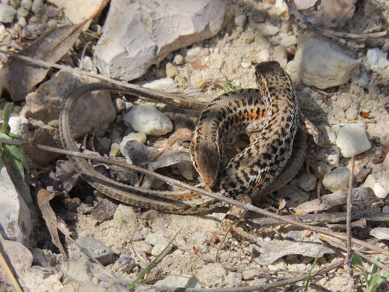
Snake-eyed Lizard Ophisops elegans -
Rock Pigeon Columba livia -
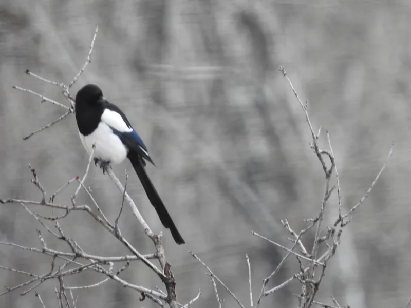
Eurasian Magpie Pica pica -
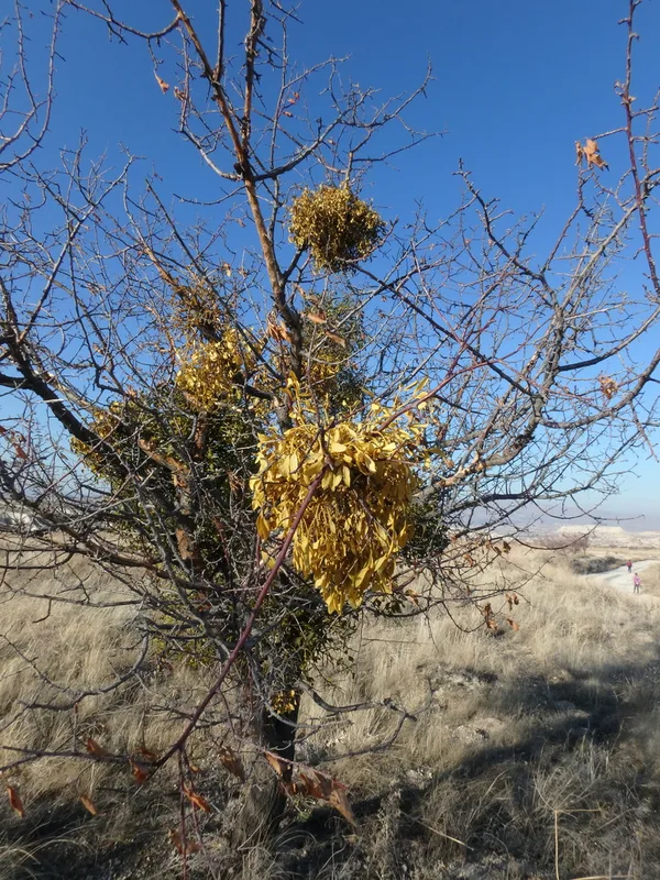
European mistletoe Viscum album -
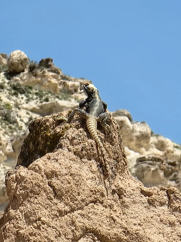
Roughtail Rock Agama Laudakia stellio -
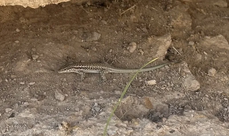
Anatolian Lizard Apathya cappadocica -
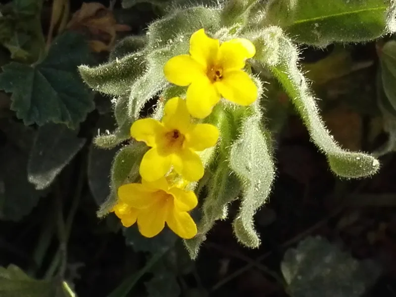
Oriental Alkanet Alkanna orientalis -
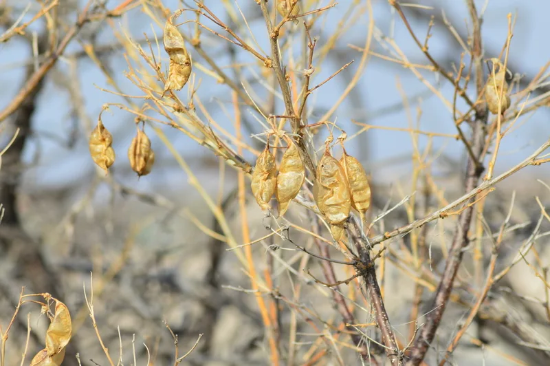
Colutea cilicica -
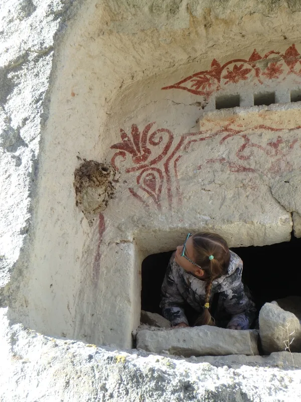
Western Rock Nuthatch Sitta neumayer -
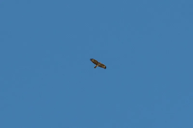
Long-legged Buzzard Buteo rufinus -
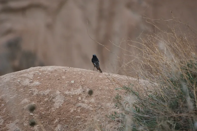
Black Redstart Phoenicurus ochruros
Field Notes · Desert & Deep Time lens · Cappadocia · 38.6500, 34.8545