Cape Flattery
Cape Flattery · Washington, USA
Here the land runs out, and the sea takes over the work of keeping it alive.
Why here
Stand at the railing where the boardwalk ends and the continent simply stops — cliffs on three sides, open water beyond, an island and its lighthouse riding the swell offshore. This is the northwest corner of the Lower 48, where the long inland strait finally empties into the Pacific. The useful idea here is that the sea made this place twice. First it built it: the cliffs you stand on are old sea floor, sand and broken rock laid down under an ocean tens of millions of years ago, later raised into these headlands. Then the sea kept it alive. Cold water rising along this coast carries food to the surface; the food draws fish, the fish draw seabirds, and the birds crowd onto the offshore island and its stacks. The same wet ocean air that blurs the view feeds the forest at your back. Everything at Cape Flattery — the caves below you, the puffins offshore, the dripping trees behind — is the sea, still at work. Follow that one thread and the whole cape reads as a single connected thing.
The story
Begin under a warm sea. Roughly forty million years ago, sand and broken rock settled on an ocean floor and hardened into stone. That stone is the cape — you can read the old sea in the coarse, jumbled rock of its cliffs. Later the coast rose, the waves went to work on it, and the softest seams became the sea caves that scallop the point today.
Onto that raised edge came the living coast. Cold water wells up offshore and turns the surface into pasture; fish gather, and seabirds gather on the fish. Tufted puffins, common murres, and pigeon guillemots crowd the offshore island and the stacks around it through the breeding season, then scatter to open water when it ends. Behind the cliffs, the same fog-heavy air keeps a dark forest dripping and green, loud with pacific wrens and chickadees.
People have lived at this corner for a very long time. The cape, the offshore island, and the coast around them are Makah land, and Neah Bay remains the community’s heart. In the late 1780s the maritime fur trade reached this coast, when British ships came trading for sea otter pelts to sell across the Pacific — one thread in a much longer human story the sources here only touch. A lighthouse later took its place on the offshore island, keeping watch where the strait meets the ocean.
The sites
Where the strait meets the ocean
Cape Flattery
48.3855, −124.7258
This is the point itself: the northwesternmost tip of the Lower 48, where a short, mostly boardwalked trail leads out through dripping forest to a set of railed overlooks. On three sides the land ends in cliffs, and below them the water has been at work for a long time. The rock here is old sea floor — sand and broken stone that hardened under an ocean tens of millions of years ago, later raised into these headlands. Because that rock is unevenly cemented, the waves find the weak seams and hollow them out, and the point is deeply scalloped with sea caves and narrow inlets where the swell surges in and out. Offshore stands the island and its lighthouse, and the water between is a corridor for everything moving in or out of the strait. It is a compact place to see the whole idea of this coast at once: the sea that built the ground, the sea that carves it now, and the wet air off the same ocean keeping the forest behind you green. Come in layers and expect wind and spray.
From the last overlook, look straight down into the nearest cave or cleft and watch a few swells enter it. The sea is picking out the softest seams in the old rock, widening a weakness into a cave one wave at a time. Look along the cliff for several such openings at different stages of the same work.
- AccessShort walk
- ExertionEasy
- TimeHalf a day
Tatoosh Island
48.3915, −124.7351
Half a mile off the tip of the cape, a low, flat-topped island rides above the surf, the largest of a scatter of rocks and stacks. You cannot go there — it is Makah land and long has been — but it is the reason the cape is loud with birds. Islands like this, ringed by cold, fish-rich water and safe from land predators, are exactly what nesting seabirds need, and so puffins, murres, and guillemots crowd its edges and the stacks around it through the breeding season. A lighthouse stands on the island’s flat back, set here where the inland strait finally meets the open Pacific and ships must make the turn. From the cape’s overlooks the island reads as a single dark shape, but a patient look breaks it into detail: pale-fronted birds standing on the ledges, dark ones rafting on the water, and the constant traffic between the two. It is the clearest place on this coast to watch the sea feeding the land — or rather feeding the crowd of life that clings to it.
With binoculars from the cape, pick out the offshore island and scan its edges and the smaller stacks. In the breeding season the ledges are lined with seabirds packed shoulder to shoulder, because bare rock surrounded by deep water is one of the few places their eggs are safe. Watch the steady shuttle of birds between the ledges and the feeding water below.
- AccessShort walk
- ExertionEasy
- TimeAn hour
The Makah harbor
Neah Bay
48.3592, −124.6108
Neah Bay is the way in — the largest community on the Makah Reservation and the last town before the road runs out at the corner of the country. It sits on a sheltered harbor on the strait side, tucked behind a small guarding island, which is why boats have always worked from here. The living wealth of this coast comes ashore at places like this: the same cold, upwelling water that feeds the seabird islands also feeds the fish, and fishing has been central to life here for a very long time. Take the town slowly. It is a working place, not a viewpoint, and its interest is in exactly that — the boats, the harbor, the meeting of an old coast culture with the open ocean at its doorstep. From here the reservation’s roads lead out to the cape, the beaches, and the outer shore, so nearly every visit to this corner passes through. Give it the attention you would give a trailhead that happens to be a town.
From the harbor front, watch which way the fishing boats point and where they head out. They are working the rich water where the cold upwelling meets the strait, the same food supply that packs the seabird islands a few miles west. Notice how the small island across the harbor mouth softens the swell and makes this a place a boat can safely lie.
- AccessDrive-up
- ExertionEasy
- TimeAn hour
Waadah Island
48.3821, −124.5978
At the mouth of Neah Bay’s harbor sits a small wooded island that does quiet, essential work: it breaks the strait’s swell and keeps the harbor behind it calm enough to shelter boats. That is much of the reason a town could grow here. You see it from the waterfront and along the breakwater rather than setting foot on it. Islands like this, standing just off a busy shore, often carry their own small population of coastal birds and haul-out spots on the rocks at their feet, because the water around them is productive and the rock keeps them separate from the mainland. It is a smaller, tamer echo of the wild seabird island out at the cape — the same principle of rock, cold water, and shelter, closer in and gentler. Read it as the harbor’s front door, the reason this whole corner has a safe way in from the sea.
From the breakwater or the waterfront, look at how the small island sits square across the harbor mouth. Line up the open strait beyond it with the calm water in front of you, and you can see it doing its job — taking the swell so the harbor stays quiet. Scan the island’s rocky foot for resting birds or seals hauled out on the stone.
- AccessDrive-up
- ExertionEasy
- TimeAn hour
The outer shore
Makah Bay
48.3198, −124.6757
South of the cape, the coast turns from cliff to open beach, and Makah Bay is the broad, surf-washed sweep of it. Two small rivers reach the sea here, and the sand is piled with driftwood logs the winter swell throws up the beach. This is the ocean side rather than the strait side, and it feels it: the water arrives with the full weight of the Pacific behind it and nothing to soften it. Where the cape shows you the sea at work on hard rock, the bay shows you the sea sorting soft material — moving sand, stacking logs, remaking the beach with every big storm. Fog and low cloud pool here readily, and the wet air keeps the forest edge behind the dunes dark and green. Come for the long view down an open shore, the sound of real surf, and the plain sense of standing on the outermost edge of the map, with the next solid ground a long way west.
Walk to the wet sand and look at the line of driftwood logs stranded up the beach. Each marks how far a winter storm pushed the sea; the highest, greyest logs are old high-water marks the ordinary tide never reaches. Follow the line along the bay and you can read the reach of the biggest swells this open shore takes.
- AccessShort walk
- ExertionEasy
- TimeHalf a day
Cape Alava
48.1698, −124.7314
About fifteen miles down the outer coast from Cape Flattery lies Cape Alava, the westernmost point of the Lower 48 — just barely, by a few hundred feet over the cape’s own tip. It is a wilder, lonelier place, reached on foot rather than by boardwalk, where the forest gives way to a low rocky shore studded with sea stacks and offshore rocks. At low tide the water pulls back to reveal tide pools and reef, and the same cold, productive sea that crowds the cape’s islands with birds fills these pools with anemones, sea stars, and clinging life. This is the outer coast at its most open — no strait, no shelter, just forest, rock, and ocean meeting on the continent’s last western edge. Give it a proper day. The walk in through dense coastal forest is part of the point, a slow transition from fog-fed trees to the raw shore they stand behind. Time your arrival to a falling tide, and check a tide table before you set out, because the best of it is uncovered only when the water is low.
On a falling tide, work out to the edge of the exposed rock and look into the pools left behind. The animals here — anemones, sea stars, barnacles — live crowded together because the same cold, upwelled water that feeds the seabirds offshore delivers food to them twice a day. Check a tide table first; this shore is only readable near low water, and the sea comes back.
- AccessHalf-day hike
- ExertionModerate
- TimeA full day
When it's best
This is a cool, wet corner in every season, so come ready for weather and let it set the mood rather than spoil it. The seabird island is busiest in the warmer months, when puffins, murres, and guillemots gather to nest; by late fall most have scattered back to open water. Summer often brings the thickest fog, the marine layer that gives this coast its character, while clearer views between banks come and go. Low tide pulls the water back at the base of the cliffs and along the beaches, the best time to read the rocky edge. The forest birds sing year-round.
Go deeper
The names behind what you saw. The rock of the cape is the Lyre Formation — mapped here as the breccia and conglomerate of Cape Flattery — Eocene marine sedimentary rock, roughly forty million years old. The seabirds of the offshore island and stacks are the tufted puffin (Fratercula cirrhata), common murre (Uria aalge), pigeon guillemot (Cepphus columba), and marbled murrelet (Brachyramphus marmoratus), with black oystercatchers (Haematopus bachmani) on the lower rocks. The fern of the coastal forest floor is common bracken (Pteridium aquilinum).
To read next. - Geologic map of the Cape Flattery area, northwestern Olympic Peninsula, Washington (1986) — the closest look at the specific rock that makes the cape’s cliffs and caves. - Geology of the coastal area between Cape Flattery and Cape Alava, Northwest Washington (1989) — carries the story down the outer coast to the westernmost point and ties the two capes together. - Geologic map of the Cape Flattery, Clallam Bay, Ozette Lake, and Lake Pleasant quadrangles (1993) — the wider regional map, for how this corner fits the whole northwest tip of the peninsula.
The names behind what you saw
What lives here, and what it's called. Photographs from open collections — an aid to identification, not decoration.
-
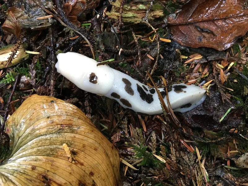
Pacific Banana Slug Ariolimax columbianus -
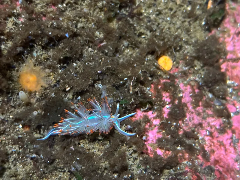
Horned Nudibranch Hermissenda crassicornis -
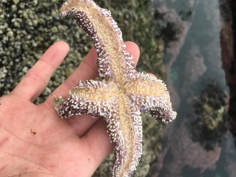
Ochre Sea Star Pisaster ochraceus -
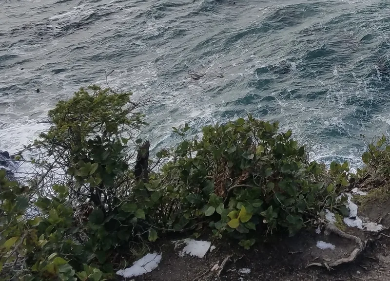
salal Gaultheria shallon -
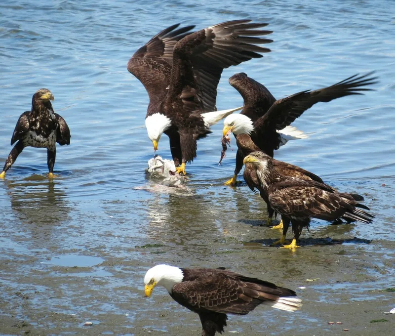
Bald Eagle Haliaeetus leucocephalus -
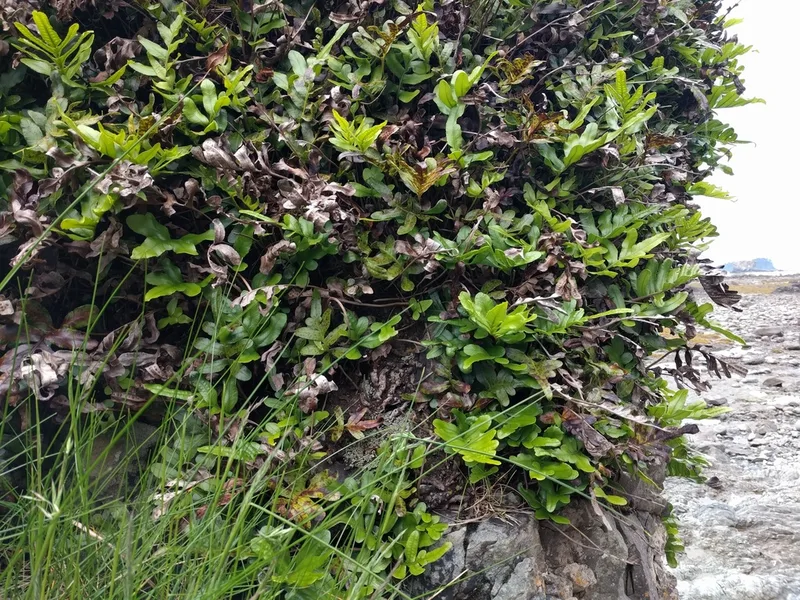
leathery polypody Polypodium scouleri -
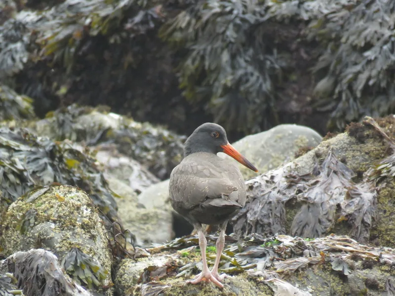
Black Oystercatcher Haematopus bachmani -
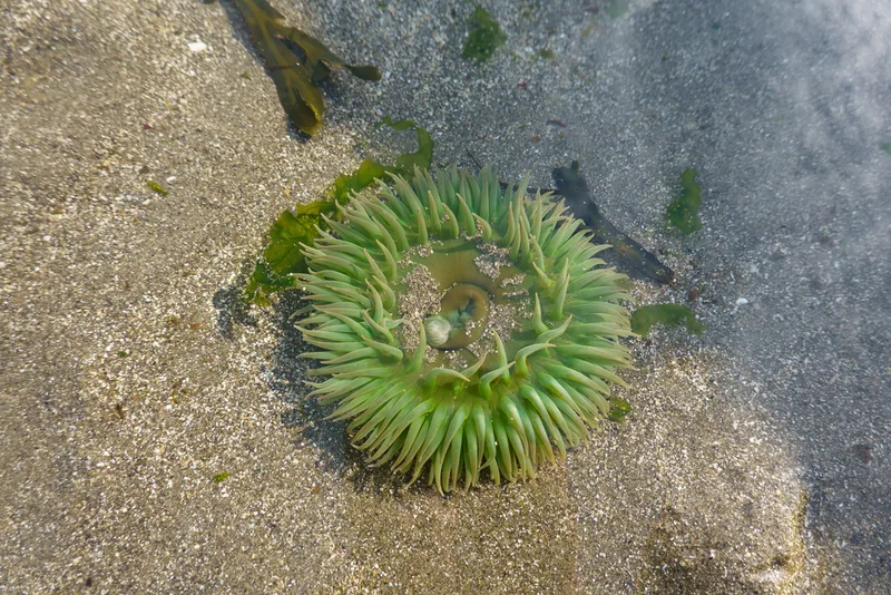
Giant Green Anemone Anthopleura xanthogrammica -
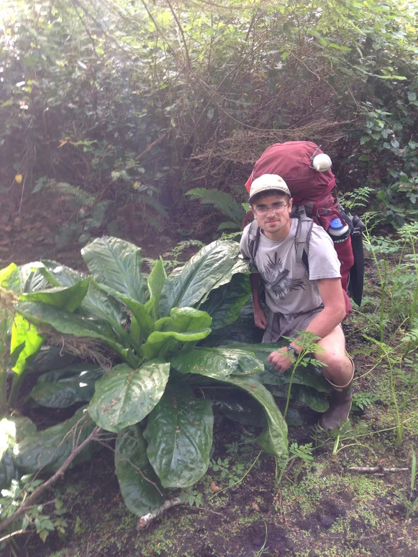
western skunk cabbage Lysichiton americanus -
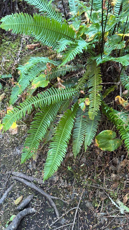
deer fern Struthiopteris spicant -
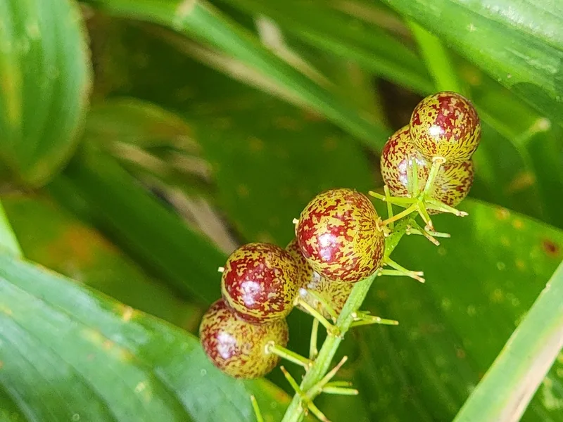
Western Lily of the Valley Maianthemum dilatatum -
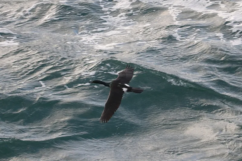
Pelagic Cormorant Urile pelagicus
Field Notes · Fog Coast lens · Cape Flattery · 48.2806, −124.6664