Bromo-Tengger-Semeru
Bromo-Tengger-Semeru · East Java, Indonesia
A volcano collapsed here once, and the hollow it left never stayed empty for long.
Why here
Stand on the rim before sunrise and the ground ahead looks like a dry lakebed circled by mountains — flat, grey, and strange for a place this high in the tropics. It isn’t a lakebed. It’s the floor of a volcano that emptied itself out in one enormous collapse and left a wide, low caldera where a much taller mountain used to stand. Most collapsed calderas eventually settle into quiet, filling in with forest or water and fading into scenery. This one didn’t get the chance. Before the wound could heal over, magma found its way back up through the broken rock at the center, and new cones began growing inside it — one of them now Java’s highest point, and still active, having broken loose again in a violent eruption within recent memory. Nothing here is finished. The old mountain collapsed, and the new ones are still deciding how tall they’ll get and how violently they’ll get there. Every stop on this note is a different vantage on that same unresolved argument between collapse and regrowth.
The story
The land came first, and it came in two very different rhythms. Long before anyone climbed here, a broad volcanic highland built up over tens of millions of years, the same kind of dark, iron-rich rock that makes up much of Java’s mountain backbone. Then, in a single catastrophic collapse roughly forty-five thousand years ago — on the scale of Krakatoa — an ancestral volcano emptied itself and fell in, leaving the wide caldera now crossed by the sand sea. New cones rose inside that scar. One of them kept going past all the others, building into Java’s highest mountain and staying restlessly active; an eruption there in recent years saw a summit lava dome collapse after heavy rain, sending pyroclastic flows and mudflows down its slopes.
Life moved back onto the raw ground quickly, the way it does on young volcanic soil everywhere — fast, hardy colonizers first, weedy plants suited to disturbed, mineral-rich earth. Further down, where the slopes turn to real forest, the mountain still supports serious wildlife: hawk-eagles and serpent-eagles hunting the ridgelines, forest barbets and babblers working the canopy below.
People arrived and stayed close to both stories. The Tenggerese, for whom this massif is named, made the active crater a place of pilgrimage — Bromo takes its name from the Javanese pronunciation of Brahma, and an offering site to Ganesha sits at the rim of the crater itself. The sand sea has carried formal protection since 1919, one of the region’s older reserves, and villages like Ngadas and Ranu Pani still sit quietly inside the boundary that protects it.
The sites
The caldera that grew new mountains
Gunung Penanjakan
−7.9037, 112.9521
Climb the short rise to the top of Penanjakan and the whole story sits in front of you at once. Below is the vast, flat floor of an older volcano that emptied itself out and collapsed, roughly forty-five thousand years ago — an eruption on the scale of Krakatoa. What you’re standing on today is the broken rim of that first mountain; what fills the bowl below is new. Four young cones have grown up from the caldera floor since, breaking the flatness of the sand sea with their own small peaks. One of them, near the middle, is rarely still — it keeps a thin plume of steam rising even on quiet days, the clearest sign this ground hasn’t finished building itself. From here you’re not looking at a single volcano so much as at a whole system in the middle of a very slow act of self-repair: a wound, and the new growth inside it.
Look past the near rim, toward the middle of the sand sea, for a low cone trailing a thin plume of steam — the clearest sign this system hasn’t gone quiet. Time your visit for a still morning, when no wind is around to scatter the plume before you can pick it out against the sky.
- AccessDrive-up
- ExertionEasy
- TimeAn hour
Gunung Watangan
−7.9561, 112.9353
Watangan is one of four young peaks that broke through the flat floor of the Tengger caldera after the older, larger volcano beneath it collapsed. It stands close enough to Bromo’s own crater that hikers crossing the sand sea often pass beneath it without ever climbing it. That’s worth pausing on: a caldera rarely stays a hole for long. Magma keeps arriving from below even after a mountain has emptied itself out, and it finds new paths upward through the fractured rock at the center of the collapse. What’s unusual here isn’t Watangan by itself — it’s the company it keeps. Four separate young cones stand inside the same old wound, born of the same collapse, each one a slightly different answer to the same pressure rising underneath. From its lower slopes, the sand sea reads less like a beach and more like a hardened lakebed, ash and pumice packed flat by wind rather than water.
From partway up the slope, crouch and look at the ground itself: fine grey grains, not quartz sand but broken volcanic rock, packed hard enough in places to walk on without sinking. Compare a handful from here with a handful nearer the crater rim — the grain size changes with distance from the vents.
- AccessHalf-day hike
- ExertionModerate
- TimeHalf a day
Gunung Kursi
−7.9597, 112.9561
Kursi is smaller and quieter than its neighbors, but the same rules built it. Where Bromo keeps venting and Watangan rises smooth and rounded, Kursi shows the layered construction underneath: young volcanic cones like these grow in stacked increments, a scatter of ash and cinder from one small eruption, then another, piling into a hill loose enough that wind and rain are already cutting shallow gullies down its flanks. Seen from a distance across the sand sea, the four cones inside the Tengger caldera don’t look identical, and that’s the interesting part — same collapse, same magma supply underneath, four different volcanic personalities on the surface. Kursi is the one that reads as almost finished, holding its shape rather than actively changing it, at least for now. Nothing here is permanent. It’s just building on a longer timescale than the crater a short walk away, and it rewards the patience of anyone willing to look at a quiet cone rather than the loud one.
Walk the base of the cone and look for shallow, parallel gullies cut straight down the slope — signs that loose ash and cinder, not solid rock, make up the hill. Compare the steepness here with Bromo’s crater rim nearby; looser material holds a noticeably shallower angle.
- AccessHalf-day hike
- ExertionModerate
- TimeHalf a day
Water in an unstable landscape
Gunung Kumbolo
−8.0530, 112.9231
From the slopes of Gunung Kumbolo the ground drops toward Ranu Kumbolo, one of several lakes tucked into this volcanic high country. None of these lakes are old the way lowland lakes usually are — they sit in low ground shaped by an unstable, still-changing volcanic landscape rather than in a valley cut slowly by a river over millions of years. Water collects, has nowhere obvious to drain, and stays. The lake below is also part of the standard route between the trailhead village and the summit of Semeru, Java’s highest point and still an active volcano to the south — trekkers heading for the peak generally camp near the water before the final push. Standing here, on a peak that shares the lake’s name, is a good place to notice how much of this park’s geography is quietly organized around volcanic accident: a low spot that could have stayed dry stayed wet instead, and it changed how everyone since has moved through the mountains.
Look down at the lake’s shoreline rather than its center. A lake with no obvious inlet or outlet stream, fed mostly by rain and runoff, is a good clue that you’re looking at a basin shaped by volcanic ground movement rather than ordinary river erosion.
- AccessExpedition
- ExertionStrenuous
- TimeWorth two days
Gunung Ranupane
−8.0096, 112.9497
Ranupane takes its name from Ranu Pani, the lake and village at its foot and the usual starting point for the walk into the high country toward Semeru. The lake itself is a modest one, and it’s getting smaller: like a lot of shallow lakes in young volcanic terrain, it’s slowly filling in with sediment washed down from the surrounding slopes, a process that’s been steadily shrinking its shoreline over time. None of that is unique to Ranu Pani — it’s how most volcanic lakes eventually end, silting up into wet meadow and then dry ground, unless a fresh collapse or eruption resets the basin. From partway up the peak you get a clear sense of scale: a small village, one small lake, and behind it, the long approach into a mountain wilderness that includes Java’s highest and most active summit. It’s a good place to register that this landscape is layered in time as well as elevation — old collapse below, young cones ahead, a slowly vanishing lake at your feet.
From the lower slope, look at the lake’s edge for a band of green marsh grass between open water and dry ground — that band is new land, sediment that has filled in shallow water within recent memory. A wider band means faster filling.
- AccessShort walk
- ExertionModerate
- TimeHalf a day
Old ground, seen whole
Gunung Tangkil
−7.9513, 112.8051
Most of what draws people to this park is young: a caldera less than fifty thousand years old, cones younger still, one summit that erupted again not long ago. Tangkil, out on the western edge of the massif, is a reminder that the mountain-building here didn’t start with any of that. The rock underfoot across much of this region is a mafic-to-intermediate volcanic rock laid down over a much longer stretch of the geologic past, tens of millions of years rather than tens of thousands — an older basement that the younger, more famous volcano was eventually built on top of and, in places, blew apart. Standing on Tangkil doesn’t give you drama the way the caldera rim does. It gives you depth: proof that this is not one eruption’s landscape but many, stacked in overlapping generations, only the newest of which happens to be the one steaming today. The older ground held up the whole show and then quietly stepped out of the story.
Look at the exposed rock directly underfoot rather than the view — weathered, grey-brown, and older-looking than the sharp black cinder near the main crater. That color and softened edge, worn rather than fresh, is what a much longer stretch of weather does to volcanic rock, far longer than the young cinder has had to endure.
- AccessExpedition
- ExertionStrenuous
- TimeA full day
Gunung Ayeg-ayeg
−8.0680, 112.8183
From Ayeg-ayeg’s summit, well outside the caldera itself, the whole system reads as a single unit rather than a collection of separate mountains. In one sweep you can pick out the older, weathered highlands that make up most of the massif’s bulk, the wide flat scar of the sand sea sitting lower and younger in the middle of it, and — if the air is clear — a thread of pale steam marking the one cone that’s never entirely stopped. Seeing it from a distance does something a close-up crater visit can’t: it makes the scale of the collapse obvious. The caldera isn’t a small feature tucked into the landscape, it’s a wide, low disruption in an otherwise much older and much taller volcanic country, and everything young inside it looks small only because it’s surrounded by so much older rock. Coming here after visiting the crater rim, rather than before, changes how the whole place reads.
Trace the skyline with your eyes rather than the ground: find the lowest, flattest stretch of the horizon among the peaks — that’s the caldera and sand sea, sitting distinctly lower than the older highlands around it.
- AccessExpedition
- ExertionStrenuous
- TimeA full day
When it's best
Java runs on a wet-and-dry monsoon rhythm, and this park feels it more than most, since so much of what’s worth seeing here depends on a clear sunrise view across open ground — cloud and rain hide the caldera fast. The drier months, roughly the middle of the year, tend to give steadier, clearer mornings for the rim overlooks and easier walking across the sand sea. Wetter months bring more cloud and mud, and are worth noting for another reason too: saturated ground on the mountain’s active slopes has been linked before to the kind of mudflows that came off the summit after heavy rain. There’s no wrong season for the quieter, older ground away from the caldera — only the crater views reward some care in timing.
Go deeper
The names behind what you saw - The older highland rock across much of the park is mapped as Cenozoic volcanic rock — mafic-to-intermediate lava laid down over the Neogene, tens of millions of years before the caldera existed. - The caldera itself is the collapsed remnant of the ancestral Tengger volcano. - The active peak to the south is Semeru, a stratovolcano built at a subduction zone, where the Indo-Australian Plate slides beneath the Eurasian Plate. - Early colonizers of open volcanic ground recorded here include Tropical Pokeweed (Phytolacca icosandra), Brazilian Vervain (Verbena brasiliensis), and Mexican sunflower (Tithonia diversifolia). - Forest raptors recorded on the park’s wooded slopes include the Javan Hawk-Eagle (Nisaetus bartelsi) and Crested Serpent-Eagle (Spilornis cheela).
To read next - Bromo Tengger Semeru National Park (Wikipedia) — the clearest overview of the caldera, the sand sea, and the four cones that rose inside it. - Mount Bromo (Wikipedia) — the crater’s Hindu pilgrimage history, including the Ganesha shrine and the Brahma origin of the name. - Semeru (Wikipedia) — the geology of Java’s highest peak and its position over an active subduction zone. - 2021 Semeru eruption (Wikipedia) — a detailed account of the lava-dome collapse and the pyroclastic flows and lahars that followed. - Ranu Kumbolo (Wikipedia) — background on the lake and its place along the standard route to Semeru’s summit. - Ranu Pani (Wikipedia) — the trailhead village and lake, including its slow loss to sedimentation.
The names behind what you saw
What lives here, and what it's called. Photographs from open collections — an aid to identification, not decoration.
-
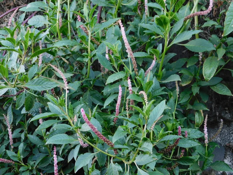
Tropical Pokeweed Phytolacca icosandra -
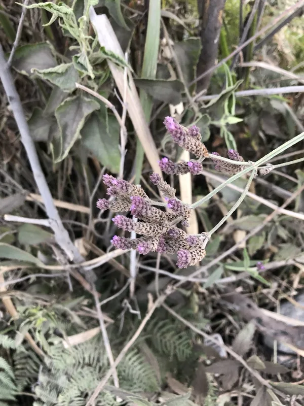
Brazilian Vervain Verbena brasiliensis -
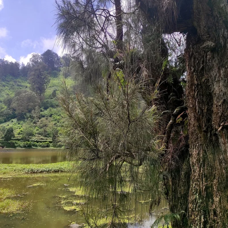
Mountain Ru Casuarina junghuhniana -
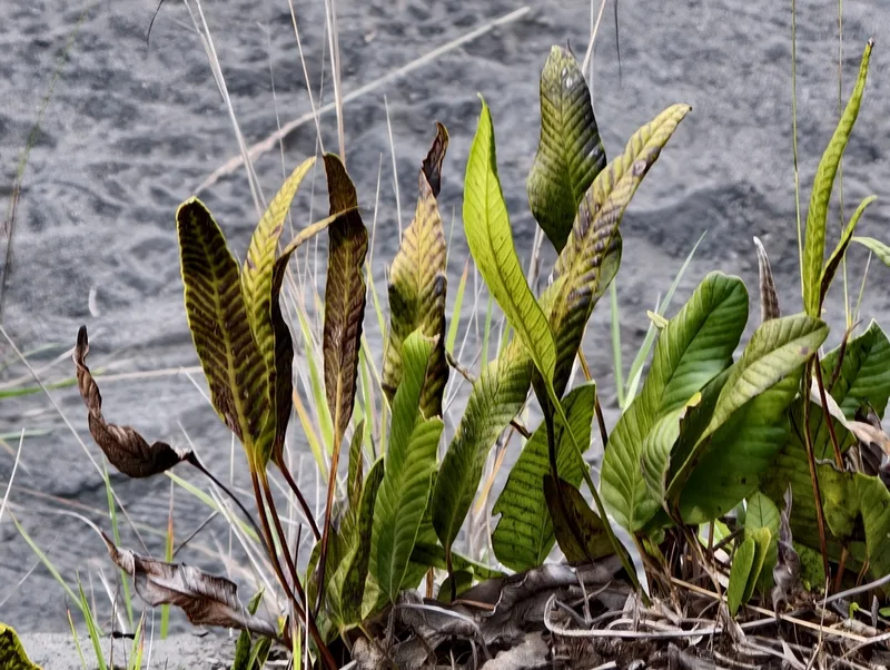
Selliguea feei -
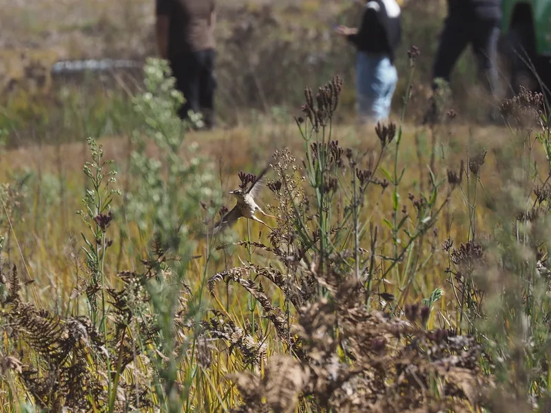
Paddyfield Pipit Anthus rufulus -
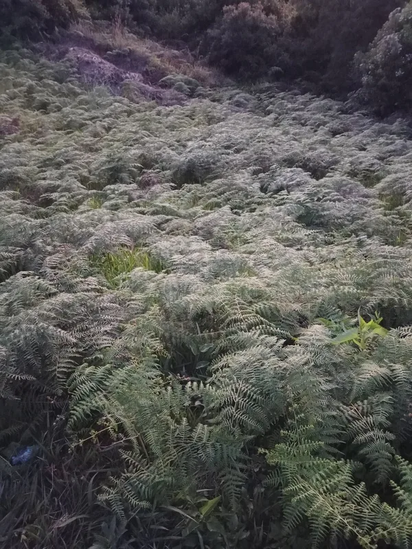
South Asian bracken Pteridium revolutum -
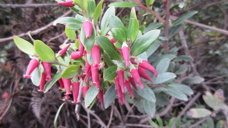
Javan blueberry Vaccinium varingiifolium -
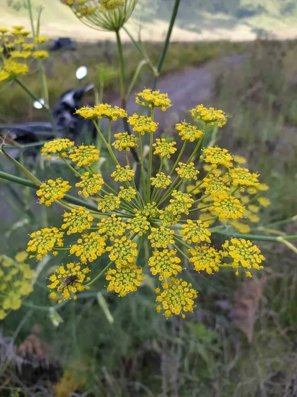
fennel Foeniculum vulgare -
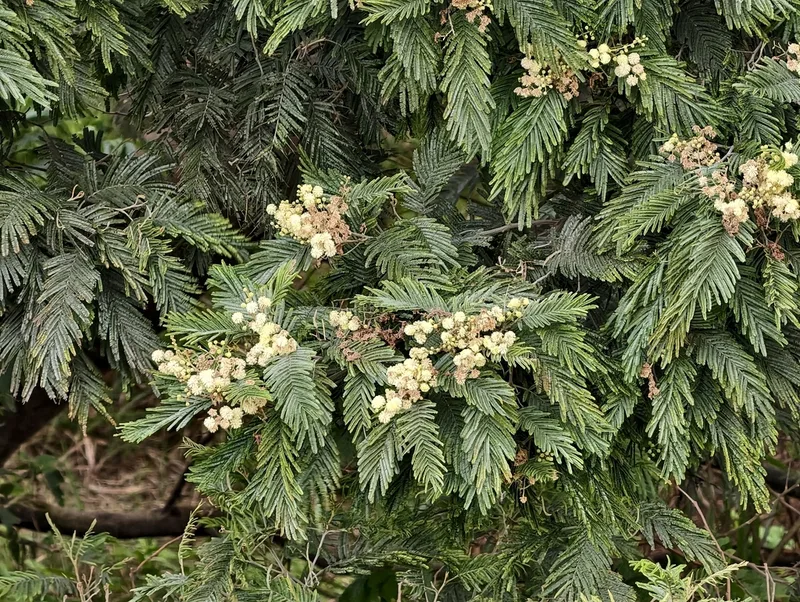
black wattle Acacia mearnsii -
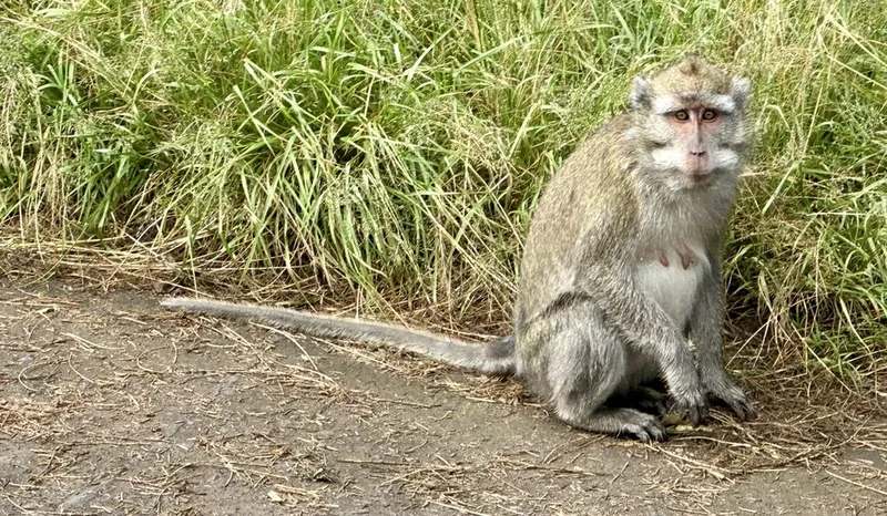
Long-tailed Macaque Macaca fascicularis -
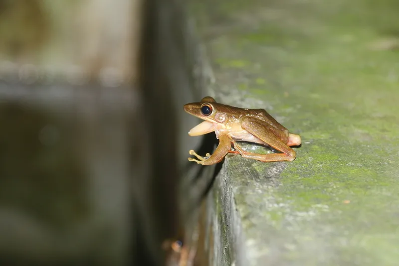
Schlegel's Frog Hylarana chalconota -
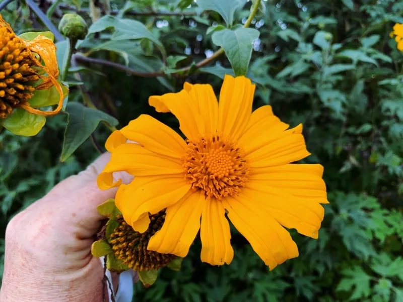
Mexican sunflower Tithonia diversifolia
Field Notes · Volcanic lens · Bromo-Tengger-Semeru · −8.0277, 112.9478